This roller coaster of a winter shows no signs of letting up as we head through the opening days of 2017. We have sleet, wind chills in the teens, a widespread freeze…and 80° weather to discuss. Here’s how it will unfold.
Friday & Weekend
Cold weather has now settled into the region.
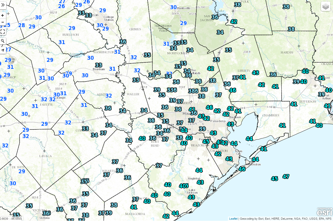
Expect a chilly, raw day today. We’ll have a stiff north wind, coupled with temperatures not getting much warmer than they are on the map above. In addition, we’ll have clouds and occasional light rain and drizzle throughout the day. Temperatures will be cold enough for perhaps some sleet or ice pellets to mix in over the area. Fortunately, the precipitation looks light enough and temperatures just warm enough that this shouldn’t be anything more than “conversational” wintry precipitation.
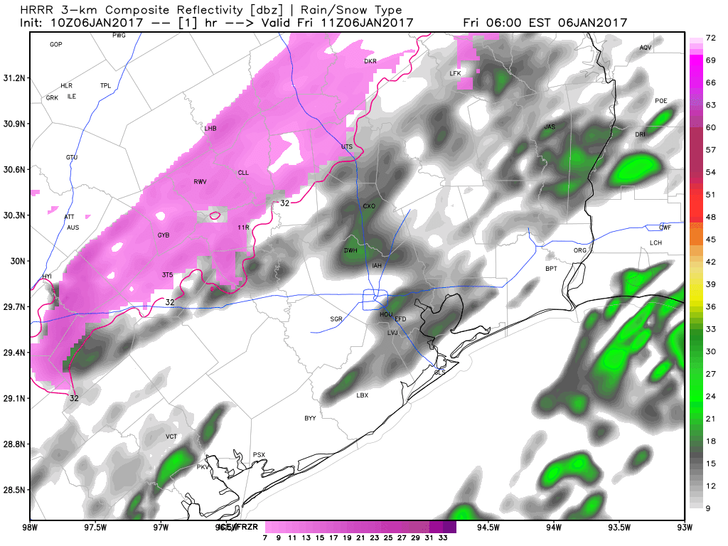
But don’t be shocked to see or hear some ice pellet pings today.We’ll clear skies out, and actually, the weekend is going to be an absolutely beautiful winter one for Southeast Texas.
(Space City Weather is sponsored by Westbury Christian School for this month)
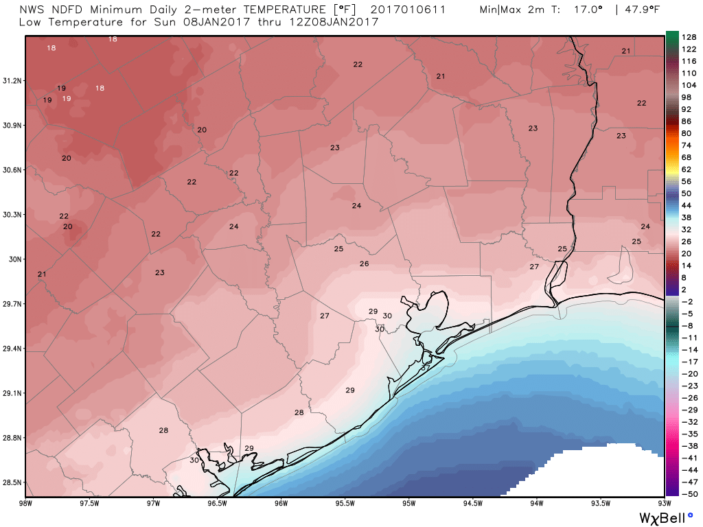
So how cold does it actually get? We should see widespread mid to upper 20s in the metro area. North of Highway 105 and west of Highway 6, we’ll see low to mid 20s for actual low temperatures. So there should certainly be a serious freeze for places like College Station (which could even slip into the teens), Brenham, and Huntsville. At the coast, you’ll bottom out near freezing. A bit of wind still around on top of these temperatures will make wind chill values feel like the low teens north of Houston and upper teens near the coast. Bundle up tonight and Saturday morning!
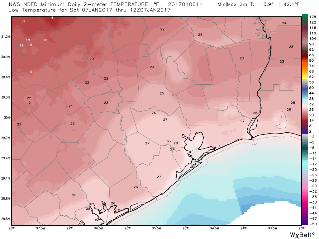
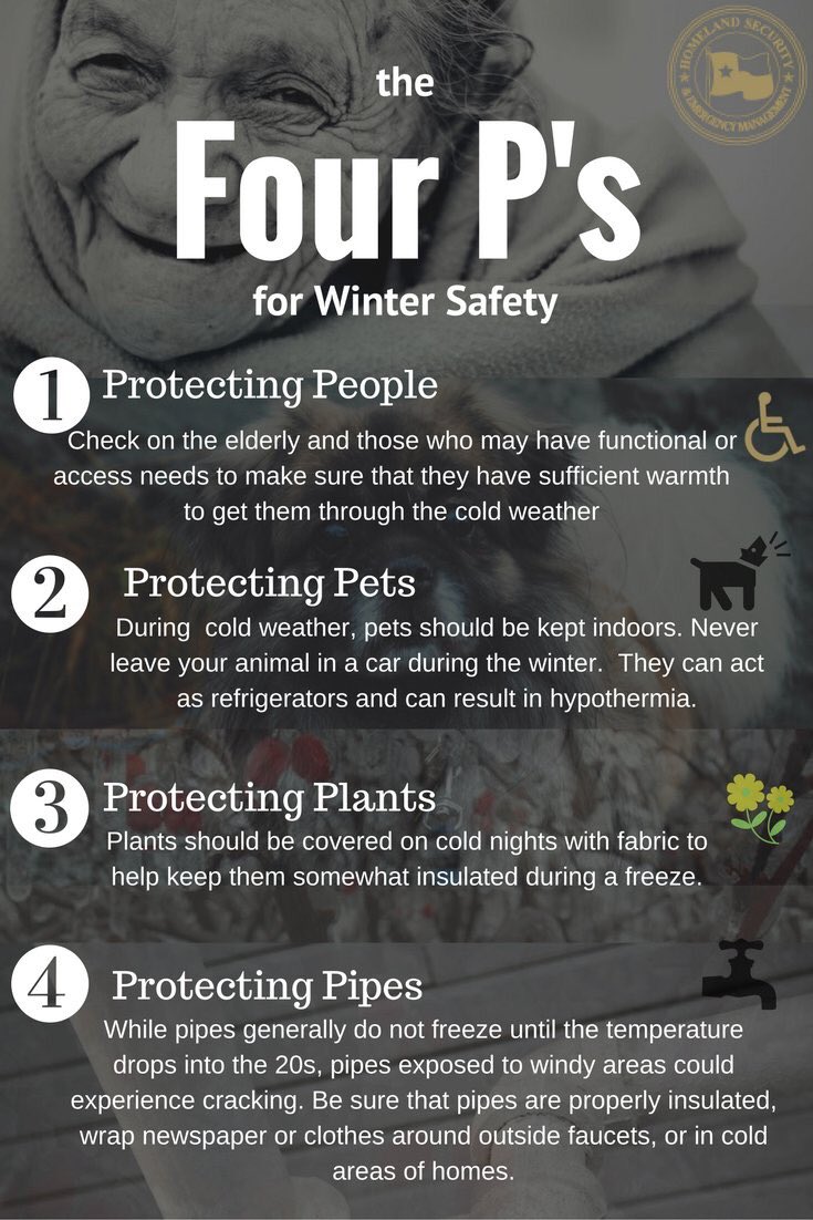
In and around Houston (and even perhaps at the coast), you’ll want to implement whatever cold weather precautions you’d normally take for sensitive plants & vegetation with at least 3-4 hours of temperatures below freezing. North of highway 105, and west of about Sealy, you’ll want to probably protect pipes as well. We typically need temperatures around or below 20° for pipes to be at risk of bursting. The forecast is close enough in those areas right now.
Temperatures will be similar on Sunday morning. We could be a little colder than Saturday morning in Houston and at the coast and perhaps a degree or two milder far to the north and west. Either way, we’re likely to get another freeze across the entire area, except perhaps the coast on Sunday morning. There will be a bit less wind though.
Next week
Winds flip back onshore as early as Sunday night, and our next warm up will commence. Look for upper 40s on Sunday, then upper 60s by Monday. We should crack into the 70s on Tuesday, but by Wednesday, Thursday, and Friday, we should be off to the races. High temperatures near 80° can’t be ruled out heading into the late part of the week. This warm up will also likely bring a period of widespread sea fog back to coastal areas.
The roller coaster ride continues in Texas, so I hope you’re buckled up!
Houston Marathon update
Eric’s been covering the Houston Marathon forecast all week, and he’ll have more updates this weekend.
I don’t have too much more to add to what he discussed yesterday afternoon, except that the European model continues to show *some* potential for hope. The GFS and its ensemble continues to show very warm temperatures continuing.
I mentioned the hope from the Euro above? Well, it shows a cold front in here Friday morning or afternoon that could wipe out the humidity, if it’s successful. Unfortunately, the European operational model has lost some of its luster lately with some wild forecast swings on days 8-10, so I’d be apt to not trust it yet. So Eric’s odds from yesterday still hold: A 50% chance of well-above normal temperatures (lows that morning of 65 degrees or greater), a 35 percent chance of lows between 55 and 65 degrees, and about a 15 percent chance of a cold front keeping temperatures cool and comfortable. We’ll continue watching.
Posted by Matt at 6:40 AM
“Conversational” sleet is a brilliant way to describe it !
Matt…and we’re still expecting sunny skies with wind Saturday between noon and kickoff at NRG?!
You bet. Roof will be closed I presume. Definitely a “brisk” tailgate. Fortunately wind will be a little less than today and tonight, but it’s still going to feel dang cold.
Maybe they will finally turn off the A/C in our office building. It was 64 degrees in my office yesterday morning.
Don’t worry about the sleet, people. We will rebuild.
LOL!
Thanks for the info about pipes and the 20-degree threshold. I wrapped mine this morning but reassuring to know that it won’t be an issue in Sugar Land where I live.