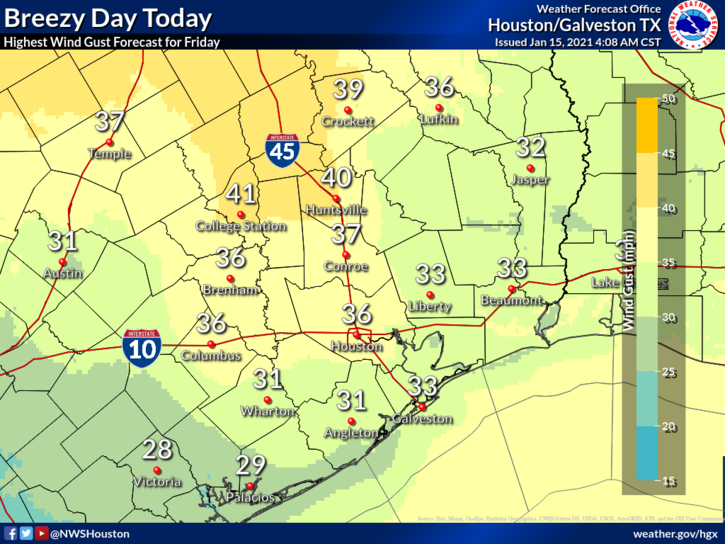
Good morning, and happy Friday. It’s a cool start to the day today, as we’re in the wake of a cold front that moved through last evening. We’ll have a round of gusty winds today before things settle down for the weekend.
Today & tonight
Today is starting off calm enough with clear skies, cool temperatures, and generally light winds. The clear skies and generally cool temperatures will stay with us today, with highs in the 50s. But the wind? That will begin to howl in just a few hours. We expect wind gusts of 25 to 35 mph area wide today, with some higher gusts possible in northern stretches of the region.

A wind advisory is posted for late morning and early to mid-afternoon. With high winds and low humidity, it’s a higher than usual brush/grass fire danger day today. Relative humidity could drop below 20 percent at times, a very dry day.
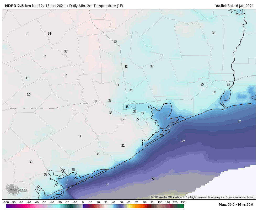
Winds will quickly settle down around and just after sunset, and they should be back to relatively calm conditions tonight, with lows near freezing north and west of Houston.

Look for 30s elsewhere, with near 40 at the coast, a chilly night.
Saturday through Monday
After today, fair, quiet weather will be the story through Monday. Look for sunny conditions with just a few clouds on Sunday and Monday. Temperatures will slowly warm through the period, topping off in the upper-50s on Saturday, low-60s on Sunday, and mid-60s on Monday. Morning lows will stay cool, with 30s to near 40° on Sunday morning and mostly 40s on Monday morning. Winds will stay light but could pick up a bit on Monday afternoon as onshore flow redevelops.
Tuesday and beyond
A pretty messy weather pattern is expected Tuesday through Thursday or even Friday before a cold front finally clears everything out. Onshore flow will transport really humid air back into the region Tuesday and Wednesday, likely leading to scattered showers. The problem in this period is that details around the forecast continue to fluctuate both in terms of how much rain we see and where it falls. We know that the potential will exist for heavy rain and at least some thunderstorms. But we don’t know if it’s more a story for our area, farther north toward Shreveport, LA, or for all of eastern Texas and western Louisiana. We will have a full update on this for you Sunday or (more likely) Monday.
