In brief: A stormy pattern will descend upon Houston through Saturday or possibly Sunday. We don’t expect serious flooding, but there will be plenty of showers and thunderstorms to go around, especially during the afternoon hours, so remain weather aware in the coming days.
Stormy pattern
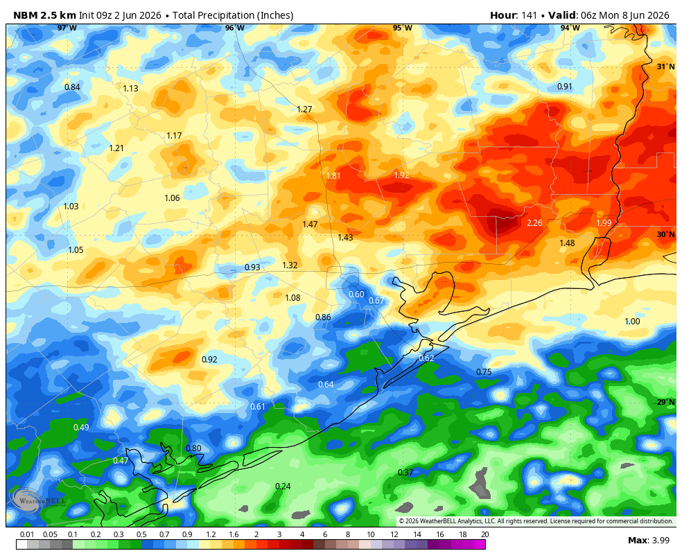
Houston will see a mish-mash of boundaries, weak fronts, sea breezes, and disturbances that will combine with an atmosphere filled with moisture for the rest of the week to produce a daily chance of showers and thunderstorms across the region. Chances each day will vary from about 40 to 70 percent, and there will be the usual pattern of hit-or-miss showers. Overall most of the region will probably pick up 0.5 to 1.5 inch of rain, but given the background moisture available some areas could see higher bullseyes of 3 or more inches. All in all we don’t expect much in the way of flood impacts, but this could prove disruptive to outdoor activities.
Tuesday
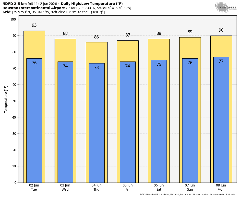
At sunrise this morning we’re tracking some storms off the to east of Houston, on the far side of Galveston Bay. These may drift westward, into Houston, during the morning hours, primarily south of Interstate 10. Then, this evening and into the overnight hours, a weak front may produce a broken line of storms that drop down from the north and into the city. Whether these storms hold up all the way into Houston is not entirely clear, but thunderstorms are possible later this evening and overnight. At this time nothing with these storms looks to be too severe. Highs today should be in the vicinity of 90 degrees, with partly to mostly sunny skies. Lows tonight will drop into the mid-70s.
Wednesday
This should be a mostly sunny day with temperatures again reaching up to around 90 degrees. There is something like a 50 percent chance of showers and thunderstorms.
Thursday, Friday, Saturday, and Sunday
During this period of time we are likely to see partly sunny days, with high temperatures ranging from the mid-80s to around 90 degrees. Temperatures will depend on the extent of cloud cover during the afternoon hours, and when showers and thunderstorms roll through. We expect to see periodic rounds of showers, but again there will also be plenty of breaks with some sunshine as well. Storms will be most active during the afternoon and early evening hours, with peak heating. Nights remain quite warm, in the mid- to upper-70s. As we get closer to the weekend we should have some better details about what each of these days looks like, but for now we expect to see a situation in which, during the afternoon, we see storm-o-clock descending upon the region.
Next week
The most likely outcome next week is a little more sunshine, a little less rainfall, and highs around 90 degrees. But do I feel particularly confident in that outlook? I do not.