In brief: In today’s post we take a broader look at rains expected to move into Texas from the remains of a Pacific hurricane, and look ahead to cooler and wetter weather across the Houston region toward the end of this week.
Polo’s remains bring Texas rains
Hurricane Polo, a powerful storm in the Pacific Ocean, is about to make landfall over Baja Peninsula and then will move toward Texas over the next couple of days. There it will bring the potential for heavy rainfall. Houston, under less of a threat, will see rains later this week, which we’ll discuss below. But to start I wanted to highlight the threat from Polo to central Texas. The following is a snippet from our companion site, The Eyewall.
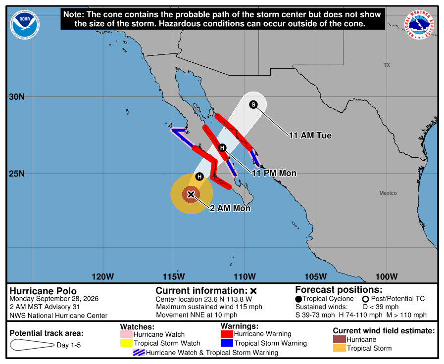
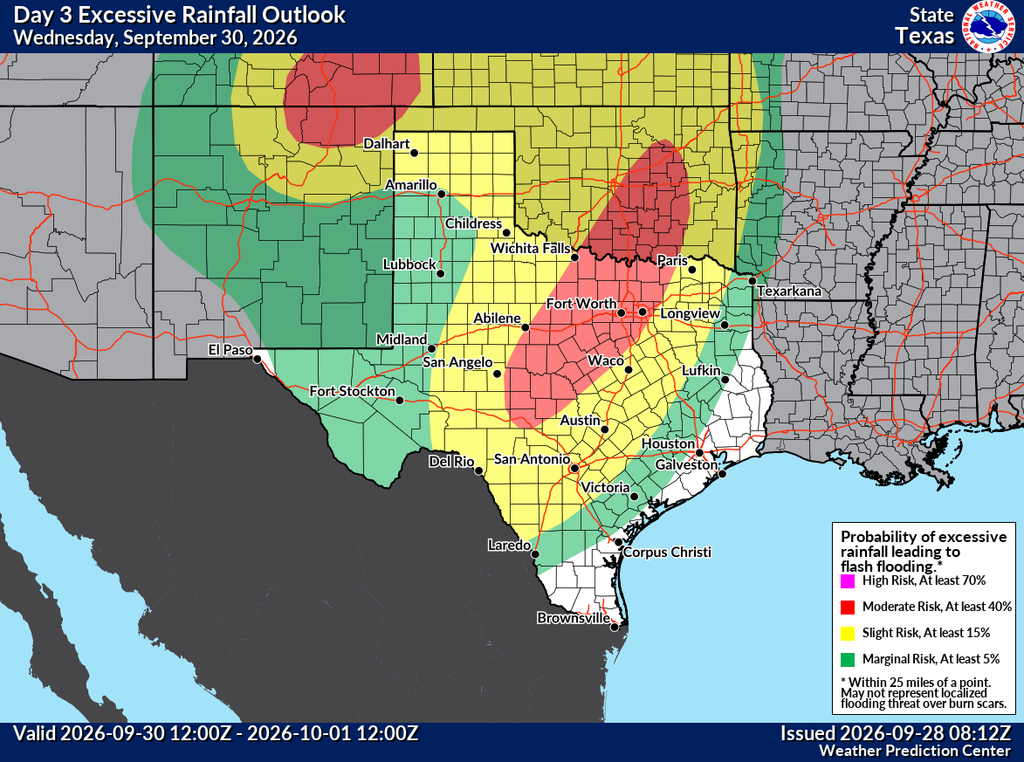
Copious amounts of moisture will surge into the Desert Southwest and eventually the Southern Plains and Texas from Hurricane Polo. The moisture from Polo and a slow or stalling cold front will probably focus repeating rounds of rain from Hill Country into North Texas. Those areas are already under a moderate risk (level 3/4) for flash flooding on Wednesday, and that will likely extend into Thursday as well.
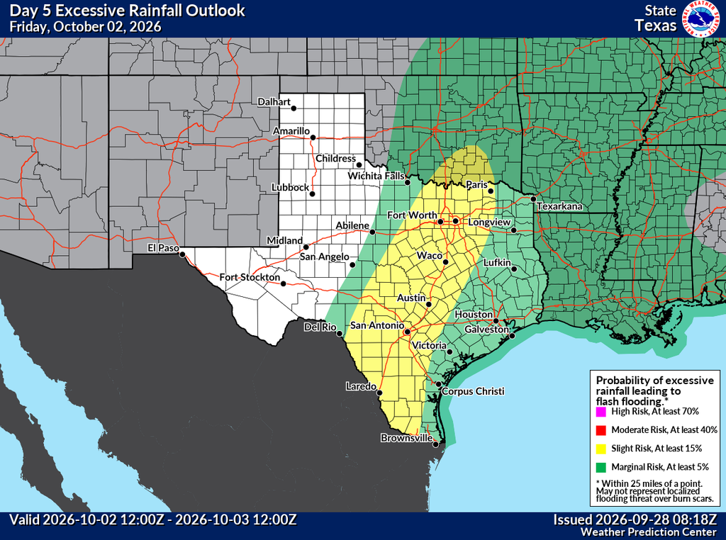
Rain totals are likely to end up in the 4 to 8 inch range from south of San Antonio through Dallas and perhaps up toward Durant, OK through Friday. There is a chance that some areas see as much as 10 to 12 inches though, as we know Texas flood history is littered with these types of remnant Pacific hurricane events.
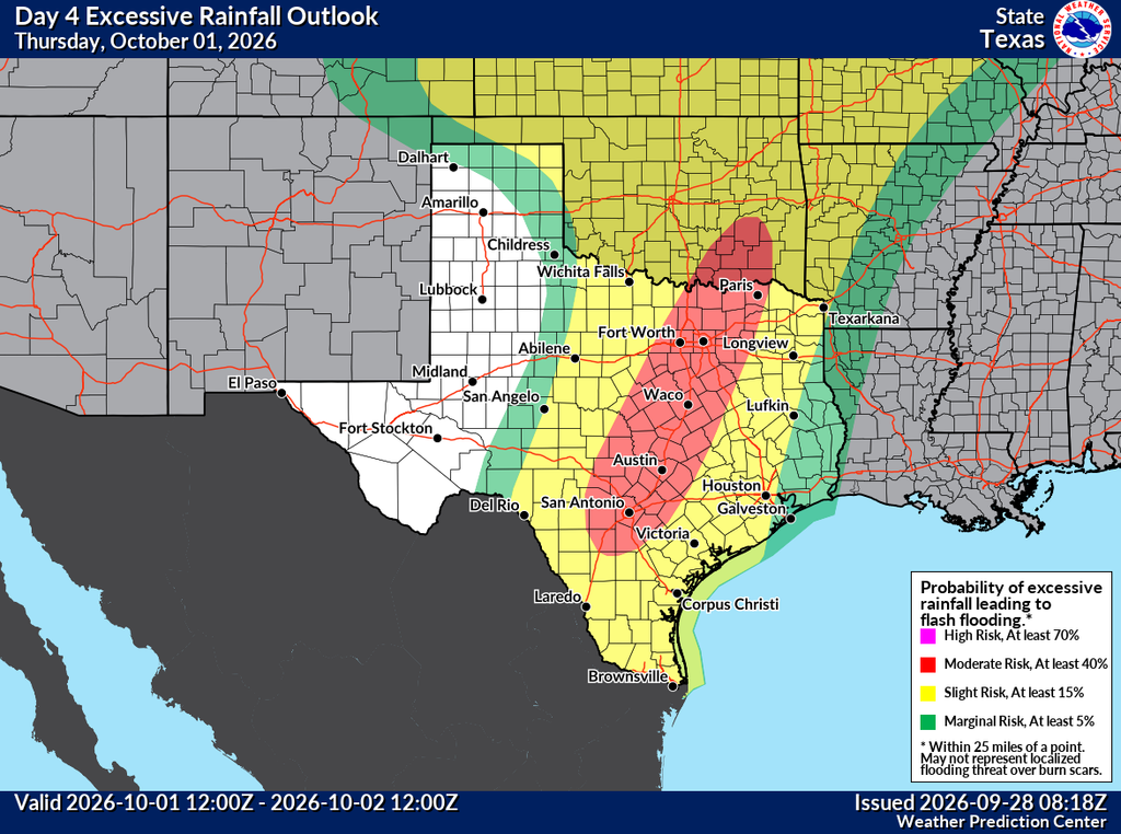
For now the more serious flooding concerns are likely to stay north and west of the Houston region. Texas folks in Hill Country and the Metroplex should monitor the next couple days of forecasts very closely and be prepared for disruptions on Wednesday and Thursday.
Monday, Tuesday, and Wednesday
Locally, we don’t expect too much rainfall over the next few days. Rain chances through Wednesday will be on the lower end, probably 20 to 30 percent each day. Yes, there could be a few more clouds, and we certainly cannot rule out some thunderstorms, but any moisture related to Polo should remain well to our west. Highs each day will be in the low- to mid-90s with plenty of humidity. Nights will be muggy, in the upper 70s for the most part.
Thursday, Friday, Saturday, and Sunday
This is the period when we expect improved rain chances across the Houston region as available moisture in the atmosphere surges upward. Unfortunately, I cannot give you a precisely detailed forecast for each day. However, rain chances should be 50 percent or above, with with partly to mostly cloudy skies. At this point Friday appears likely to have the best overall chance for rain, but this could shift over the next couple of days. In terms of overall accumulations, they will vary widely, but I expect most of the Houston region to pick up 1 to 4 inches of rainfall through Sunday. Again we’ll need to fine tune this forecast as we get closer.
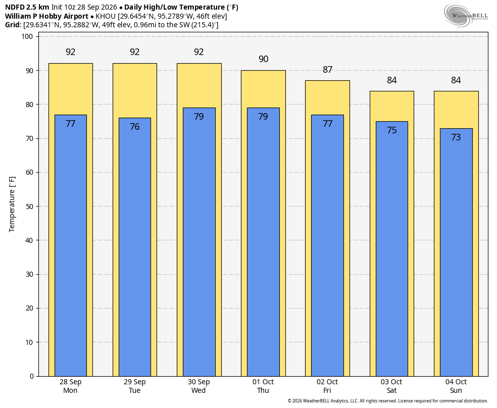
In terms of daily temperatures, the cloud cover, rain, and a weak front should help pull highs down into the 80s on most days, with overnight lows in the mid-70s. So basically we’ll be at pretty seasonable levels for early October.
Next week
The rains should subside by Monday or Tuesday of next week, after which point something of a stronger front may arrive to possibly push nights into the 60s during the second half of the week. More on that in the coming days as we get more clarity on the situation.
