In brief: A humidity front pushed through overnight, which will allow today to be significantly less humid and a couple degrees cooler. Humidity does return heading toward next week. While we are continuing to track a possible cold front later next week, confidence remains quite low in what it will actually do for the Houston area, other than lowering high temperatures a bit.
Just as a reminder, in case you missed it, we did make an important comment about hurricane season in Texas yesterday. We also have big app update news!
On to the forecast.
Today
Do you feel less humidity today? You should. A weak little boundary pushed in out of the north and east overnight, and with perhaps the exception of the extreme south and west parts of the area, it should be noticeably less humid today. Dewpoints are running about 5 to 10 degrees lower than this same time yesterday, meaning it feels that much more comfortable.
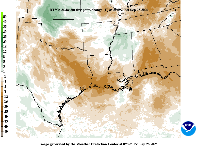
It will remain hot for sure, so look for highs in the low-90s. Thankfully not as hot as yesterday’s 97 degrees. But that humidity will make it feel far less painful regardless.
Weekend
The humidity will slowly return this weekend, especially on Sunday. But otherwise, it’ll be more of the same: low 90s, maybe a few mid 90s, and sun and clouds. Rain chances, while not zero look to remain fairly low.
Early to mid next week
The late summer party continues early next week, with heat and a slight chance of a storm on Monday. By Tuesday, a cold front is going to work across part of the state. Our modeling confidence drops off beyond that.
Mid to late next week
Either the front is going to stall west of Houston keeping us warm and humid (80s) with thunderstorm chances. Or the front is going to slowly push through the Houston area bringing in less humid and pleasant weather with thunderstorm chances.
Let’s diagnose this a little further.
If you look at the European ensemble’s probability of highs near 90 degrees, you’d see Houston generally running at 70 to 90 percent odds most days through Tuesday. By Wednesday, those odds drop to 50 to 70 percent, Thursday’s odds are 20 to 50 percent, and Friday’s odds (shown here) drop to about 10 to 30 percent.
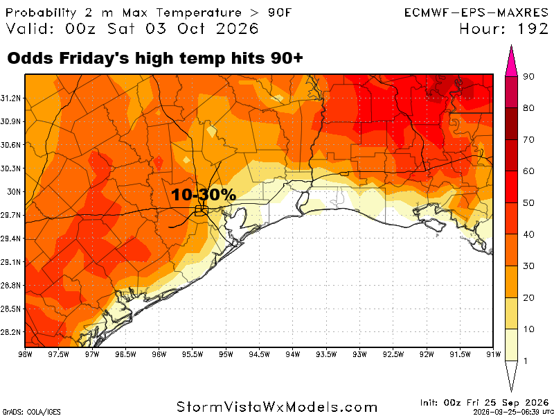
This is the under the hood element of the models we will look at to say, “Alright, you’re forecasting a certain value, but what does it actually mean the probability of X, Y, or Z is?” In this case, we have a decent signal that the odds of 90 degree heat are dropping through later next week. So, we at least can say that with some confidence. Will we get the full-frontal experience (rated G for Great)? That remains TBD. At this time, models want to keep our precipitable water levels pretty elevated into next weekend, which I would say is a proxy for higher humidity.
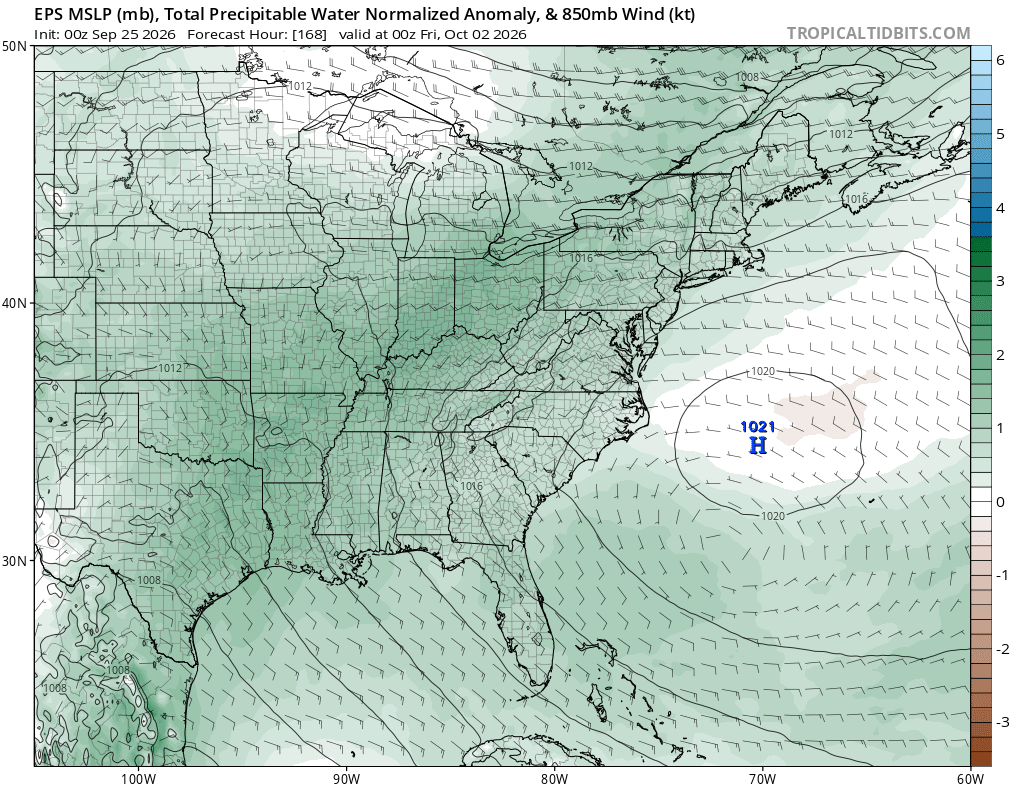
So sitting here today, I would expect declining temps but maybe not necessarily declining humidity, at least not substantially so later next week. That said, eventually one of these things is going to break through and allow lows in the 60s or 50s. It’s a matter of when, not if, and there’s still at least some chance next week’s front is the one. I’m just not terribly confident in that today.
At the least, we should all see a bit of rain next week, although the highest totals will probably stay toward Hill Country and North Texas.
We will have more on all this Monday!
