In brief: Houston faces a couple of more days of late summer weather before a significant pattern change brings us a soggy weekend. After that we expect cooler conditions next week. Is it goodbye 90s?
Tuesday
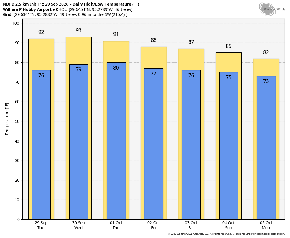
Today will bring partly sunny skies into the region, with high temperatures in the low- to mid-90s as late September heat stubbornly holds on for a few more days. Winds will be from the southwest, gusting up to 15 or 20 mph during the afternoon hours. Areas near Matagorda Bay may see a few showers, but overall chances closer to Houston, and within the metro area, look to be low today—probably in the 10 to 20 percent range. Lows tonight will only drop into the upper 70s, and briefly.
As for the Astros and their playoffs against the Chicago White Sox, with games here locally on Tuesday, Wednesday, and Thursday, I would not expect the roof to be open at all for the AL Wild Card Series.
Wednesday
This day will be similar to Tuesday, although rain chances will be slightly higher, perhaps in the 20 to 30 percent range. Expect another muggy night.
Thursday
Skies should transition to become mostly cloudy on Thursday, with highs likely in the vicinity of 90 degrees. Rain chances will be improving, but as we discussed yesterday, the bulk of the rains during the mid-week period will be concentrated over central Texas, due to moisture from the remnants of Hurricane Polo. I’d say the region has about a 50 percent chance of rain on Thursday, but the likelihood of heavier rainfall will not pick up until Friday, or the weekend.
Friday, Saturday, and Sunday
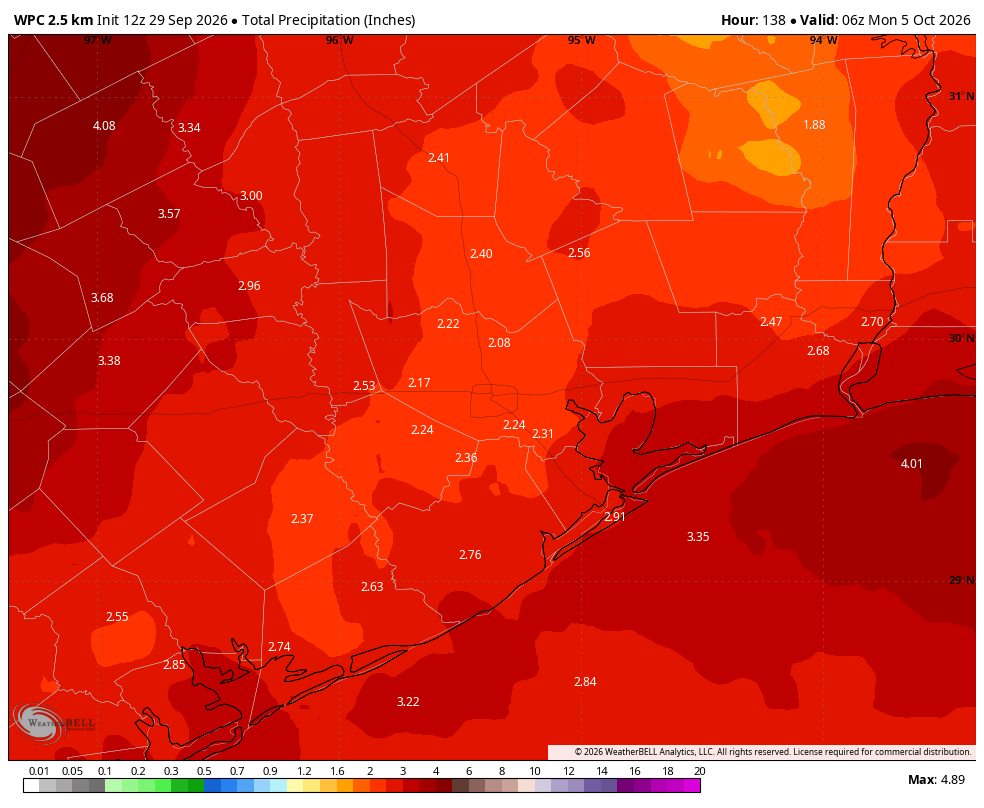
This is when atmospheric moisture peaks, and each of these days will see a healthy rain chance in the 60 to 80 percent range. Overall accumulations this weekend will likely be in the vicinity of 1 to 4 inches across the metro area, but some areas may see higher isolated totals. For now we are not going to issue a flood scale warning, but Matt and I are watching things closely to see how things evolve. Mostly, we think this just will be a soggy weekend, with on-and-off showers putting a damper on some outdoor activities. Due to rains and cloud cover, expect highs in the mid- to upper-80s this weekend, with overnight lows in the 70s.
Next week
Highs next week should remain in the 80s, and our nighttime temperatures will depend on the extent to which a series of fronts make it into the region. Right now I think it’s possible that a weak front makes it in on Monday or Tuesday, with the possibility of a another front later in the week. The details on all of this are very much fuzzy at this point, however.
