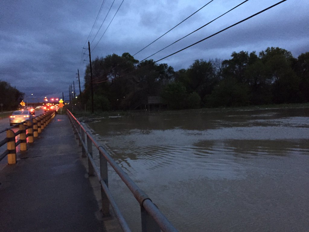
Well, some heavy rain finally came overnight, with 1 to 4 inches generally falling across the Houston area. We were lucky. A region along the Texas-Louisiana border north of Beaumont received 6 to 10 inches overnight, and there are major flooding problems.
Here’s a look at the overnight rain totals in Houston.
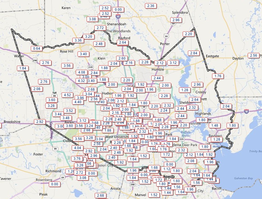
According to the Harris County Flood Control District, here are a list of watersheds affected by the rains:
Little Cypress Creek:
Creek is overbanks at Becker Rd with minor flooding in progress. Subdivision on the south side of the creek west of Becker Rd may experience some flooding of the streets as water backs up into the underground system. Creek continues to rise slowly, but looks like it is close to crest.
Upper Spring Creek:
Creek is overbanks from the headwaters to below Hegar Rd. Field Store Rd and Hegar Rd have flooding over the roadways. The creek is continuing a very slow rise.
South Mayde Creek:
Creek is overbanks at Greenhouse Rd. Creek has crested and is starting to fall. Greenhouse Rd is passable.
Upper Cypress Creek:
Creek is nearing bankfull at Sharp and Katy Hockley and will likely exceed banks later this morning. Current RFC forecast brings the creek to near 158.5 ft tomorrow morning. Minor flooding is likely along the channel from the headwaters to upstream of US 290. Portions of Sharp Rd and Katy Hockley will likely become inundated and possibly impassable.
Little Mound Creek:
Creek is overbanks and continuing to rise and may be close to impacting Mathis Rd.
West Fork San Jacinto River:
River began a rapid rise overnight. It is forecast to crest at 51.3 feet Friday morning.
Now let’s move on to the forecast.
TODAY
The bulk of the heaviest rain has now moved off to the east. That’s not to say we won’t see intermittent showers and thunderstorms today in Houston—that’s definitely possible. But the National Weather Service has let our area’s flash flood watch expire and we should not see sustained, heavy rain today. Highs will be near 80 degrees.
FRIDAY and SATURDAY
As this potent upper-level low pressure system finally moves off to the east we should see gradually drier conditions, although the possibility for rain will remain through Saturday morning. Skies should begin clearing later in the day on Saturday. Highs in the both days should be in the mid-70s, with lows near 60 degrees.
SUNDAY and MONDAY
Is anyone ready for some warmer, sunny weather? By Sunday and Monday we’ll see lots of sunshine and highs likely in the low 80s. Lows will only fall into the 60s.
We will likely stay in this warmer and drier pattern through the early part of next week as well.
About 2″ of rain for the entire event around beautiful downtown Ellington.
No flooding at all.
4.25″ overnight, 5″ for the full event in squishy Satsuma (290 @ Eldridge).
3 inches at my house near Rice University. Some ponding in the alleys, but not bad overall.