Good morning. Houston is headed toward a period of three very warm days before somewhat more moderate temperatures this weekend. But in case you feared that spring has entirely fled the region, we are reasonably confident that a fairly strong outbreak of cooler weather will arrive next week. Texas will mostly lie in the southern periphery of much colder temperatures for the United States, but we should still see a few nights in the 50s—and I’m not ruling out the 40s, either—about a week from today.
Tuesday
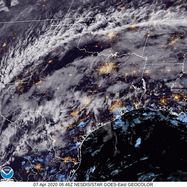
This morning is starting off foggy, but this should burn off by around 9am. After the fog goes away we’ll be left with a mostly cloudy and warm day. Winds at the surface will be light, out of the south or southwest, but if we go a little higher in the atmosphere we can see a pronounced southwesterly flow. This movement of warmer air into the region (see satellite image from early this morning below) will really help drive warmer temperatures. Highs Tuesday should get into the mid- to upper-80s, and overnight lows are unlikely to drop below 70. Rain chances are near zero.
Wednesday
After a cloudy start, we expect some sunshine to break through on Wednesday afternoon. With partly sunny skies, we probably will see high temperatures nudge up to near 90 degrees, if not hit that plateau. Expect another warm night.

Thursday and Friday
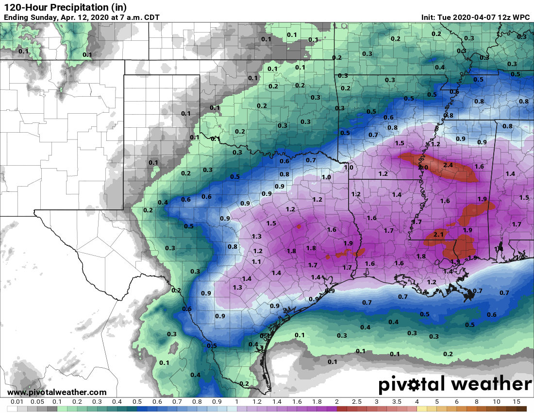
This period will be dominated by an approaching cold front and several atmospheric disturbances that will lead to precipitation. Thursday should be cloudy and warm, with highs in the mid- to upper-80s, and increasing rain chances later in the day. The front will likely edge into Houston Thursday night. Although we may see some sunshine Friday, in addition to highs in the 70s, some additional rain is possible.
Saturday
An upper-level low pressure system should keep rain chances relatively high on Saturday and possibly into Saturday night, with highs in the 70s. Total rainfall accumulations through the end of this week will likely be between 1 to 2 inches for most.
Sunday
After the upper-level low pressure system pushes through, right now Easter Sunday looks reasonably nice, with partly to mostly sunny skies later during the day. Highs probably will be around 80 degrees, but overall confidence in the weekend forecast remains somewhat low.
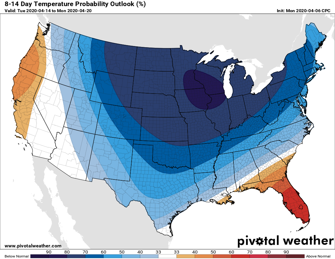
Next week
As mentioned at the outset of this post, we expect a stronger front to arrive perhaps around Monday of next week, which should set the stage for a cooler, spring-like week in Houston.
Actually got a little rain last night – – just to intensify the humidity this coming hot afternoon.
I’d prefer it to be cool and dry all the time – but that’s not Houston’s typical weather. One can still dream big.
I’ll take a few days of cooler weather gladly – gives the AC and my wallet a rest.
The last cool weather should be due this week or next, it is what everyone from Houston knows as the Easter Snap or the Easter Spell.
I hope some of you got to see the space station fly “over the moon” at about 8:22 last night. We were out searching for it and there was just enough haze on its path that I thought we were going to miss seeing it, but then it came into the clear patch near the moon.
I keep track on Spot the Station and sometimes look for it when it is going to be visible for a long time. I like to notify the local kids too, if it isn’t past their bedtime!