I was pleasantly surprised to be wrong on Tuesday night. I expected mostly cloudy skies to preclude local sightings of the full Moon—dubbed a supermoon by some because it is the closest full Moon of 2020, about 7 percent larger than a regular full Moon. However skies for the first couple of hours after sunset were clear, affording an amazing view of our heavenly companion. I hope you were able to enjoy it as well.
Wednesday
Skies are mostly cloudy this morning, with warm temperatures in the mid-70s. A few very scattered, light showers are possible before noon, but we should see some partial clearing of our skies this afternoon. This, in concert with a strong southwesterly flow aloft, will bring the region’s warmest day of the week. Depending on how much sunshine we see, highs will range from the mid-80s to low-90s across the region. Clouds should build again during the overnight hours, with another warm night in the 70s.

Thursday
This has the potential to be a more dynamic day, with an approaching cold front. This front, in concert with a disturbed upper atmosphere, will bring a healthy chance of showers to the region, along with a slight chance of severe thunderstorms and possibly hail. In terms of timing, my best guess right now is the afternoon through Thursday night, but hopefully we’ll get some clarity on this over the next 24 hours. In any case, Thursday will be cloudy, with highs in the 80s. The front arrives during the overnight hours.

Friday
Rain chances drop back to the 20 percent range on Friday. In the wake of the front high temperatures should drop back into the 70, but mostly cloudy skies will remain. These clouds should ensure that lows only drop into the 60s.
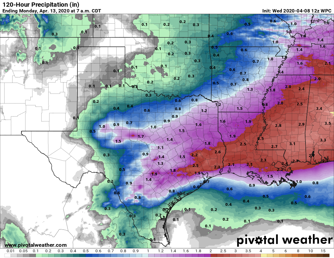
Saturday
An upper-level low pressure system will approach the area from the west on Saturday, bringing a healthy chance of rain to the area, perhaps 1 inch or so for most areas. These rains may linger in the overnight hours into early Sunday morning. Expect highs on Saturday near 80 degrees despite the rain.
Sunday
For Easter Sunday, we expect any rains to end during the pre-dawn hours. Sometime, perhaps around noon, a strongish cold front will move into the region. This will clear out our skies almost immediately, and bring much drier air. Therefore we should expect a mostly sunny Easter afternoon with highs of around 80 degrees. Winds will be fairly brisk after the front’s passage, out of the west at about 20 mph—something to keep in mind if you’re planning to set a table out of doors.
Next week
Houston should experience dry and sunny conditions for several spring-like days in the wake of the front, with lovely days in the 70s, and nights in the 50s.
What about Galveston this weekend?
Thanks – but I don’t feel like visiting Galveston this weekend.
I very much like the format of this weather report. I would like to have it in my inbox whenever possible.
Here we go. SPC slapped part of the CWA with a pretty black shaded area on an Enhanced Risk. Can definitely do without the sig hail/wind but I’m ready for a rock n roll weather day