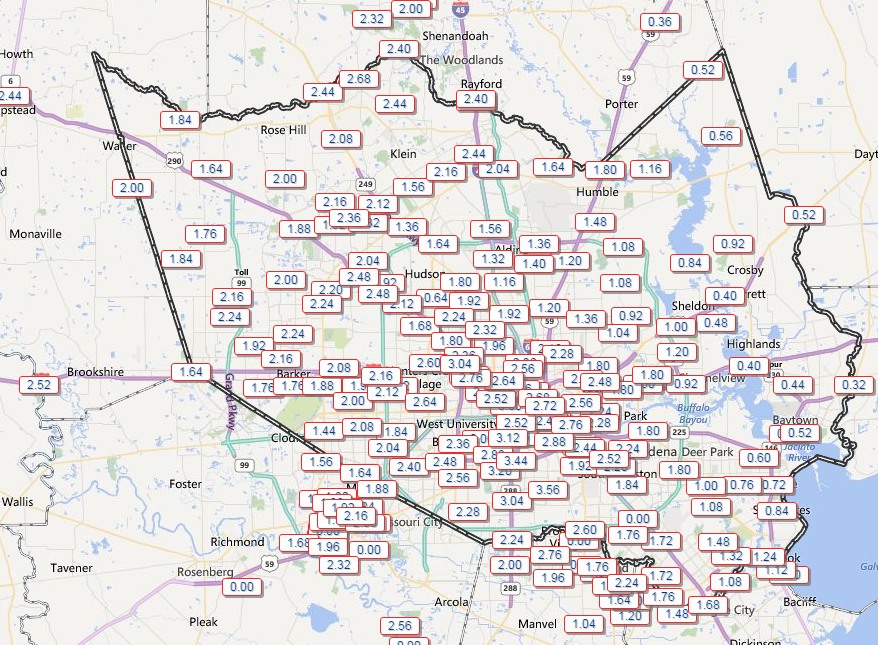
The first significant rains have moved into Houston this afternoon and early evening as 1 to 3 inches have generally fallen across the area during the last six hours.

Houston’s bayous have thus far handled the inflow of rain, no doubt aided by the fact that the region’s parched soils have sucked up some of the water and rainfall rates generally have been less than 1 inch an hour.
If the rains hold steady like this there will be few problems. But will they hold steady or increase in intensity? The answer is that, for some areas, tonight will bring mostly steady rains. But for other areas things will get much more intense.
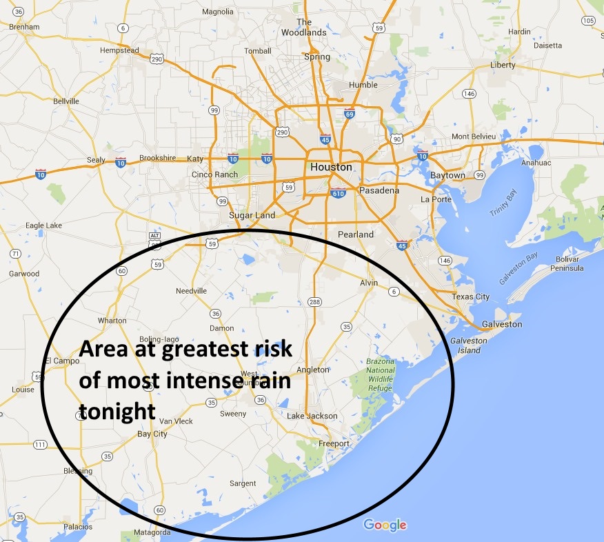
During recent runs several forecast models have indicated the heaviest rains will be to the southwest of the city of Houston, roughly in the area shown below.

It seems most likely that, if we are to see rain totals in excess of 10 inches during this event, they will occur along the coast and to the south-southwest of Houston. This is not an iron-clad guarantee, of course, this just seems to be where the radar, models and atmospheric data are pointing right now. We’ll have to continue to watch the situation closely.
I’m still expecting the heavy precipitation to move out of the area on Sunday, between about 9 a.m. and 3 p.m., from west to east.
I’ll update by 10 p.m.
Posted at 7 p.m. CT
Thank you Eric for your new website and for keeping us updated during this rain event. Wouldn’t know what to do without your info!
Thank you for all your updates and may I say: it is such a pleasure to read them without all the clutter from the old Chronicle site. Best wishes in your new endeavors!
The new “should we evacuate?” is now officially changed from Katy to Meyerland, for at least the next year or two.
OH NO, what will I do without the Katy Jokes. NOT 🙂
Thanks Eric. And I love the new blog!
Considering you are, in fact, no-hype (if history is any indication), and hype is extraordinarily tempting when launching a business where success depends almost exclusively upon public engagement, I’d say your timing in launching your site was SUPERBLY timed (Patricia gave us sumthin’ positive, dangit!).
I discovered you on recommendation of a friend about six months ago, and I’ve come to depend on you for no-nonsense, truthful (even and *especially* when the answer is “hell if I know right now”), detailed, evidence-based, objective weather forecasts.
Congratulations on embarking on this independent journey. I will be visiting here often, and I will continue to recommend you to everyone I know (to the point of exasperating them, if that’s what it takes to get them here!)! 🙂
Thank you so much — recommendations to friends and family members are the highest compliments one can give!
Eric,
I too have followed you almost exclusively in my need to find good, or Great if you will (not trying to blow wind up your skirt) lol (pun intended) weather information. I never commented on your weather blog on the Chronicle, (or felt I needed to) But your weather news was my go to place. I was SOO disapointed to hear of you leaving and was Afraid I would never find a place to hear weather (wind and rain free reporting). Thank you soo much for not leaving you faithful and (mostly intelligent) lol, readers.
Ok, (kissing A$$ done). 🙂
thanks again,
A loyal reader.
Thanks for following me over here, John.
I can’t tell from this map. Is Missouri City included in your circle of the heaviest rain? It looks like it’s right on the edge.
The map is a rough approximation, please don’t read to much into my arbitrarily drawn boundaries.
I must make it to Spec’s before the streets flood…
Happy to see you are still “hobbying” as only you can do.
And, nice graphics/layout/typeface on the new blog. We notice.
Thanks! I’m going for both informative and aesthetically pleasing.
I even Told my wife, ” If you really want to find out what is truly going on with the weather, read Eric’s blog!!”