We are looking at sort of a weird forecast for Houston in the days ahead. Read on for all the details, but basically we’re first going to get hot, and then we’re going to cool down and probably see some pretty decent rainfall. Have a great weekend, everyone!
Friday
Today’s forecast is pretty straightforward. With a warm and gusty southerly flow in place we’re going to see temperatures bump up into the mid-80s, with some areas likely reaching the upper 80s depending on how many breaks in the clouds there are. There will be a slight chance of light rain during the daytime. Conditions this evening will be warm.
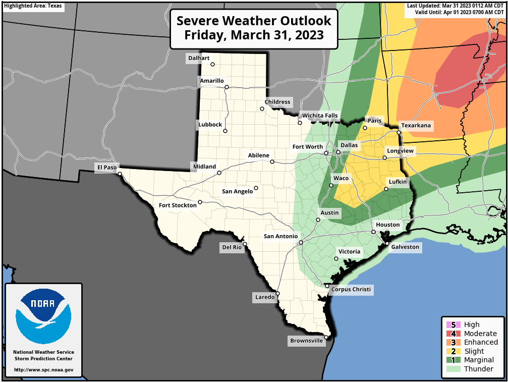
A cold front will approach Houston this evening, and this may bring some strong thunderstorms well to the north of the metro area, including locations such as College Station or Conroe. (So if you’re driving to place like Dallas this afternoon or evening, please take care). But further south, we should be protected by a capping inversion that prevents the development of such storms. Could the cap break somewhat for areas north of Interstate 10 late this evening? It is possible, but the chances are probably on the order of 10 percent.
Saturday
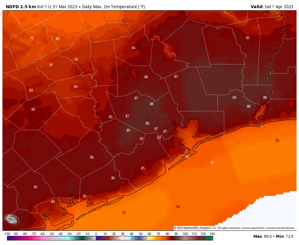
By Saturday morning drier air associated with the front will be moving into Houston. And this is going to be something because, for about 12 hours, dewpoints are going to absolutely plummet. This will feel nice, in the form of low humidity. But it’s also going to allow temperatures to spike. If we get partly sunny skies on Saturday afternoon, we will probably see high temperatures in the upper 80s to 90 degrees as dry air warms more efficiently than humid air. This dry air will be pulling back by Saturday night, as the front lifts inland, but I still think we’ll see low temperatures in the 60s for all but the immediate coast.
Sunday
This day should be partly to mostly cloudy, with returning humidity and highs in the low 80s. There is a slight chance of showers during the afternoon hours, but I don’t think we’ll see much (if any) precipitation.
Monday and Tuesday of next week
Welcome back, summer! With a warm southerly flow in place and partly sunny skies, both of these days have a solid chance to hit 90 degrees, or even a bit higher, across the entire region. It’s going to feel hot after five months of cooler weather. Rain chances are near zero.
The rest of next week
Some sort of front is going to drag into the area next week and then probably get hung up near the coast or offshore. This will do two things. First of all it should knock highs back into the upper 70s or so, and take a bit of the sting out of the humidity. Secondly, it will act in concert with some atmospheric disturbances to produce a healthy chance of rain from from Wednesday through Saturday. The details are to be worked out, but we’re probably looking at something like 50 percent rain chances each day. The Easter forecast is still very fuzzy, but I’d ballpark a high of around 80 degrees, with low-to-moderate rain chances. We’ll have all the details about that on Monday morning for you.


That wind in the Cypress area about 3 am this morning was no joke!
Yes they were! I was so confused because I expected there to be a severe storm on the radar and saw it was only mild showers but insane wind gusts!
Yes, I’m surprised Eric didn’t mention it. Our power flickered on and off for maybe 1/2 hour at around 3AM. This morning many large tree branches were down in our neighborhood (near Champions).
The “capping inversions” all day all the time are disturbing. Lack of periodic rain in the metro area now seemingly going on 3 years. Winds are out of the SE today so no impact from the desert west. What’s the deal with this.
Looking at the LCH sounding from this morning, the column is not that saturated. The cap is weak, but there, and with no significant forcing mechanism via front (won’t be here until later) nor daytime heating (several cloud decks looking at HOU time series), there’s just not enough oomph to produce sufficient precip.
While I’m sad to hear that the dry air will only be for a short 12-hour duration on Saturday, I’ll take it.
Dry and warm is a fine blend. Hot and wet is not but that’s what we usually have most of the year. To paraphrase a certain “performer” who said if someone else got indicted, I’ll dance in the street if it is dry.
Seems to be a disconnect with local weather now days. Y’all are saying no rain Sunday while ch 13 says 70% possibly severe Sunday. Losing confidence with local Mets around town now days.
https://cdn.abcotvs.com/dip/images/13052034_033023-ktrk-ewn-530pm-travis-thurs-omw-irios-vid.jpg?w=800&r=16%3A9
I was thinking the same thing and kept checking multiple sources. 13 seems to be the only one thinking that on Sunday.
Maybe their forecasts ignore the fact that we are capped all day all the time
I wouldn’t call the forecast “weird” because spring is a transitional season, with weather that can range from scorching summer weather to chilly and breezy. April is typically one of the rainiest months in Houston; the “April Showers” rhyme does hold true here, although, last year spring and summer were unusually dry.
Ninety degrees? BOOOO!!!
Back to miserable swamp weather for another 6 months, where you can’t step foot outside.
Please stop exaggerating, lol… can’t step foot outside, c’mon
Looks like one of the biggest tornado outbreaks in years to our east, glad we aren’t dealing with that!
Where is Thunderstorm Lover or Joseph when you need them….