Three more days of heat. That’s how much of this late-summer like weather remains for Houston before some relief arrives to rescue us with some more fall-like weather. And after Sunday’s 91-degree high temperature I am certainly ready.
Monday and Tuesday
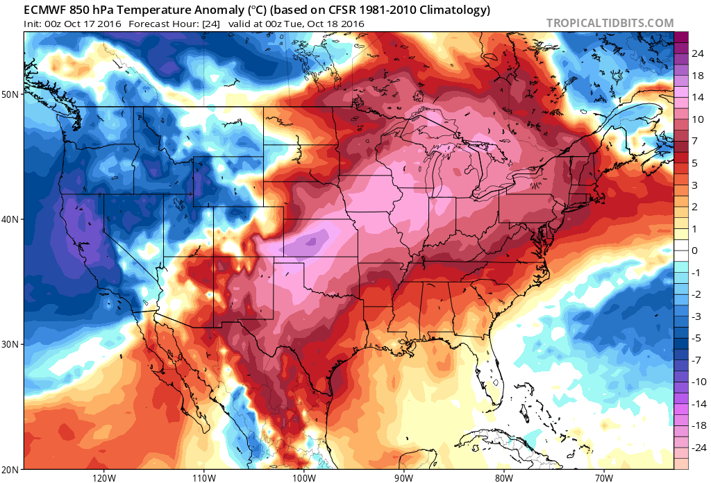
High pressure should dominate our weather for the next two days, and this will allow temperatures to rise to about 90 degrees, or even into the low 90s for inland areas, along with mostly sunny skies. (Today’s record high of 93 degrees for Houston, set back in 1895, is not out of reach). Rain chances are near zero.
Wednesday
As high pressure finally exits to the east we could see some better rain chances, especially during the afternoon hours. I don’t think we’re looking at anything too widespread, but at least some scattered showers should be possible with the lower heights. Temperatures will still rise to near 90 degrees.
Thursday
Late on Wednesday, or early Thursday, a fairly strong cool front will move through the Houston region and finally knock out the heat and humidity. Some showers will be possible with the frontal passage but I don’t expect a major line of storms. Conditions should be breezy on Thursday after the front moves through, with northerly air moving in. Highs likely in the low 80s, cooling off to the upper 60s after sunset.
Friday and Saturday
Finally, some beautiful fall weather arrives. Expect mostly sunny skies, highs near 80 degrees, and lows in the 50s (low 50s inland). Hard to beat these conditions. Saturday morning likely will be the coldest morning of fall so far for the entire region.
Sunday and beyond
Temperatures will slowly begin to warm up by late Sunday or Monday, and I’m afraid that by Tuesday or Wednesday of next week we’ll probably be back into the late 80s as higher pressures build back in. It’s not clear how long this warmer weather will persist.
Posted at 6:45am CT on Monday
Looks like a nice weekend for an air show.
Nigh perfect.
what’s the forecast for la niña this year & what’s the dew point forecast for next bout of summer-lite?
thanks
Right now most of the models have swung back toward a weak La Nina.
As for the return of summer lite dewpoints, probably a bit lower than the current bout.
Are we on track to record one of the warmest Octobers the Houston area has seen?
Right now we’re on pace to be one of the top five Octobers. The strength of the ridge next week will probably be the biggest determinant.
Wow…a chance to reach the high temp record (93) for this date set in 1895…wouldn’t that be “cool”?! I know…a bad attempt at humor…
You’ve got a hot sense of humor, sir.
Next week will bring higher pressure and time travel to the late eighties? Ought to be interesting!
I believe December 26, 1989 was our all-time record low temperature day in Houston (9 degrees). I’m not sure we need a return to that date but sometimes the late 80’s sound better than the mid 2010’s.
Late 80’s, eh? Better dust off my Beastie Boys and LL Cool J tapes to get prepared.