Good morning and welcome to a new week. There remains little exciting to say about our region’s weather as this week will feel like Groundhog Day, with conditions each day more or less like the last. Sure, a few areas may see a stray shower or thunderstorm during the afternoon hours, but for the most of us, it will be hot and mostly sunny. The good news remains that, one does not really enjoy the weather during August in Houston—one survives it. And given that we are unlikely to face triple-digit heat or widespread floods over the next week, it is difficult to complain too much.
Monday
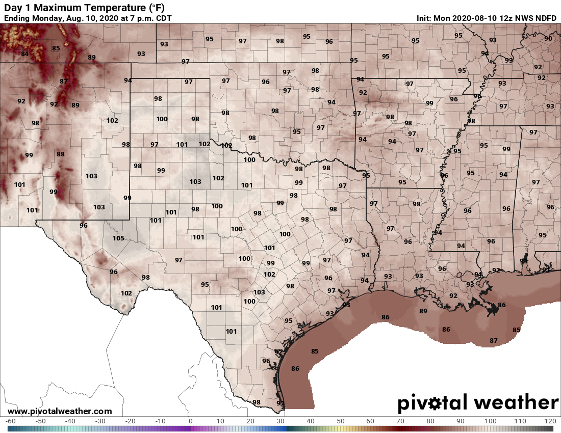
Houston remains on the periphery of a high pressure system anchored to our west, and this should both prevent temperatures from getting too hot, while also allowing for a few sea breeze showers to develop during the afternoon hours and move inland. Look for high temperatures in the low 90s along the coast, with temperatures in the mid- or upper 90s for far inland areas. Light, southerly winds will offer little relief. Nor will nighttime temperatures. With lows of only 80 degrees last Thursday, Friday, and Saturday, Hobby Airport tied record for overnight heat and we should remain nearly as warm.
Tuesday and Wednesday
This will be a pair of mostly sunny days, with high temperatures in the mid-90s, along with more warm nights. Again we may see a few coastal showers develop during the afternoon, and progress inland.
Thursday and Friday
Overall this pattern of partly to mostly sunny weather will continue. Highs will remain in the low- to mid-90s for the most part—which is certainly hot, but not as hot as we sometimes see beneath a strong ridge of high pressure. Scattered rain chances will pop up during the afternoon hours.
Saturday and Sunday
As the high pressure system to our west backs further off to the west by this weekend, it could open the door to slightly more widespread showers and thunderstorms. However, if I were a betting man, right now I’d anticipate that conditions for this coming weekend will not be too different from what we just experienced this last weekend, with highs in the mid-90s and scattered showers. Like I said, Groundhog Day, y’all.
Tropics
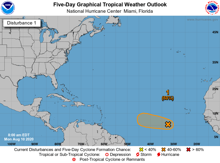
Matt will have more to say about this on Tuesday, I am sure. There’s a new blob on the five-day outlook from the National Hurricane Center, but as of now we don’t think this will move toward the Gulf of Mexico. For us, at least, things look to remain quiet for a bit longer.
July and August are months where local TV meteorologists can usually be replaced by cardboard cutouts and the words “hot and humid”.
The dog days of August are here but I don’t mind changing it to “groundhog days” of August thanks to Eric (who is always appreciated for his solid calm work).
It may be a boring and unpleasant forecast but each week that goes by quietly is another week closer to the first cool front. Then, the house projects can begin.
You mean, I can wait?
Boring is good during hurricane season.
Sounds like fine summer weather to me. What really makes Houston so hot is the intensity of the sun. And the way that it heats the pavement.
Thank you for your simplified and very accurate weather forecasts. You save me daily from waiting for the news to squeeze out a little info here and there
I’ll take mid 90’s and no tropical weather any day in Auggghhhst.
Ground Hog Day Weather with Ground Hog Day COVID-19…ooohh joy! Hey, can anybody out there tell me how I missed COVID’s 1 through 18?
I think the 19 is for 2019, the year it originated……
The Houston Chronicle just released a Flood Risk Map and Weather Tracker Map. What’s your view of this tool and others such as Harris County Flood Warning System, etc?
https://www.houstonchronicle.com/news/houston-texas/houston/article/texas-flood-map-tracker-weather-rain-houston-tx-15468139.php