We’re going to have a pair of warm and potentially wet days this week before a cool front arrives on Wednesday evening to bring sunshine and more seasonable weather back to the area. We’re still eyeing the possibility of storms Tuesday night and Wednesday, but we’re not overly concerned as we expect the system to weaken as it approaches Houston.
Tuesday
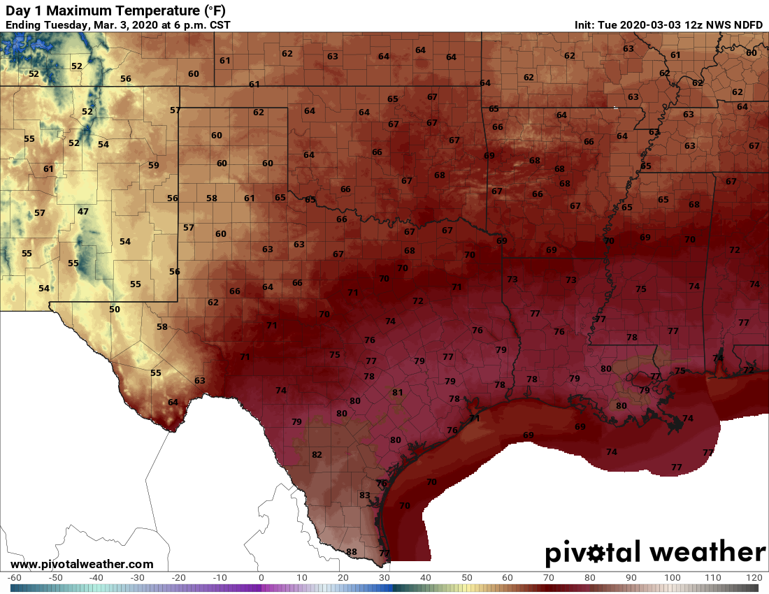
You’ve got two choices for weather today: Gray and humid, or humid and gray. Some areas near the coast are seeing foggy conditions, and that should burn off later this morning. We’ll be left with a cloudy day, high temperatures near 80 degrees, and increasingly moist air. But it seems likely that rain showers will, for the most part, hold off until at least the overnight hours. 
If you’re heading out to the Houston Livestock Show and Rodeo’s opening night, you probably don’t need sleeves. Temperatures this evening should remain in the low 70s, with only light winds from the southeast. A smattering of light rain is possible, but our guess is that you’ll remain dry.
Wednesday
An upper-level low pressure system will push through the region on Tuesday night and Wednesday, but the models are all over the place in terms of rainfall. They’re struggling with the fact that while there is a fair amount atmospheric moisture, a capping inversion may prevent widespread showers and thunderstorms. At a best guess, I think most of the area probably will see a couple of tenths of an inch of rainfall, but its certainly possible that northern areas (likely north of The Woodlands) could get 1 to 3 inches, and southern areas little to no rain at all. A front arrives Wednesday afternoon or evening to begin to cool us down.

Thursday
This has the look of a very nice day, with a moderate northerly breeze and clearing skies. We can probably expect high temperatures in the upper 60s. Lows Thursday night will likely drop down to 50 in the city of Houston, with warmer temperatures along the coast, and cooler inland.
Friday
This should be another day like Thursday, with partly to mostly sunny skies, and a high temperature of about 70 degrees. Darn nice.
Saturday and Sunday
The weekend holds more sunshine on Saturday, but we may see a few clouds mix in as the onshore flow begins anew. This will nudge overnight temperatures into the mid-50s on Saturday night. Despite more clouds on Sunday, temperatures will likely push into the 70s with more humid air.
Next week
The first half of next week looks fairly warm, with highs probably somewhere in the upper 70s to 80 degrees. There are hints of a cool front by around Wednesday or so, but nothing concrete in the offing. Rain chances begin to increase on Monday or Tuesday but we’re not seeing anything spectacular.
Woot for all of us running The Woodlands half/full marathons on Saturday morning!
Most accurate and straight forward forecast I use. Would great if you could include wind-predictions as well
Thanks for the great work
Prayers out to the folks in Nashville this morning. I remember 2 1/2 years ago visiting that city and touring Vanderbilt and the student guide told us her city is now considered the center of Tornado Alley. I don’t know if that is true, but sadly was reminded of it this morning.
Thanks for my first laugh of the day “You’ve got two choices for weather today: Grey and humid, or humid and grey.” Love you guys!
Eric/Matt, what is the forecast as the low moves further east? We are out on a roadtrip to south FL on Thursday. Thanks in advance.
Prayers to all who were affected by the Tornado outbreak.🙏