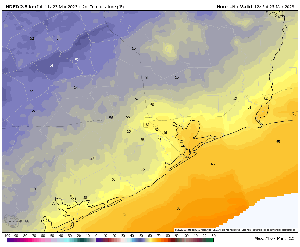
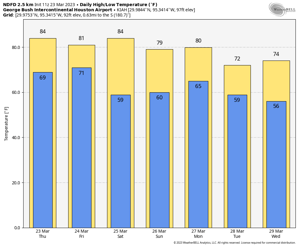
Good morning. Houston’s more or less Spring-like weather will continue through this weekend and into next week. We won’t be getting too hot, and we won’t be getting too cold, and there will be a smattering of rain showers from time to time.
Thursday
Today will see fairly warm temperatures, as mostly cloudy skies give way to partly to mostly sunny skies this afternoon. This will allow temperatures to pop up into the low- to mid-80s. Winds will be noticeable out of the south at 10 to 15 mph, with gusts up to 25 mph. As clouds return this evening, expect a warm night with lows in the low 70s.
Friday
A front will progress toward the Houston metro area on Friday, likely producing fairly widespread, but mostly light showers. A capping inversion in the atmosphere will most likely prevent stronger thunderstorms from developing over the Houston metro area, but the further east you live the more likely this is to happen—further east as in the Beaumont area. Highs will be about 80 degrees on Friday, and overnight temperatures will slowly come down as the front stalls before finally pushing off the coast Saturday morning.
Saturday
This will be a fine, sunny day with an abundance of dry air. Look for sunny skies with highs in the low- to mid-80s as air temperatures warm quickly with less moisture in the air. Clouds return on Saturday evening as the onshore flow redevelops, however. Lows should drop to around 60 degrees in Houston, with cooler conditions inland.
Sunday
With a southerly flow, look for more humid and partly cloudy conditions on Sunday. Highs will probably top out in the upper 70s. It’s increasingly likely that most areas will see at least some sprinkles on Sunday, with accumulations of one to two-tenths of an inch possible.
Next week
We’ll see more of the same next week, which is to say a weak front comes in on Monday and cools us down and dries out our air for a few days before a warmer flow resumes. The details of this remain unclear, but it seems safe to expect highs in the 70s and 80s, and lows in the 50s and 60s. So all in all, pretty Spring-like weather for Houston.


Hello! Thank you for the updates on weather. As always, y’all are awesome. I just want to clarify something since I’ll be outdoors most of Friday:
…but the further east you live the more likely this is to happen….
Is the capping more likely further east, meaning more chance of thunderstorms in the immediate Houston area? Or are thunderstorms more likely further east?
Thank you for your time and dedication to Houston weather!
stronger storms east of Houston, light storms in Houston due to capping
Yes I agree with “IR” and would like to have more detail on the capping inversions here in Houston. We seem to always have them and it’s really dry – almost seems like the Arabian/Persian Gulf at times. And I can’t find anything on Twitter that describes technical weather effects (height anomalies and such) for our area. Lots of stuff on Twitter for Cali and the NE. But USGC not so much. Maybe because our weather is BORING hot, humid mostly so meteorologists are not that interested in the weather here. This site gives a detailed 5 day forecast – which is excellent – but I do miss the old sci guy!
The desert Mountain plateau in Mexico is the primary origin of the notorious “capping inversion” here in Southeast Texas. The elevation of these hot desert mountains are much higher than our part of Texas so this dry warm air aloft is pretty much invisible to us as it floats much above the surface. But they become very noticeable over time because of how they suppress rainfall in our area. I’m sure there are other causes for the capping inversion here in Texas but the dry desert mountains in Mexico seems to be the most common cause. A meteorologist will probably have a much better answer than me though.
The majority of the low pressure systems also known as mid latitude cyclones that typically swing through the country during the fall, winter, and spring have been steered north of Texas thanks to a further northern position in the jet stream. Winds always blow toward the center of a low in a counter clockwise motion. This causes warm dry air from the mountains in Mexico to drift over Texas. This warm dry air aloft tends to intersect approaching cold fronts which can outright prevent any rain from developing at all ahead of the front. The warm moist air at the surface can no longer rise once it meets that warm dry air in the middle of the atmosphere. It’s amazing how geography can influence the weather in areas hundreds of miles away. This same phenomenon contributed to the catastrophic Texas drought in 2011. I think that La Nina is partly to blame but isn’t the main driver since this same pattern can occur even in El Nino years. Other factors are involved that I don’t fully understand yet. Winds need to blow more directly out of the gulf ahead of the cold fronts in order for our area to see widespread soaking rains. This becomes easier when low pressure systems associated with cold fronts swing further south into Texas. This is something that tends to occur more during El Nino Winters.
I should also mention that High Pressure areas can also cap the atmosphere as air sinks instead of rising in a high pressure system. This is what can cause or exacerbate droughts during the Summer here in Texas much like last year and many other Summers throughout history.
Joseph, well done!
Thank you! I study alot of weather and atmospheric science. I still have much to learn. I have always had an endless curiosity and obsession with what makes the weather tick the way it does around the world lol