Thanks to a drier airmass this weekend, we’ve seen overnight low temperatures dropping from their extreme highs this summer. Lows this weekend at Bush Intercontinental Airport were 71 and 70 degrees on Saturday and Sunday mornings. This slightly drier air will start to mix out over the next couple of days, leading to a better chance of rain later this week.
Highs will be in the mid- to upper-90s to start the week, but should cool off a bit with the better rain chances toward the end of the week. And another weak front appears to be on the horizon by late weekend that may—just maybe—push daytime highs into the upper 80s for some locations. No promises!
Monday
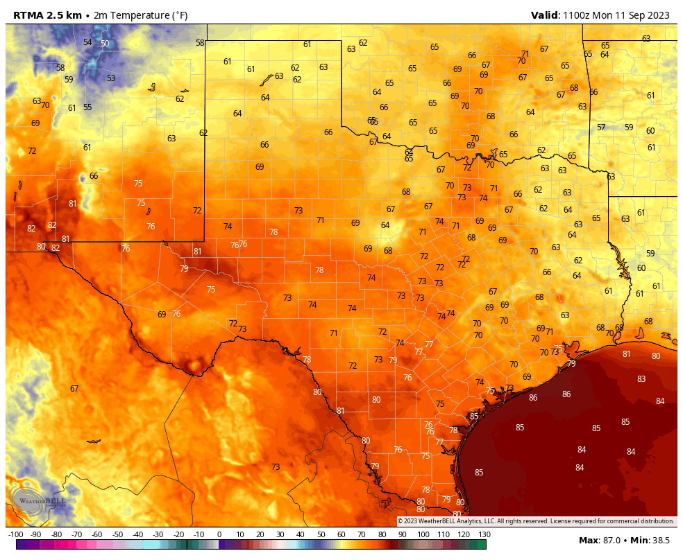
With light northeasterly winds today, we’re going to see continued sunny skies and highs in the mid- to upper-90s. Due to the light winds, the Texas Commission on Environmental Quality has issued an Ozone Action Day, meaning that atmospheric conditions are expected to be favorable for producing high levels of ozone pollution today. People who are sensitive to this should take precautions such as limiting time outdoors. Low temperatures tonight will be a few degrees warmer, likely in the mid-70s for much of the area. This is still considerably cooler than we’ve experienced for most of the summer.
Tuesday
Another sunny day, a lot like Monday. However as winds become easterly and southeasterly we’ll see a bit more humidity. Expect mostly sunny skies and highs generally in the mid- to upper-90s. Rain chances remain essentially zero.
Wednesday and Thursday
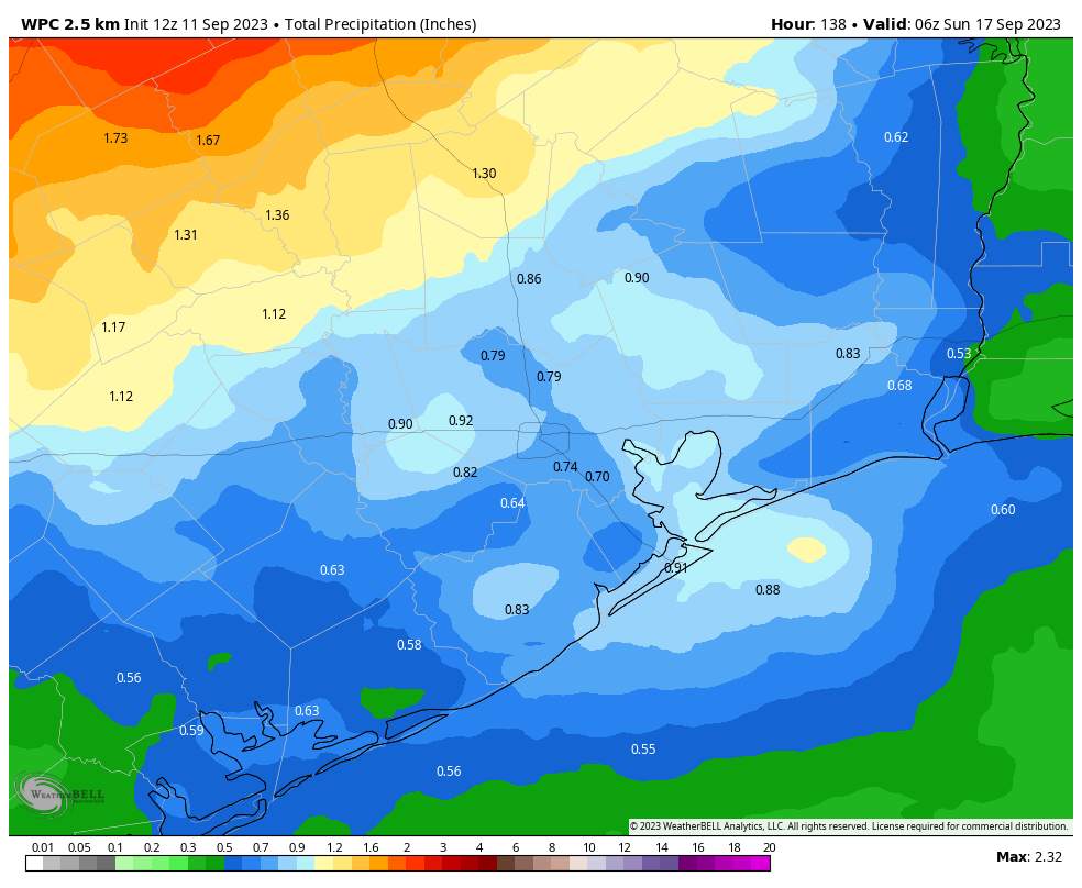
The atmosphere turns more perturbed by mid-week, and with slightly higher atmospheric moisture levels we should start to see better rain chances by Wednesday afternoon or evening. Daily rain chances will be on the order of 40 to 50 percent, probably. Showers most likely will not last super long, but some areas could receive a decent soaking of a few tenths of an inch of rainfall, or more. Daytime highs will depend on the extent of rain and cloud cover, but for the most part expect temperatures in the low- to mid-90s.
Friday
Our rain chances look to peak on Friday, with coverage of perhaps 60 or 70 percent of the area. Look for highs, again, to be in the low- to mid-90s. Accumulations for Saturday look higher for inland areas, perhaps an inch or more, and lesser closer to the coast.
Saturday and Sunday
Some rain chances will linger into Saturday, but for the most part skies should be mostly sunny with highs in the low- to mid-90s. Rain chances should end definitively by Sunday, as another weak front appears likely to push into the area. The extent of this front’s influence remains a bit unclear, but we should at least see some drier and slightly cooler air by Sunday or Monday night.
Next week
Most of next week should see sunny skies, with highs possibly in the upper 80s to start the week, before warming back into the low- to mid-90s.
I’m not ready to declare “Fall Day” yet, as that comes with the season’s first decently strong front, which knocks air temperatures down to 65 degrees or below. And this definitely is not “fall-like” weather. But it is fairly typical for mid-September, and an improvement from a few weeks ago.


So what’s your take on the rest of hurricane season? Can we breath a sigh of relief for this year?
Its still active in the tropics “all caps” David, and still in September
Nope…
This summer has been off the rails, ONE degree away from the all time high, and ONE day from tying 2011’s record number of 100 degree days (at IAH). It’s still not even mid September yet, hang in there guys and appreciate the dry air!
from breaking the all time high*
The dry air makes a world of difference and I’m happy for it! It allows the place to cool off below 80 degrees at night – sure, it is still 75 degrees but a world of difference (again).
And, while it is still toasty during the day, the lower humidity lessens the oppression. Keep it coming! Can Fall Day be too far behind? Be still my beating heart.
Let see if the rains verify. Time and time and time again this summer, when rain has been forecasted, it has woefully under produced or not materialize at all. As far as temperatures go, we gotta start somewhere that leads to the crisp 55 degree days that we have earned 10 times over, so staying out of the 100s is a start.
I would say this is a HUGE improvement over our conditions from a few weeks ago. It’s still way hotter than I would like but there is a massive difference between 107 and 97!
Got down to 65 degrees here about 6am, here in Pinehurst / Stagecoach area (between Tomball and Magnolia).
The temps this morning were wonderful! Excited to see some moderated temps!
On Saturday, I got a whole 0.01″ of rain! It is now 65 days without appreciable rain.
What happened to the Eyewall website. All i get is the headline. No forecast.
What happened to Chuck Perry above just now happened to me with this Space City Weather post. Reading my email on my phone, I only had the title of the post. However, I tapped on the title (once or twice?), and the whole post opened in a new page. Just an fyi here for Eric, Matt et alia.
I had the same issue as Nora, except I was reading my email on my laptop using Outlook (so it’s probably a more widespread problem). Great post otherwise, SCW team (per usual)!
I looked at the display of the outdoor temperature this morning and thought the sensor was broken. Not only below 80 for once but below 75 ! An inch of rain Saturday morning plus 0.5″ on Labor Day.
It sure felt nice! Had 73° at my place. Able to walk the dog much further! I’m dying for that first COLD front to get here. 🙂
Sixty-two this morning northeast of Bryan, TX – Reliance area. Downright chilly!!! for a welcome change.
Raising my early Pumpkin Spice Latte to welcome cooler temps.Fall and Winter are my Favorite Seasons.
So… has the heat dome finally broken down or has it just moved to the West again only to make a triumphant return later this month?
Heat Dome is inevitable. All hail Heat Dome.
So very true. If nature could embody itself, it would do away with us utterly useless and destructive beings.
We need the rain.