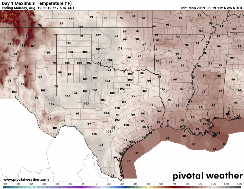
So far, August has been mostly a hot and dry month. Average temperatures are running 3 to 4 degrees above “normal” levels, with most of the area at a rainfall deficit. The good news—and good is definitely a relative term for August—is that this pattern should moderate slightly for the last 10 days or so of the month. This means that, with one or two exceptions, we are probably finished with 100-degree days. And hopefully rain chances will be a little bit better.
Monday
Conditions will be muggy and partly sunny today, with high temperatures generally climbing into the mid- to upper-90s across the region. High-resolution models suggest that scattered, but locally strong thunderstorms should pop up today from around 2pm through sunset across the region. Chances may be best roughly along the Interstate 10 corridor and closer to the coast, but I don’t have too much confidence in locations. Overnight lows will remain warm, around 80 degrees for most of the metro area.
Tuesday
A similar day to Monday, albeit with perhaps slightly less shower and thunderstorm coverage during the afternoon and early evening hours.

Wednesday and Thursday
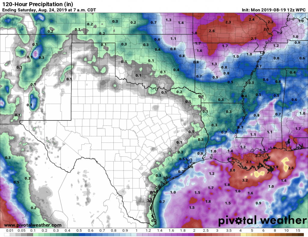
As high pressure tries to build in a little bit, we may see rain chances fall back to around 20 percent, but they’re not going to go away entirely. These will be partly to mostly sunny days, with highs in the mid- to upper-90s. Thursday may be the warmest day of the week.
Friday, Saturday, and Sunday
High pressure appears to back off for the weekend, but as of now—even though our atmosphere will be open to the Gulf of Mexico—the appear to be no real triggers for widespread rainfall. For now, I think it’s best to broad brush the area with 30 to 50 percent rain chances for the weekend, with high temperatures generally in the low- to mid-90s. If you have outdoor plans, stay with us and we’ll try to refine the forecast a bit better over the next day or two.
Tropics
On Friday, Matt expressed some well-grounded concerns about the tropics and the Gulf of Mexico, but over the weekend the global models have really backed off scenarios showing development that could threaten Texas over the next seven days. Now it appears as though the Gulf, and pretty much the entirety of the Atlantic basin, is likely to remain quiet this week. As we head toward the end of August, that’s a great place to be.
Wish I had waited for this forecast. Now I’m 45 miles from the house in a stripped down Jeep. Along the coast. Fingers crossed!!!!!😂
Eric, are there any correlations between how active the Pacific is versus the Atlantic?
And, is there any correlation when a given year is particularly “dry”?
In other words, scientifically, if one year is dry (drought), is the hurricane season worse the next or subsequent years? (Or remaining months in a season)
Or is it all random?
Thanks for taking time to teach!
This has got to be one of the few places where “mid- to upper-90s” would be considered “moderation”. Sigh.
Is August the driest month of the year?
According to that infallible keeper of all truth known as “Wikipedia”, it’s February – 3.2” at IAH. August averages 3.76”
Good news that there is not a hurricane or tropical storm brewing. August and September seem the most likely months to have one hit, even though “hurricane season” lasts until November or December, the likelihood drops a lot after September.
It has been mentioned, on this website, that September 24th is the usual end of hurricane season around here. I believe the odds of a hurricane after that date are pretty low.
Eric, I wish, on occasion, that you would revert to “Sci-guy” mode and write an article on science like you did for the Chronicle way back when.
Go to https://arstechnica.com/ fo that.
Eric, I wish that occasionally you wuld write an article on science as you did for the Chronicle way back when. Thanks.
I was hoping that the models would hang on for some type of development and a decent rainmaker. Guess not. Burn bans for us