Good morning. After several partly to mostly sunny days, Houston’s weather will turn cloudy today. And beginning Thursday, we’ll see at least low rain chances daily through the weekend.
Wednesday
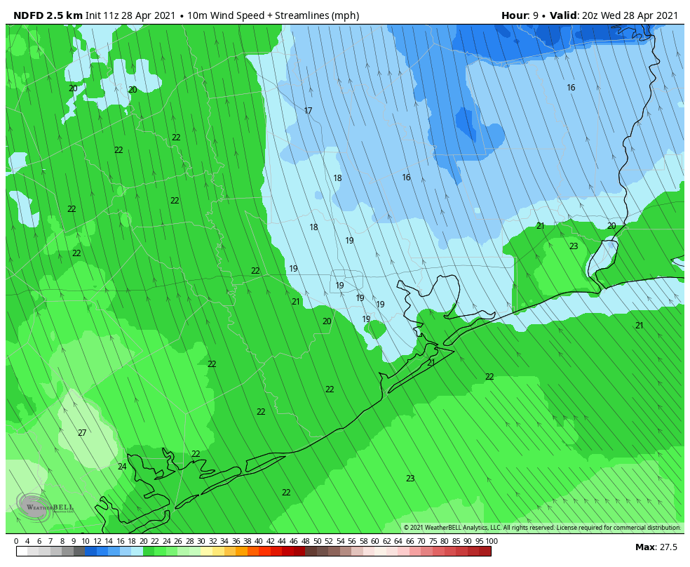
Today will be warm, mostly cloudy, and quite breezy. In response to a low pressure system over central Texas, onshore winds will blow at about 15 to 20 mph, with gusts up to 30 mph. A wind advisory is in effect for areas just west as southwest of Houston, including Brazoria and Fort Bend counties from 11 am to 7 pm. It will be a rather warm day, with highs in the mid- to upper-80s, and the mercury could go a bit higher still for areas that see snippets of sunshine this afternoon. Rain chances are near zero, with a capping inversion in place, but we can’t entirely preclude a few sprinkles. Lows tonight will not drop below 70 degrees.
Thursday
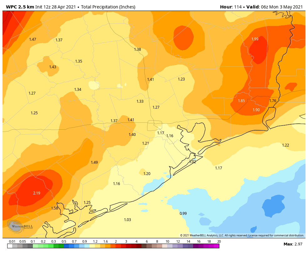
A cold front will be pushing through Central Texas overnight, and this will send a line of showers and possibly thunderstorms toward the Houston area. This line, which likely will be weakening as it moves into a more stable air mass, should reach College Station by around sunrise, and the Houston area itself during the afternoon hours. As for accumulations, its sort of a crap shoot, but I’d estimate most areas will see one to two tenths of an inch of rain.
It now appears that this line of showers, and an attendant weak front, will move off the coast Thursday evening. Daytime highs will be in the low 80s, with cloudy skies. Overnight lows will probably drop into the upper 60s.
Friday
At this point Friday looks mostly dry, but we can’t entirely rule out at least some scattered showers in the wake of the weak front. Skies will be mostly cloudy with highs likely somewhere in the upper 70s for most areas. Lows Friday night should again drop into the upper 60s, but my confidence in temperatures is not great.
Saturday and Sunday
Both weekend days should see mostly cloudy skies, and highs of around 80 degrees. The bigger question concerns rain chances, as a few disturbances pass across the area. I think both days will have about a 40 percent chance of at least light rain showers. For those participating in the Bike MS Texas on Saturday, that’s the bad news. The good news is that winds will have shifted to come from the south and southeast on Saturday, so there are very good odds that riders will have a tailwind going from Houston to College Station. Overnight lows will probably be in the upper 60s to 70 degrees.
By Monday, with sunnier weather on the way, highs should start to push into the mid- to upper-80s. Most of next week looks fairly warm, as one would expect for early May.
My venue is hosting an outdoor wedding ceremony at 5:30 on Saturday near Memorial Park. Do you think we will need a tent?
Eric as given you the data he has. You need to make the decision.
With 40% chance that day might not be a bad back up plan. Houston can be so unpredictable so i would err on the side of caution. Happy Nuptials!
People will appreciate the shade even if it doesn’t rain.
I see that our old friend, Capt. Inversion, is back in the picture.
Captain Inversion! That’s a good idea for a Space City Weather fundraiser t-shirt. I’ll buy one cuz I’m a sci guy dork! 🙂 No one gets my Berger Lanza campaign shirt.
At the risk on incurring the wrath of the weather gods again, I hope the rain isn’t a bust again.
Eric – we’re going to be outdoors most of the day at Sherwood Forest Faire in McDade – Near Elgin and Bastrop. Do you envision the weather in that area being bearable, or is it likely to be more turbulent / heavier rains with lightning?
Or perhaps ubiquitous tornadic cyclones?
Ah, the wonderful weather of May in Houston is back. The mosquitoes are all in force already reading to sing their buzzing songs into our ears.
Exactly what is the “relevance” of a “wind advisory” in Fort Bend with winds possibly 15-20mph? What are we supposed to be readying for? Napkins from our Starbucks blowing away?
Ah yes – NWS playing weather nanny to the weather weenies again…