We’ve been talking since last week about how the end of this week and/or the weekend look like hot days in Houston, giving us our first shot at 90° in 2017. However, after looking at weather data today, I think there’s a legitimate chance Houston could officially touch 90° for the first time tomorrow. Not a guarantee by any means, but there’s a chance. And the meteorology around it is sort of interesting, so let’s lay it out for you.
Step 1: Have a warm air mass in place
The recipe for Houston to hit 90° in late April involves a few factors. And this may seem like a “duh” statement, but it’s important to touch on. You need to have a warm enough air mass overhead.
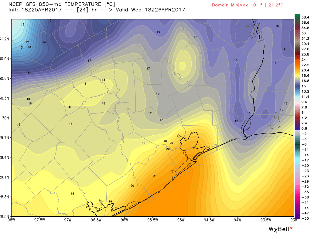
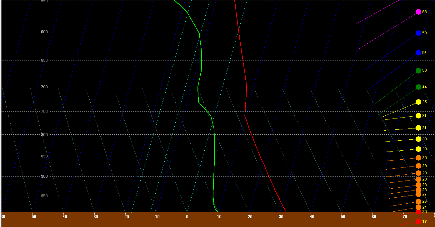
The GFS forecast for tomorrow afternoon has temperatures borderline, but close enough to historically be capable of producing a 90 degree day in Houston. The map of 850mb temperatures above shows how warm it is about 5,000 feet up in the atmosphere. There’s an old school meteorology trick you can use to forecast high temperatures using the 850 mb temperature in the morning. It involves using a sounding (as explained here) and taking the 850 mb temperature down what we call the dry adiabat to the surface. One of the problems tomorrow is that with a front coming through, it creates volatility, which makes using that method difficult. But if you look at forecast soundings for 4 PM tomorrow afternoon, they look healthy for at least an 87-89° sort of day.
So on Wednesday, we have just a barely warm enough atmosphere to work with.
(Space City Weather is sponsored this month by The Mole, a Jonathon Price novel.)
Step 2: Dry out the atmosphere
Houston gets hot in late spring. We know this. But typically it’s mid to upper 80s most of the time. We’re heavily modified by the Gulf of Mexico. Yeah, the Gulf gives us a lot of humidity, but it keeps temperatures somewhat in check, because it is generally cooler than the land. This is why it’s usually hotter in summer in Austin and Dallas than Houston. It’s hotter, but it’s also less humid. In a nutshell: The science is that dry air warms up easier than moist air. Water molecules need a good bit of energy to heat up, so the more humidity you have, the more energy it takes to heat that air up. Dry air will heat up quicker and more efficiently because there’s less energy “wasted” on dealing with the moisture in the air. So how can we view this on a day like tomorrow? Dewpoints.
For tomorrow to be a 90° day, you need to get dewpoints out of here. If you’ve been outside Tuesday evening, you know it’s disgustingly humid out. Dewpoints in Houston are officially up around 70°. Galveston is in the low 70s. Once you cross the 70° threshold for dewpoints, it starts feeling gross. So what happens on Wednesday? We have a cold front coming, and ultimately the speed of that front will determine whether or not the atmosphere dries out enough allowing us to test 90° Wednesday afternoon.
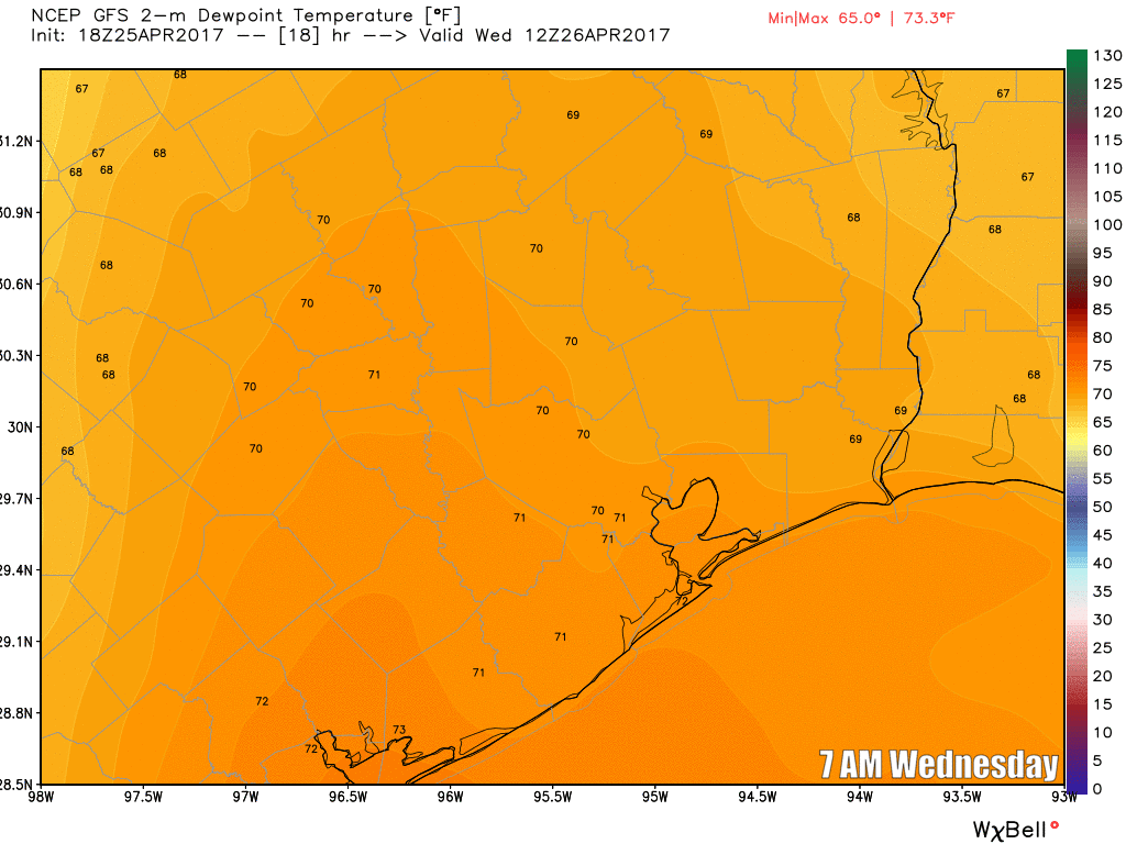
According to the GFS at least, the dry air arrives here around 2-3 PM. Is that too late for us to get to 90°? I’m not sure, but it’s close enough that I’m not going to rule it out.
Step 3: Some wind wouldn’t hurt
Some wind tomorrow would be of help. It could help us to advect in some of that drier air a little faster. We have strong winds this evening off the Gulf pumping in moisture and humidity. Once the front passes tomorrow, those winds will shift to an offshore direction, more from the west.
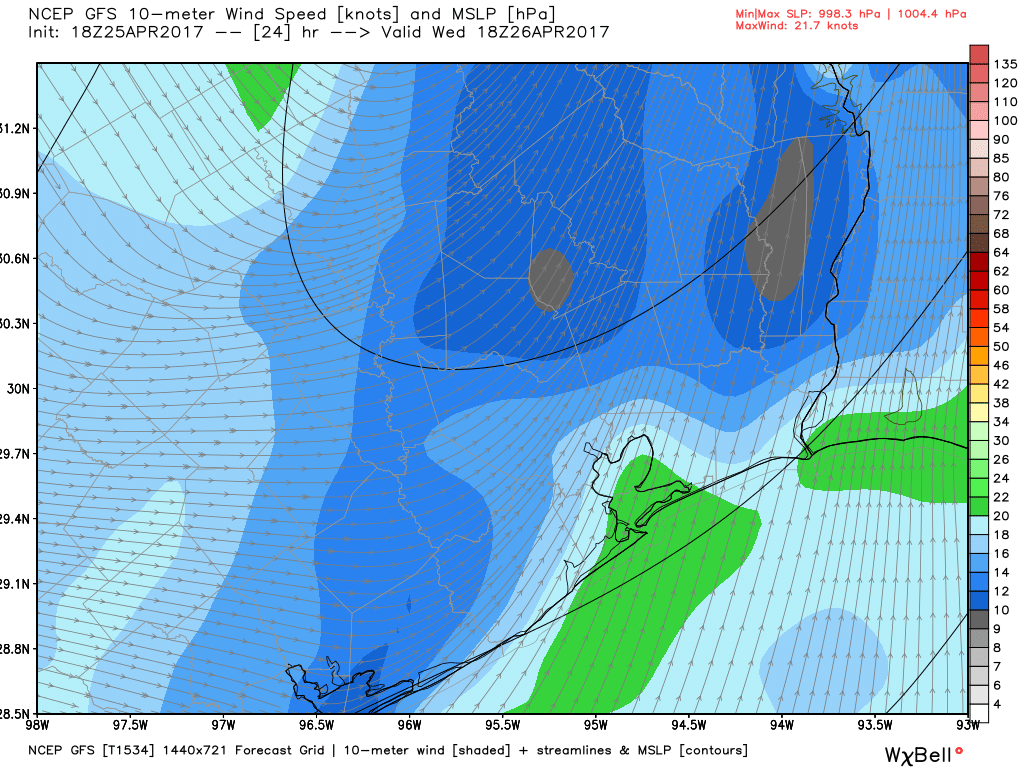
This should help areas west of Houston try for 90° tomorrow, but is it enough to get us over the hump in the city? Tough to say. I’d probably give it about a 50-55% chance, not super high, but not inconsequential either.
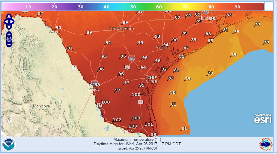
So for tomorrow to see Houston hit 90° for the first time we’ll need the cold front to step on the gas in the early afternoon and give us just enough time to drag in just enough dry air to take advantage of a just warm enough atmosphere. It’s a borderline case, but it may be achievable if things come together perfectly. One place that shouldn’t have trouble hitting 90+ tomorrow? South Texas. The Rio Grande Valley to the Coastal Bend will see widespread 90s and even 100s tomorrow.
If you’re thinking it’s too early for this sort of heat, don’t worry. Comfortable weather Thursday morning should be followed by another couple comfortable days early next week. There’s still some spring to go through before the summer sets in. Eric will have more in the morning!
90° in April. Ugh!
Average first date is May 7th, so…it’s almost that time sadly.
Many times in Houston, I’ve witnessed short-lived heat bursts immediately prior to frontal passages. If the ingredients are in place tomorrow, your idea of a 90°F day on Wednesday may, indeed, come to pass.