Hurricane Nate is moving rapidly toward the northern Gulf of Mexico coast on Saturday morning, likely making landfall tonight in extreme southeastern Louisiana and the Mississippi coast. Probably the biggest concern is the potential for storm surge.
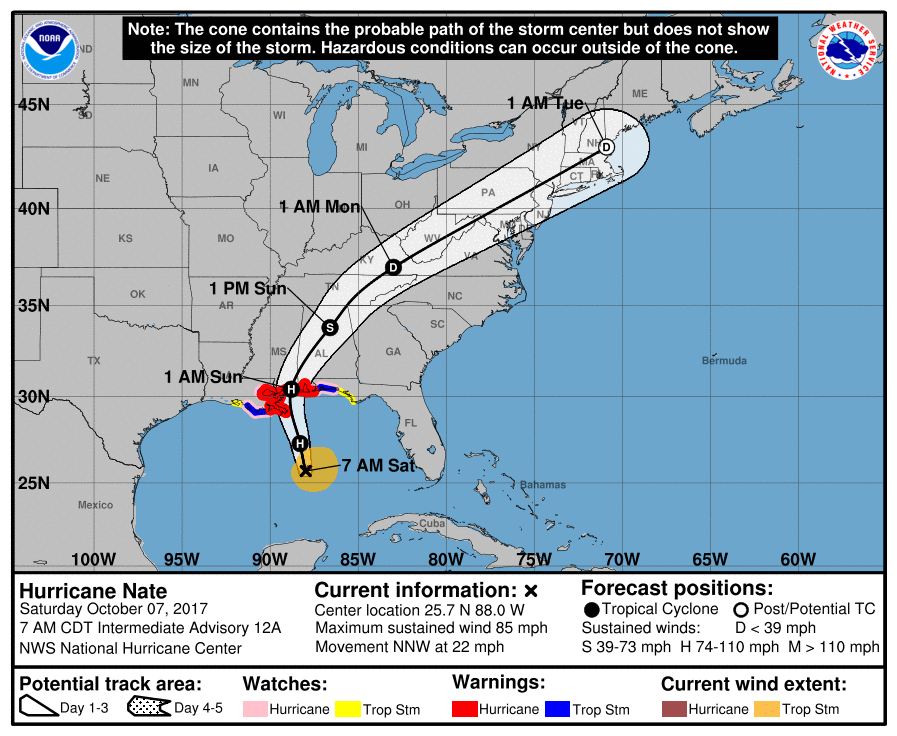
Nate shot the gap between the Yucatan Peninsula and Cuba on Friday, allowing its center to remain over water, and it is now taking advantage of low wind shear to intensify. Nate had 85-mph winds as of 7am Saturday morning, and could strengthen further before landfall. Reconnaissance aircraft show Nate to be a lopsided system, with all of its significant winds on the east side of the storm. With that in mind, here is a look at the storm’s principal threats.

Winds and surge
Along the current forecast track, the greatest threat for hurricane force winds is along the coast, and on the west side of the storm.
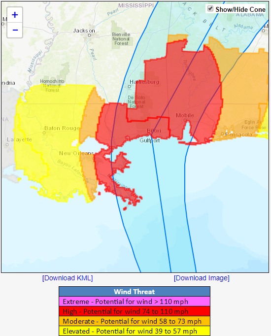
Because of these winds, some significant storm surge flooding is likely along portions of the northern Gulf Coast, and a storm surge warning is in effect from Morgan City, Louisiana, to the Okaloosa/Walton county line in Florida. Residents in these areas should heed any evacuation instructions given by local officials as water levels may be 5 to 10 feet above normal tides.
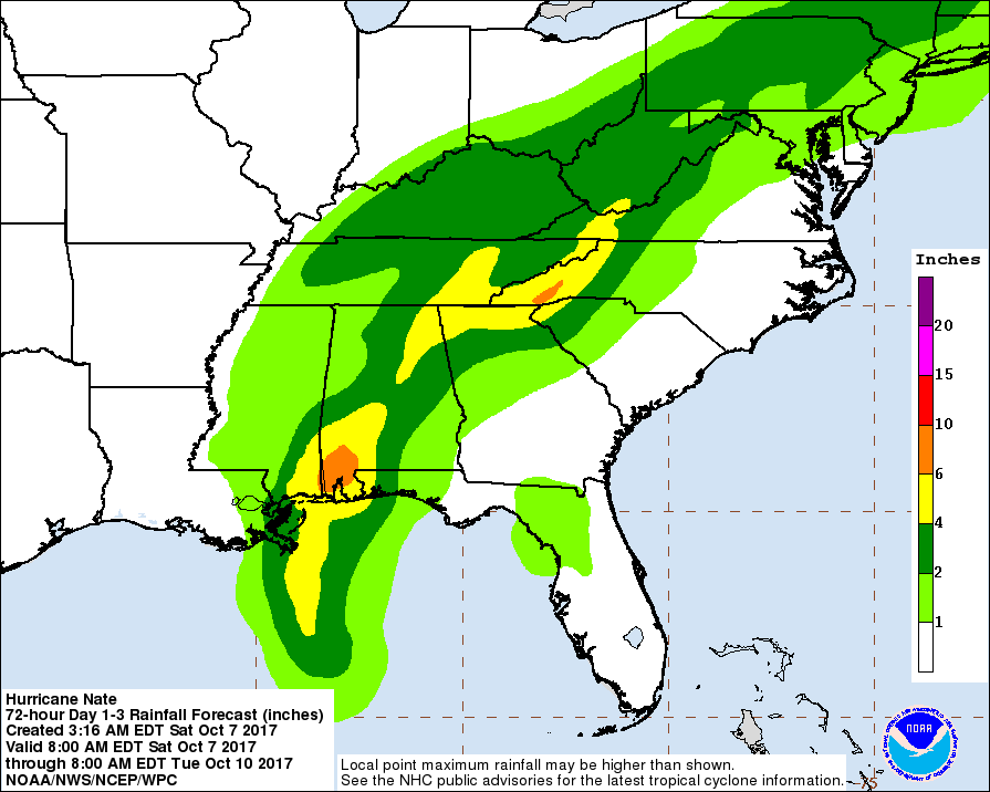
Rainfall
Due to the rapid movement of Nate, to the north-northwest at 22mph, rain accumulations from the storm are a lesser concern. Some inland flooding is possible in southern Alabama and Mississippi, but for the most part storm totals should be manageable. Here is the rainfall total forecast from the National Hurricane Center:
Houston
As we have been suggesting for some time, Nate is not at all a threat to Texas, including the Houston area. Effects here will be minimal, with some minor coastal flooding possible Saturday due to higher tides and longer running waves. There will be a chance of scattered rain showers this afternoon, but nothing we need be too concerned about. Sunday and Monday will be warm and sunny.
Thanks for the info, Eric. Tragic that we keep having storms but glad that Texas is safe from this one. I was looking at Hurricane Pro on my phone and saw a disturbance in the atlantic (more north with a trajectory looking for a possibly guidance towards the east coast. I know it’s too early to tell but do you see any potential for this thing to develop and affect Texas? It doesn’t seem probable but figured I’d ask in advance.
I appreciate you keeping tabs on Nate. I live in Beaumont (you were a godsend during Harvey), but have many relatives and friends in Mobile and Baldwin County AL.
Anything to worry about with regard to boating this evening in Galveston? Saturday.
“all of its significant winds on the east side of the storm”
“greatest threat for hurricane force winds is along the coast, and on the west side of the storm”
Both of these phrases can’t be true, right?
You were right about Nate since it was a baby spinner. Good job, again!
You never cease to amaze me, no hype, and so accurate. Eric and Matt, I hope you know how much the world appreciates your dedication, intelligentsia and great passionate hearts.
What about damaging winds & rain on Tuesday with the Cold front coming?
Just went out to the back yard this morning- one word: ugh.
Tuesday can’t come fast enough!
Looking at the forecast on weather.com it doesn’t look like we’re getting our cold front on Tuesday, unless Eric has more information on this.