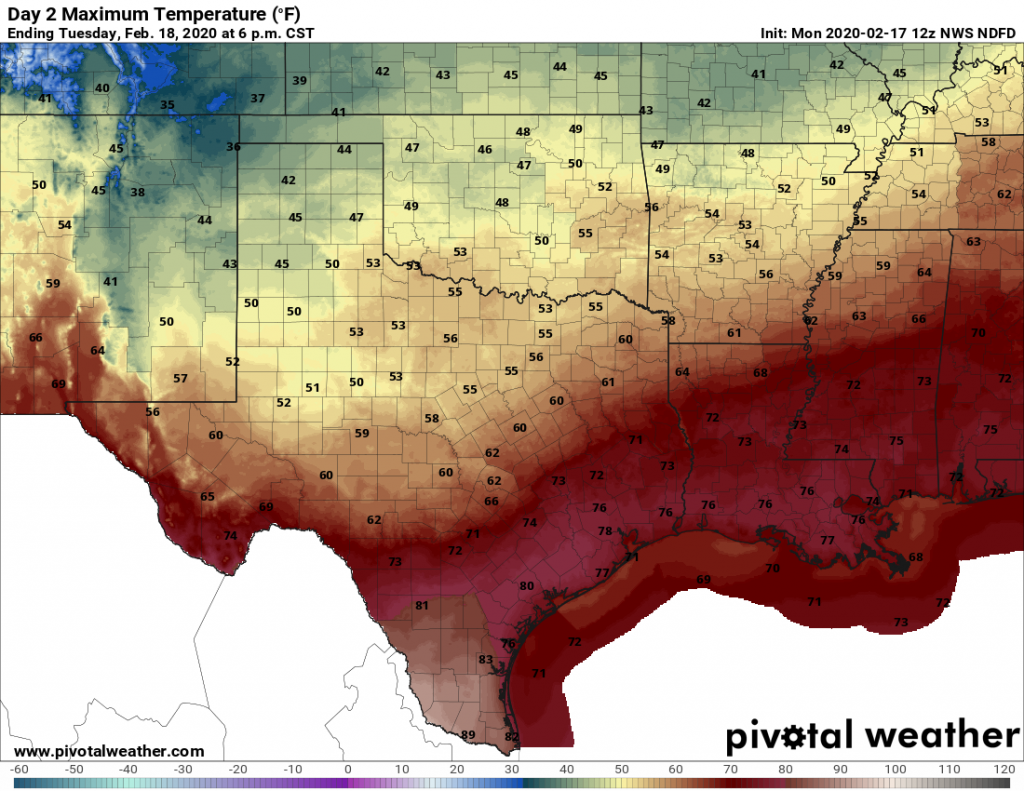
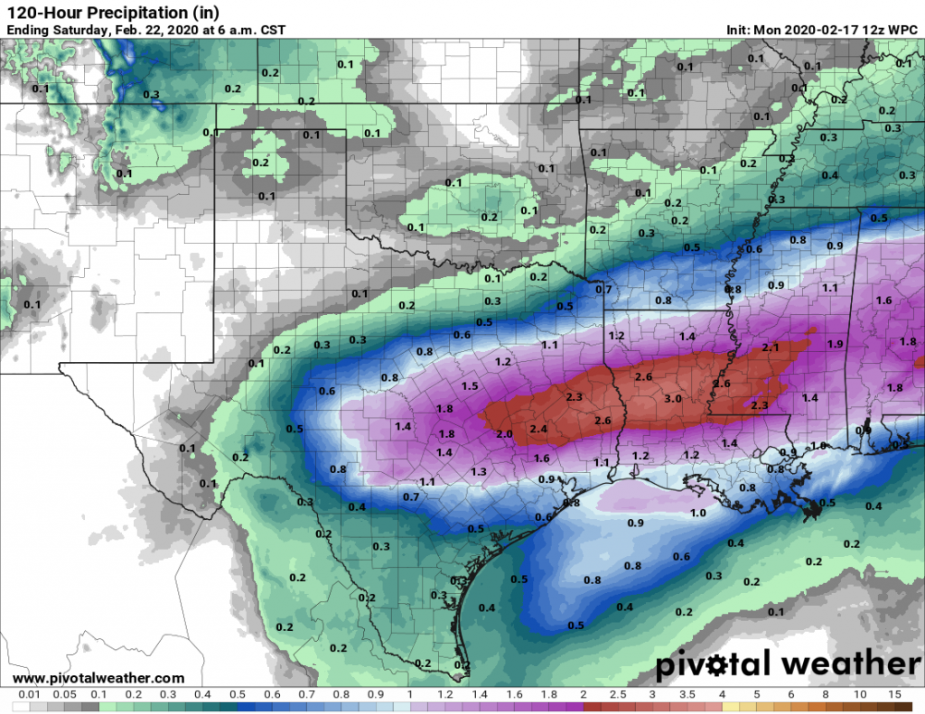
Houston will remain in a gray, humid funk until Tuesday night when a cold front pushes through the area. However, this front is not going to scour moisture from all levels of the atmosphere, so we’re going to see very good rain chances on Wednesday and Thursday before another front clears us out. Don’t expect to see much sunshine until Friday, at the earliest.
Monday
Patchy fog should clear out by mid-morning, leaving behind a mostly cloudy and warm day with highs in the mid- to upper-70s. Some very light showers will be possible later today, but mostly skies should just be gray. Winds will be out of the south, gusting up to 20 mph and really pumping moisture in the region. Look for low temperatures only to fall into into the upper 60s tonight.

Tuesday
This day will be similar to Monday in terms of fog and temperatures. The only difference is that a cold front will approach the area from the north, and bring an increased chance of rain. This will be especially true for northern areas, such as Montgomery County, which may see as much 0.5 inch of rain whereas the coast sees little to none. The front itself pushes into the area on Tuesday night for the northwest half of Houston, and likely sometime Wednesday morning for coastal areas.
Wednesday and Thursday
Expect gray, cold, and wet conditions. In contrast to most fronts, atmospheric moisture levels will remain high, and this will drive healthy rain chances for Wednesday and Thursday. It seems a safe bet that much of Houston will see 1 to 2 inches of rain, with the potential for some spots (especially in Montgomery County and points north) to receive as much as 3 inches. Highs both days will likely be somewhere in the 50s, with lows in the 40s.

Friday
A second frontal push should dry out the atmosphere, bringing some nicer weather to Houston, with partly sunny skies and highs in the mid-50s.
Saturday
For now, the first half of the weekend looks pretty nice, with highs in the 60s and at least a little bit of sunshine. Overall confidence isn’t that high, however.
Sunday and beyond
The onshore flow returns pretty quickly, sometime on Saturday, which should lead back to highs of around 70s degrees and decent rain chances for Sunday and the early part of next week. A stronger front later next week should finally bring several days of sunshine to the region.
I’ll take any rain. We’re already behind and that darker orange shade is creeping closer on the drought monitor.
I find that strange. It seems to have been raining so much lately and yet in my area, the drought is worse than when it wasn’t raining at all. How is that so?
My wife calls it the “umbrella”. Moving here from Denver and it’s semi-arid climate in which almost half of the precipitation falls as snow…I would expect this type of behavior. It’s crazy down here how IAH can receive double of what some of us get mainly to the Northwest/Southwest of the airport. I have asked and researched it and can’t find rhyme or reason. I’m open to any suggestions 😳
Thanks for so subjective and precise weather forecast, this really helps a lot in planning the entire week schedule.
I know none of us wants drought. But after the insane storms we’ve seen around here over the last 5 years, I’ve learned not to complain too much when it gets dry.