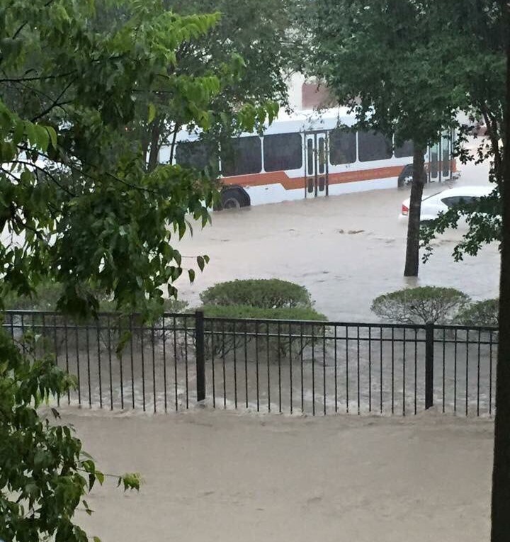
You may have seen the extreme weather in central Texas this morning — some areas near Austin received 10 inches of rain in two hours — and understandably had the concern that similar conditions are coming to the Houston region later today, tonight and on Saturday.
The short answer is, I don’t think so, at least not so extreme conditions.
The storm cells that produced strong rains over Austin and the Interstate 35 corridor today, and continues to do so, are moving off to the north-northeast. That complex is unlikely to affect Houston in any meaningful way.
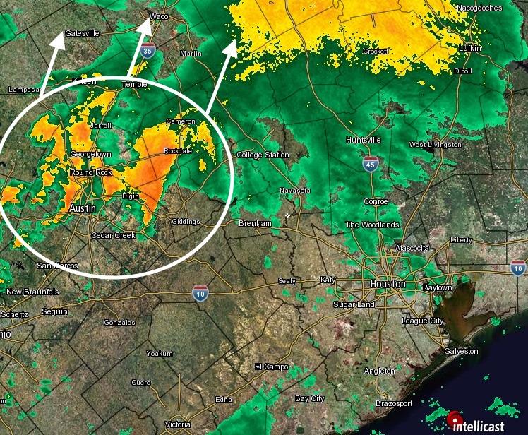
However the overall dynamics of this weather system remain the same. An upper-level low pressure system over New Mexico and West Texas is pushing an area of disturbed weather into Texas, where its meeting up with a moist, warm air mass. This is a recipe for showers and storms.
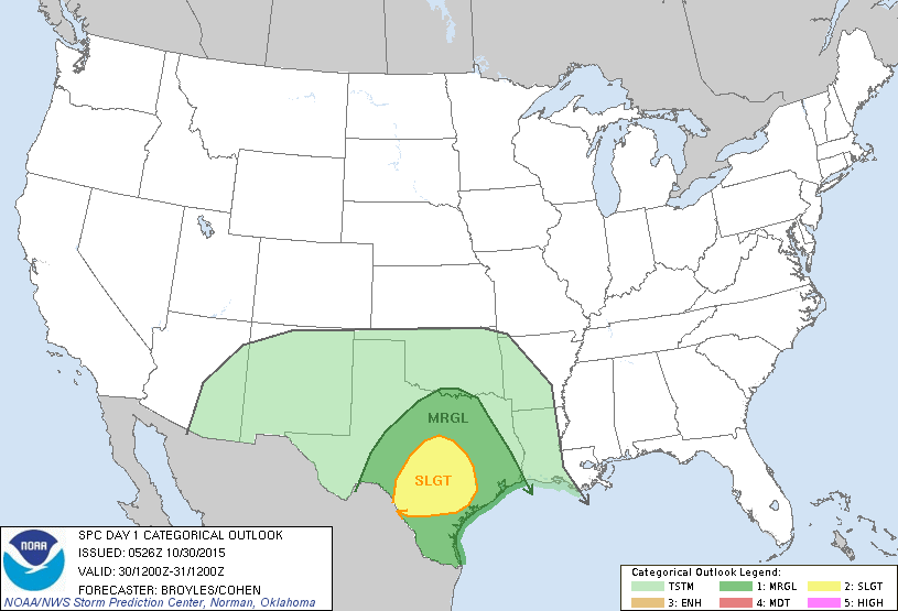
To account for this the National Weather Service has issued a flash flood watch for the entire Houston metro area from 10 p.m. tonight through 1 p.m. Saturday. The National Weather Service predicts widespread rain totals of 2 to 4 inches, with isolated areas seeing as much as 6 inches of rain.
Given the conditions we’ve seen in Central Texas today I think those kinds of accumulations are possible, but it wouldn’t surprise me if much of the Houston area saw less than that, as perhaps the storms will not redevelop quite as strongly until moving further east, beyond Houston.
Regardless, the overall picture remains the same. This afternoon and early evening should see mostly light rain. Chances for heavy rain and the most severe storms should come between midnight tonight and the early afternoon on Saturday. During this time isolated tornadoes and damaging winds will be possible. Outdoor plans should be carefully considered.
I still expect a clearing trend to begin Saturday afternoon and evening, although we can’t rule out some scattered, light rain Saturday night.
Should we be concerned about rivers and creeks upstream in central Texas overflowing the banks down here, like we had in May? They’ve had a ton of rain in the last week.
As of now I don’t think so. See, for example, this forecast for the Brazos River: http://water.weather.gov/ahps2/hydrograph.php?wfo=hgx&gage=rmot2
Thanks Eric, dunno what we would do without your steady hand at the helm.
For Halloween evening, the National Weather Service currently has a 70% chance of rain at 6PM falling to a 20% chance of rain at 7PM and later. I like this forecast graph:
http://forecast.weather.gov/MapClick.php?lat=30&lon=-95.37&unit=0&lg=english&FcstType=graphical
Eric,
Can you give a quick update on the timing of the storms tonight?
It looks like the front may be stationary just to the north currently. In you estimate, how long do you think that will hold out.
Lots of high school football games trying to get played tonight and need to avoid the lighting.
Thanks for your fine reports.
Sorry had to be away from the PC this evening. HS games, as you can see, were fine tonight.
I bet that the U.S. Drought monitor map that comes out next Thursday will show nearly all of Texas out of the drought. As you had posted earlier on your FB page, Texas is nearly drought-free. These latest storms will hopefully kiss the drought goodbye! I am enjoying your new website and was an avid follower when you were at The Chronicle.
Thanks for following me over here!