Good morning! Although some parts of the Houston area saw flakes or sleet on Sunday, the real snowfall action remained to the north and west of the Houston metro area. Bryan-College Station saw a record 4.5 inches, and some nearby areas saw as much as 6 inches. For the rest of us closer to the coast, it was just a cold rain, with an average of 1 inch falling during what was a very chilly day. We’ll continue to see cold weather for much of the rest of this week, which falls during the dead of winter.
Monday
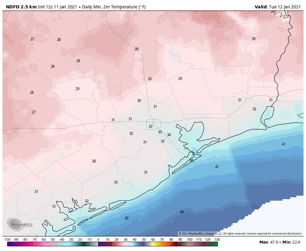
While winds have slackened for inland areas this morning, it remains breezy along the coast with gusts above 20 mph. Temperatures have bottomed out in the low 30s across much of the region and with mostly cloudy skies, high temperatures today probably won’t rise above the mid-40s. Winds will remain out of the north today, at 5 to 10 mph. Skies may break apart a little bit later tonight, but with partly to mostly cloudy skies providing a little bit of insulation most of the city should remain near or just above freezing. Outlying areas will see a freeze.

Tuesday, Wednesday, and Thursday
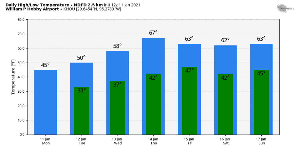
High pressure should more or less keep conditions on the mostly sunny side this week, and after a very cold Monday night a slow warming trend will begin on Tuesday. Look for highs in the low 50s on Tuesday, headed toward the upper 60s by Thursday. Nighttime temperatures, too, should warm from the low- to mid-30s on Tuesday night to mid-40s by Thursday night. All in all this will be a cold, very winter-like week for Houston.
The weekend and beyond
So what does the weekend hold? A cold front appears to be on track to cross the Houston area on Thursday night, or so. Right now this most likely will be a dry passage, with no rain, and bring more clear and cool weather for the weekend. We can probably expect highs in the neighborhood of 60 degrees, with lows down around to around 40 to 45 degrees.

Some clouds may begin to build later on Sunday—at about the same time our confidence in the forecast begins to decrease. Next week looks warmer, with more days in the 60s, and with more clouds. After our soaking and near miss with wintry precipitation this past Sunday, our next real chance for precipitation may not come for awhile. We don’t really need any more rain, so can anyone complain?

Thanks as always for the best weather info! I’m curious how this winter season compares so far to previous La Nina years — is our weather in Houston as you would expect given a La Nina or different? Is this La Nina strong or weak?
Yesterday was such a heartbreaking, disappointing, miserable cold day. Spent the whole day checking the radar watching the blue creep closer and closer to us in north west Houston, all the while getting photos from friends and family playing in the snow, and I mean a lot of snow. Was tempted to make the 40 minute drive but was confident it would reach us since it was SO close. Finally, after the sun had set, the radar showed it was here! We rushed outside to see… mostly cold rain still with a little bit of sleet. The radar was flat out lying, and Houston got screwed. Sometimes I really hate when the forecast is right. Not to worry though, I’m sure we’ll get another chance in 5-10 years. Cheers
Same here in Cypress! weather.com was saying there was heavy snow, but when I opened the door, all there was was cold rain with some sleet at times. Then it was over and we were left with cleaning up shivering muddy dogs after their last trip outside for the night. So disappointing. Glad my friends further north got a nice treat.
Matt or Eric Please explain why transition never got here. It should have. It was doing it all day. The damn blue line !!!!
So …..inside the loop….. cover plants tonight or not?
Whew. Escaped snow… now where’s my warmer than average as forecasted?
crawls back into igloo
I agree, certainly not a warmer and drier than average fall/winter here. But only 68 more days until spring though.
Below 32 degrees inside loop?
Please a week without rain. Your weather report is best. Don’t even bother with TV forecast anymore.