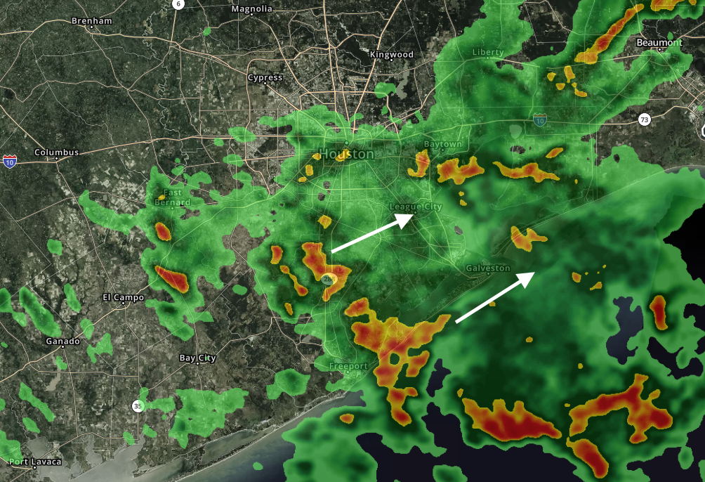
We knew rain and scattered storms were returning to Houston, but frankly we didn’t think they’d come this soon. However, a relatively localized feature, a kink in the atmosphere, is moving up the Texas coast today and it’s driving the development of some storms primarily to the south and southeast of Houston. A few areas are seeing pea and dime-sized hail as a result.
The regional models we use to predict the evolution of these kinds of storms haven’t done a great job of handling their development today, but generally I think they’re going to wane by or before sunset.
The overall forecast remains the same through mid-week, with widespread showers late Monday night and Tuesday producing perhaps 0.25 to 0.5 inch of rain, and more scattered showers on Wednesday. Some additional hail will be possible with the stronger thunderstorms on Tuesday.
Yup I rode the motorcycle to work today thinking there would be no rain. I work in Katy so I figured it would be clear. When I heard the claps of thunder, I checked the radar and got out of there in between the showers. Good excuse to leave work early 🙂
Thank you Eric! Now I know what to expect on my way home from the office!
It’s okay Eric/Matt. No one holds you responsible for kinks in the atmosphere. By the way, it hasn’t been bad on Bolivar Peninsula…yet.
Worst seems to be just holding offshore.
I read something somewhere about the NWS getting ready to roll out a new forecast model, and some meteorologists don’t think it’s quite ready for prime time.
Went to my Rodeo shift in short sleeves based on everybody’s forecasts. That’s quite a kink! We had to shut down Transportation committee twice. Enjoy the show tonight and dress warm!
Field trip to Galveston from west side will be rough tomorrow 😢
Out here in the Westchase section of Houston, just past the Beltway, we got thunder, lightning and rain early to mid afternoon. It also cooled off quite a bit. Thanks so much for the terrific work you do!