It’s chilly this morning, with lows in the 30s for areas well inland, such as the northern half of Montgomery County, and generally the low 40s for most of Houston. We will now remain on the cooler side of things until the middle of next week.
Thursday
Temperatures today will depend upon the extent of cloud cover at your location, but generally we should see partly sunny skies, and this should allow highs to reach about 60 degrees. As winds shift to the east, and a few more clouds develop Thursday night, we lows will likely be about five degrees warmer at your location on Friday morning.
Friday
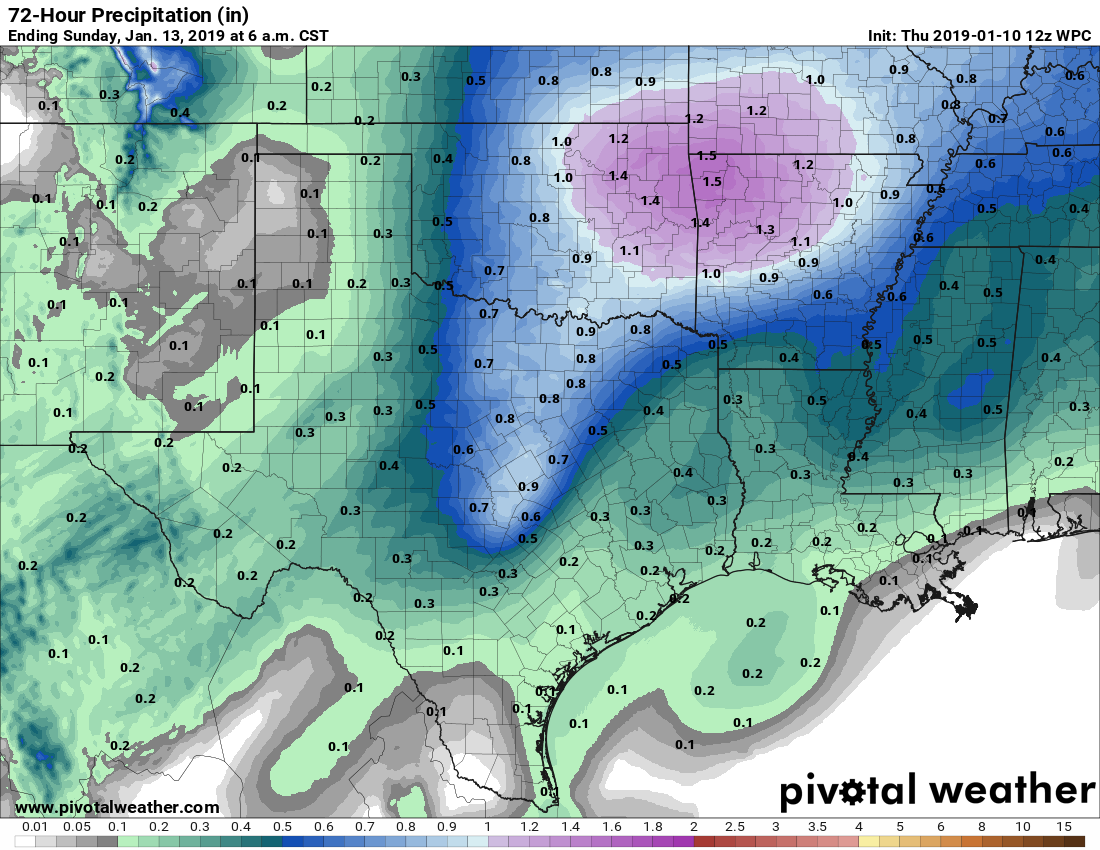
And upper level storm system, with a cold front at the surface, will move into Texas on Friday, and bring a healthy chance of rain to the region Friday evening and during the overnight hours. During the daytime, however, we should mostly see clouds, and highs in the mid-60s. As for accumulations, the better dynamics for heavy rainfall are to the north of Houston, so I expect most in the city to only see a few tenths of an inch of rain, with a few pockets of higher totals near 1 inch. Lows Friday night will be in the 50s.
Saturday
Scattered showers should clear out of the area by or before noon, with sunny skies filling in. Highs will reach the upper 60s before cooler, northern air moves in later in the day. Overnight lows Saturday will be chilly, with northern parts of the metro area likely falling into the 30s, while most of the city remains near 40 degrees.

Sunday and Monday
These should be sunny and cool days, with highs in the upper 50s to 60 degrees.
Next week and the Houston Marathon
Over the course of next week we’ll see a gradual warm-up, as highs reach into the low 70s by Wednesday or so. The next best chance for rain will likely come on Friday or Saturday of next week, ahead of what will probably be the region’s next strong cold front. If you’re running the Houston Marathon on Sunday, January 20, the timing of that front is key. At this point the majority of ensemble members of the European and GFS models bring the front through just before the race starts, which would probably lead to a chilly race start in the low 30s to upper 40s.
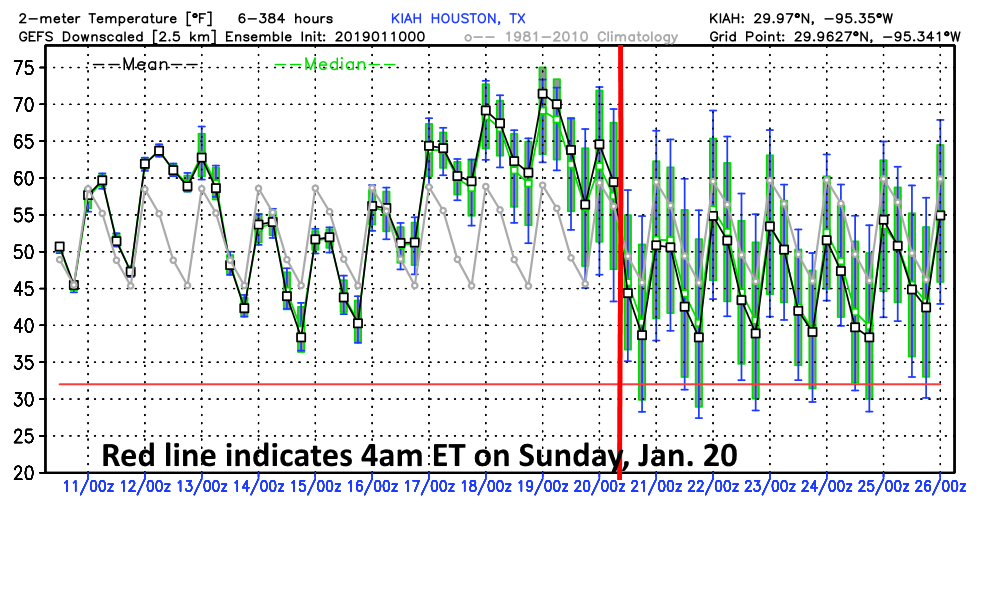
However, it remains entirely possible the front will not make it through until the race happens—which could make for messy, wet conditions during the run, or afterward. Overall, the trend here is good, it is appearing more likely the front will reach Houston for a cold and clear race start. But that is by no means guaranteed with 10 days still to go in the forecast.
Hi Eric: Don’t forget about the 5K on Saturday. (I’m running both the 5K & the half.) Thanks!
Me, too! Love the Houston Double!
Almost Heaven, temperature-wise.
And I’m NOT running in the Marathon. I refuse to do something that claimed the life of the first person to try it.
Is the red line in the right place? Aren’t we about six hours behind Zulu?