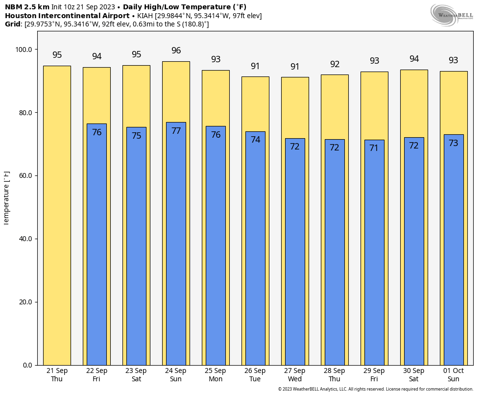
Good morning. Houston faces four more hot, sunny, and humid days that will carry us through the weekend. However, unlike earlier this summer when high pressure remained intransigent, this high pressure system will start to shift eastward by this weekend. This will allow a weak front to move into, and stall over the Houston region, providing some slight relief in terms of rain showers and moderately cooler temperatures.
Thursday
Skies will be mostly sunny today, with highs in the mid-90s for most of the area, with some inland points possibly reaching the upper 90s. Winds will be light, out of the southeast, at 5 to 10 mph. There is a very slight chance of showers or thunderstorms, perhaps 10 percent, this afternoon. Temperatures tonight will be sticky and warm, only briefly dropping below 80 degrees.
Friday
The last day of the work week will be a lot like Thursday, albeit with a bit higher chance of rain. I’d look for the possibility of thunderstorms to develop during the late afternoon or early evening hours, with perhaps a 20 or 30 percent likelihood of that happening. It’s something we’ll keep an eye on for Friday night lights, and this being Homecoming season for many schools.
Saturday and Sunday
At 1:49 am CT on Saturday we’ll reach the September equinox, the point at which the Sun crosses the equator and heads south. This is the traditional start of fall, and the march toward winter in the Northern Hemisphere, but Mother Nature will care not a single whit this year.
The weekend just looks hot and mostly sunny, with highs in the mid-90s for much of the city, and the possibility of upper 90s further inland. Rain chances, again, will be on the order of 20 to 30 percent each day, but mostly it’s just gonna be sunny outside. Nights will continue to be warm.
Next week
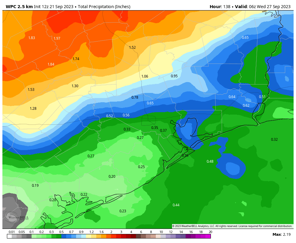
As I mentioned above, a weak front is going to move toward the region by the end of the weekend, and this will change our weather somewhat for next week. I’m afraid I still don’t have great confidence in that that means. It could lead to widespread rainfall accumulations for much of the area in excess of 1 inch, or it could be a tenth of an inch, or two. Monday will have the best chance of rain. The front also could lead to nighttime lows in the lower 70s, or we might get lucky and drop into the upper 60s. At the least, it should mean highs fall into the low 90s for awhile.


Cooler and colder weather can get here anytime it wants, that will make me happy.
You don’t enjoy the girls wearing smaller clothes in summer?
Are you stuck in 2005?
That sounds creepy
Inappropriate, to say the least.
This site could do with some moderating to deal with Jason’s comments.
From people like ya’ll who can’t take a joke!
Houston should definitely have its own weather calendar. Fall starts the day after Halloween. Winter doesn’t start after new years. And December is winfall (a mix bag of fall/winter and some late summer spikes).
Unfortunately, I see another 4-6 weeks of incredible warmth. I recall one summer and fall similar to this where it was just hot foreva, and then finally we got one of those 30+ degree drop cold fronts with those strong gusty north winds and that beautiful crisp dry Canadian air. Ah, it will come……eventually.
What type of gazing ball do you prefer for these predictions? I’ve tried my best with glass but quartz usually is better for me, however I am looking at some pretty, stained-glass options these days!
Summer has come and passed. The innocent can never last. Wake me up when September ends
Green Day has also come and passed.
Do you remember? 😉
chair dances
Houston has horrible weather and it’s just going to get worse. Much worse.
Then leave Houston
I have to agree with Kip..I have lived here for 40 years…This past summer for me has been the worst as far as heat/weather goes..I sometimes think of migrating north..But family ties keep me here for the time being..Texas seems to be in my blood after living here all these years..
If the electric grid decides to fail us multiple times in the coming years, myself, and maybe my grown kids will pack up our families and move where there’s 4 seasons and a electric grid that has a bit more wiggle room..
We’ll have to organize a wagon train so we can all get out of here. “Go north young man”. 🙂
As does the entire Gulf Coast. New Orleans, Tampa, Orlando, Pensacola all have the same heat and humidity. DC as well moving north but they do cool off faster.
I have a question about predicting summer weather patterns. Rule of thumb is La Niña typically means mild and drier winters with occasional cold blasts as in 2021 and active hurricane seasons, El Niño is the opposite.
Is there any weather clues in the spring to look at to see of our summer will be rainy and seasonably warm or the blast furnace and desert like such as we have experienced for back to back years?
Or is it hurry up and wait to find out.
Respect to Eric and Matt.
Does our soil temp usually match the air temp? Waiting for 90 or below to get fall seeds in the ground!