In brief: Today will be mostly sunny, with temperatures warming into the upper 80s, and a few isolated showers and thunderstorms later this afternoon or evening. However an advancing front tonight will likely trigger widespread storms.
Happy Mother’s Day! I hope moms everywhere are being spoiled today. I am spoiled with a great mom, a wonderful wife and mother of our two daughters, and an amazing mother-in-law. Raising children is not easy, but these moms have all done a great job.
Fortunately, for most of today, the weather will be just fine to celebrate our mothers. After a cloudy start we are seeing clear skies, and sunshine will prevail for the rest of the day. It will get fairly warm, with highs across Houston generally ranging from 85 to 90 degrees this afternoon.
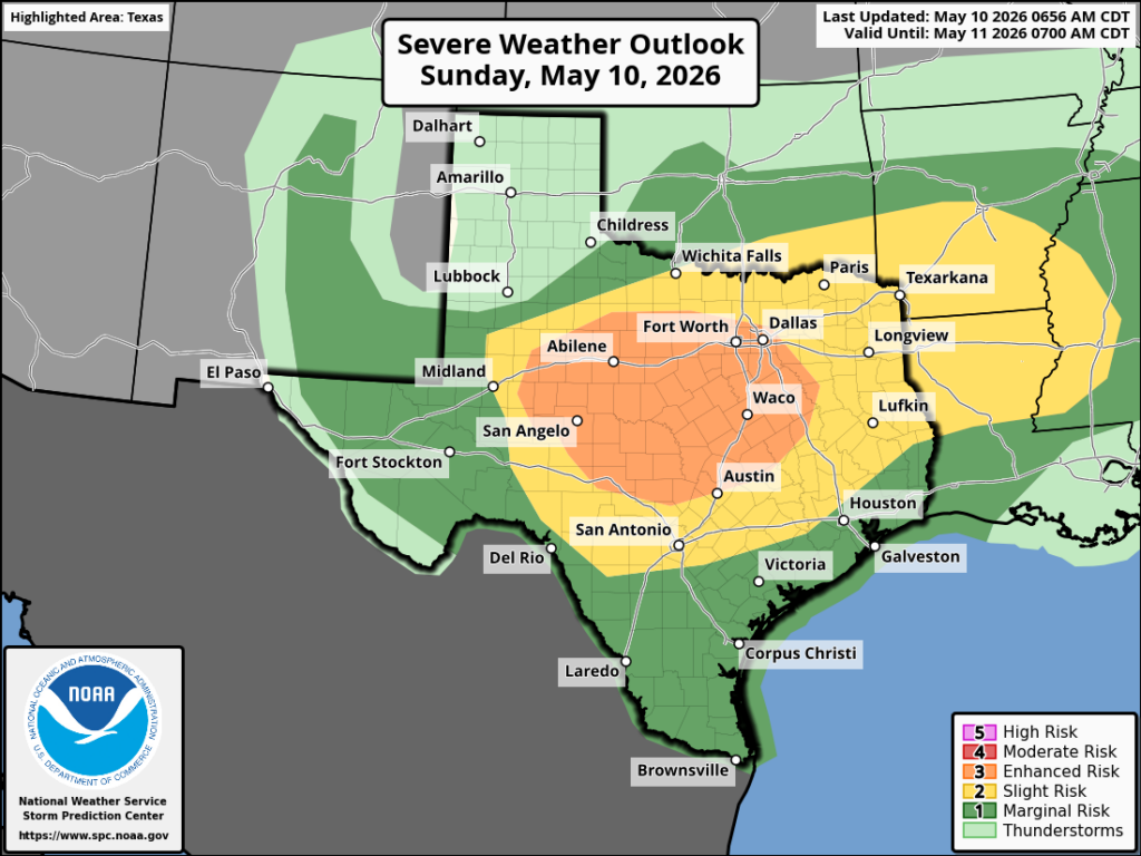
Some of this heating is due to compression, which is driven by an advancing front. This will provide a focus for increased storm activity later today and tonight. By late afternoon or early evening I expect to see some scattered showers and thunderstorms develop across the northern half of the region, and some of these storms could become severe. Threats include damaging winds, hail, heavy rainfall, and possibly a tornado. For most of us, however, things should remain fairly calm.
By around midnight, give or take, we should see a more well defined line of storms form to the northwest of Houston (i.e. Brazos Valley and College Station area). This line of storms will then move fairly quickly from the northwest to southeast, pushing off the coast by or before sunrise on Monday. We are fairly confident that this line of storms will hold together for areas northwest of Houston, and probably all the way down to the Interstate 69/Highway 59 corridor in the city. After that it may weaken as it approaches the coast (or maybe not).
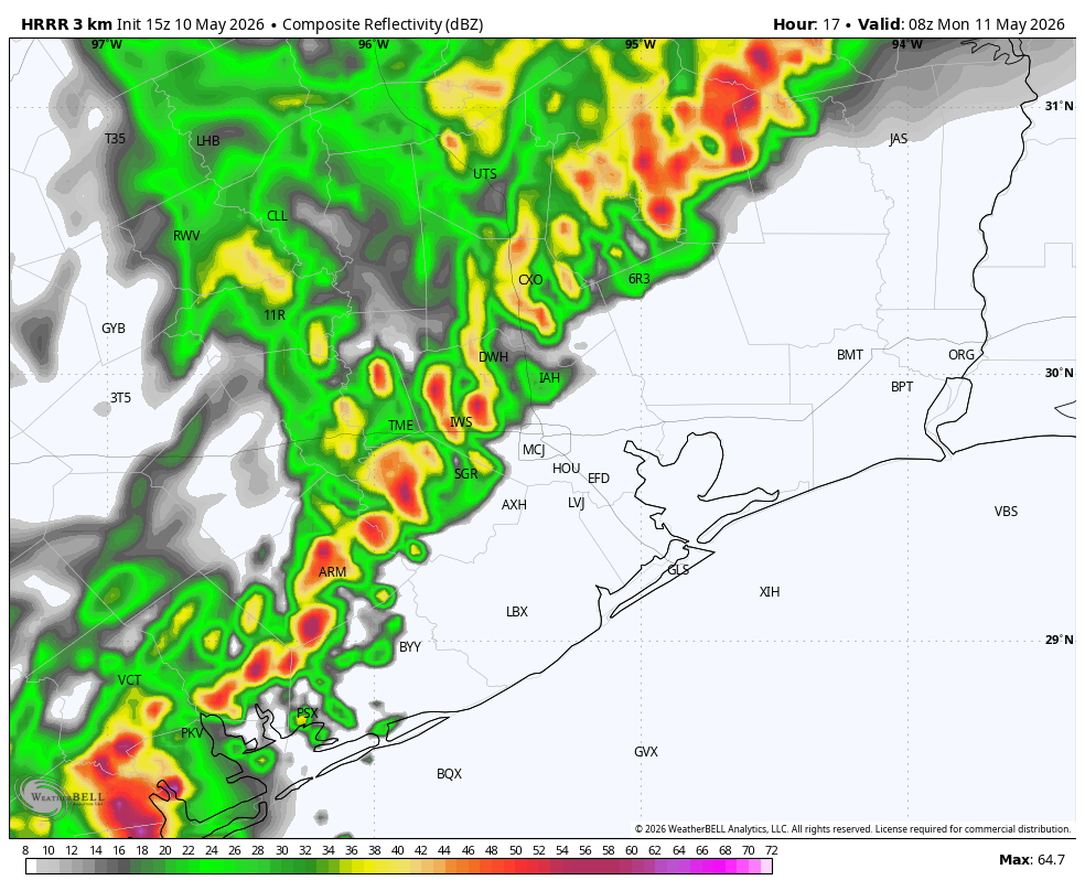
Regardless, you should be prepared for the possibility of inclement weather overnight. Since this is not a slam dunk, we are only going to a 7 out of 10 on our excitable dogs scale. But if things line up, the thunder, lightning, and wind from these storms may jolt you awake tonight. Again we are concerned about hail and damaging wind gusts, although we cannot rule out a tornado. In terms of rainfall, since the storms will be fairly progressive, most areas should see 1 inch or less, although there will likely be some higher bullseyes.
Much calmer weather will arrive by Monday morning, and prevail through much of the week.
