This week is going to be a lot about repetition: Every day should be warm. Every day will have some amount of cloud cover. And most days will feature some degree of fog too. And Matt is going to fill in for Eric all week. So you have me to blame!
Today
Monday may actually be the trickiest day of the week to forecast. With a weak disturbance passing by, we should at least see some showers through the day today. The best chance will be north of Houston and mostly in the afternoon. It’s probably a good idea to have an umbrella handy just in case, but there is a good chance many of us may not need to pop it open.
Look for highs in the mid-70s with continued increasing humidity.
If you’re heading to the rodeo to check out Chris Young this evening, expect mostly cloudy skies, maybe some  mist or light rain, and temperatures dropping from the low-70s early into the upper-60s on your way back home.
Tuesday & Wednesday
Fog is going to become the story on these two days. We should see both coastal sea fog and inland radiation fog develop. The combination will likely lead to a pair of dreary mornings on both days. Fog should clear by midday on both days, except at the immediate coast. While I think we’ll remain mostly cloudy after the fog lifts on Tuesday, we will probably get at least a few hours of sunshine Wednesday afternoon.
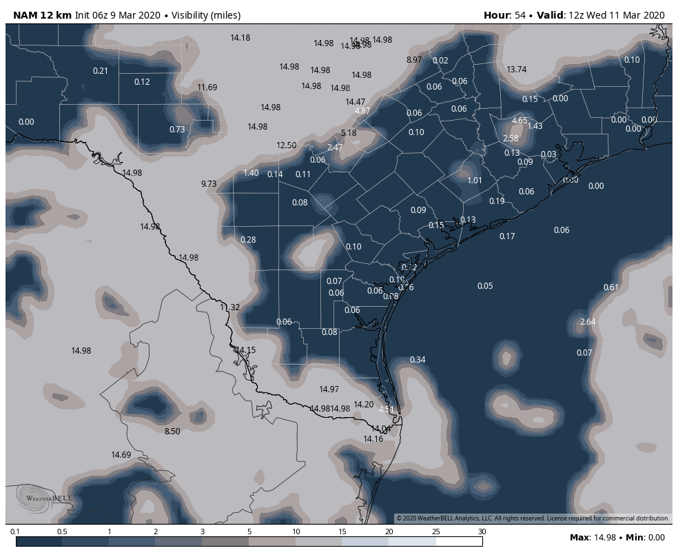
Showers are possible Tuesday, but otherwise, although the fog could occur with some mist or drizzle and it will be damp, we should not see any meaningful rain for Wednesday. Both days will see mild to warm temperatures. Look for lows on Tuesday morning to be in the low-60s, warming into the mid- to upper-70s. On Wednesday, we’ll begin in the mid-60s. With some sunshine on Wednesday afternoon, I see us easily passing the 80 degree mark away from the coast.

Thursday and Friday
As it stands right now, both days will likely see dry weather in Houston. Showers should be an issue well off to our north, closer to Dallas and Abilene, if not mostly up into Oklahoma. With no front in sight, look for warm weather to continue. Expect highs around 80 or in the 80s and lows in the 60s. Coastal fog will likely continue. Inland fog will probably become less likely by Friday. Look for a mix of clouds and maybe a little sun otherwise.
Next front?
Let’s pencil in our next cold front, should it make it to Houston, for Sunday morning. This timing could change through the week, but as of now, our best shot at any meaningful rain would be Saturday night or Sunday. There are still some questions as to whether or not that front can push all the way offshore and around how cool it will get here in Houston.
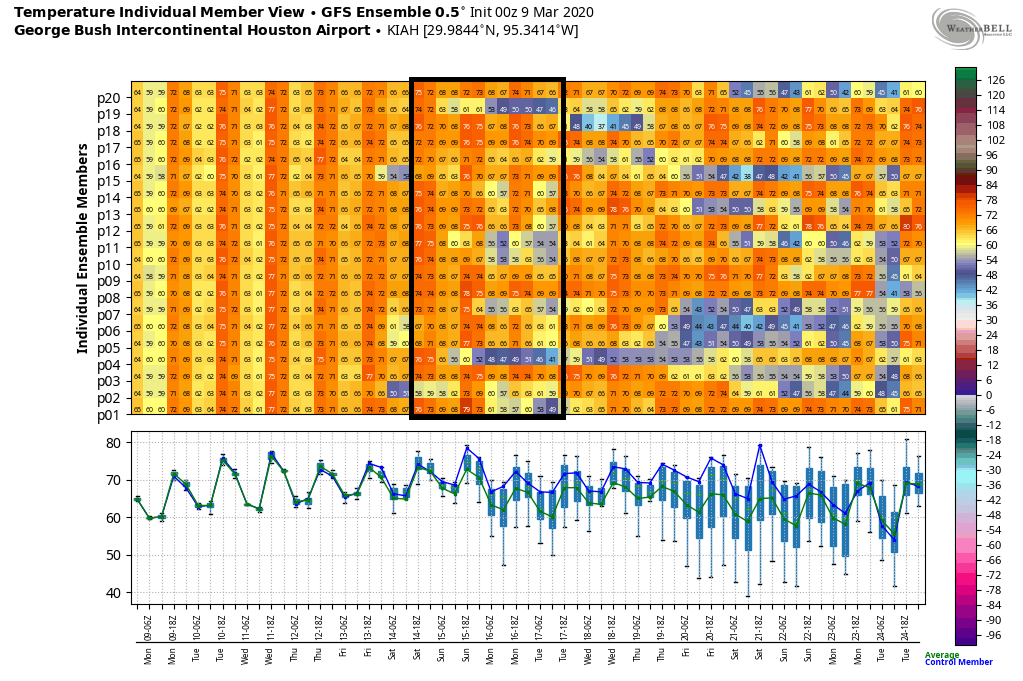
Trends have not been kind to our next front. Only about 20 to 30 percent of model ensemble members show the front pushing through Houston. If that happens, we could see lows in the 50s again. If that doesn’t happen, look for lows in the 60s, clouds, and only slightly lower humidity. It will still be warm overall, along with a chance of showers if the front halted at or before it got to Houston. We’ll track the progress of this front through the week.
Any concern of a late freeze this year? Gardening minds want to know…
There’s always a risk, right? But I have not seen anything in any model data or any hints of anything to make me think this is a realistic risk this year. I would probably proceed under the assumption that there won’t be, but of course, keep checking in to be absolutely sure!