Good afternoon. We’re continuing to follow activity in the tropics, and are focusing on Invest 97L. This is because it is the closer system and more immediate “threat.” That said, I’m afraid there’s not much useful intelligence we can share. In terms of track and intensity all options remain on the table. Here’s what we know:
As of this afternoon, Invest 97L is located almost due south of Hispaniola, and is a rather disorganized area of storms. Although it faces some difficulty with wind shear and dry air, forecasters with the National Hurricane Center predict there is an 80 percent chance this system will at least become a tropical depression, if not more organized over the coming five days.
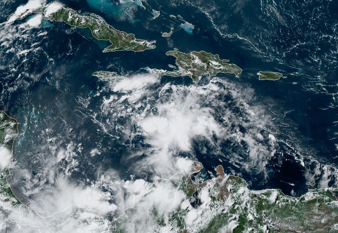
Another factor is a disturbance over South America, which may interact with 97L as it nears Central America (you can see clouds related to this in the satellite image above). All of these variables mean that we have relatively little confidence in how strong the system may get between now and the weekend. I don’t think it will get much beyond a low-end tropical storm in the Caribbean, but the tropics do love to surprise us.
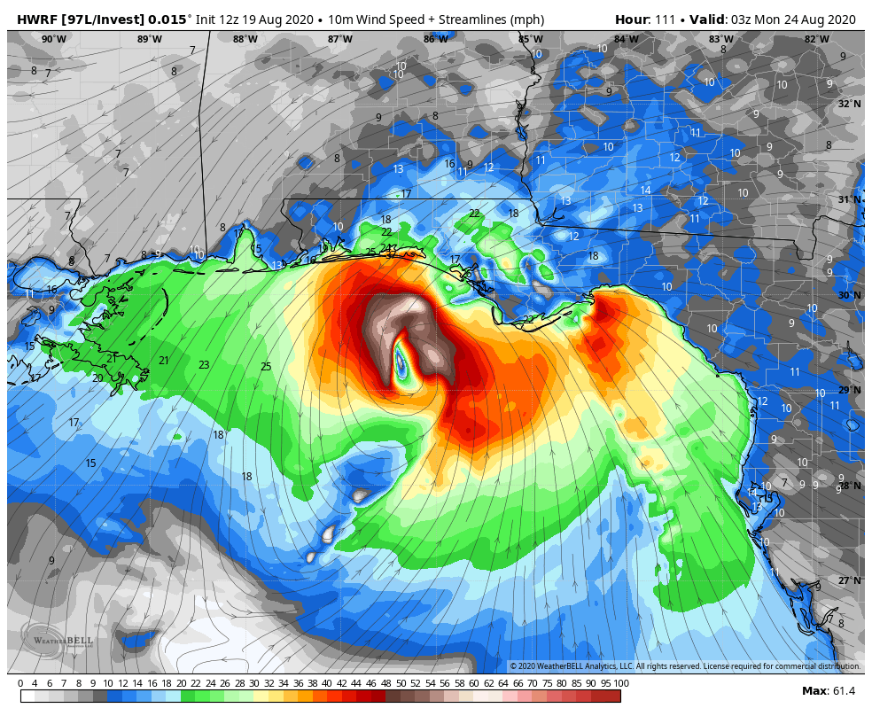
In terms of track we have lots of questions, too. The existing trough over the southern United States would normally pull a system like this northward, into the Central Gulf of Mexico, and toward Louisiana or the Florida Panhandle. However, that trough is forecast to weaken. As that happens the Bermuda High pressure system over the Atlantic is expected to expand westward. So there is a fairly narrow window for 97L to get pulled north. Still, this is the solution favored by models such as the HWRF, shown below, which brings a strong tropical storm or weak hurricane to the Florida Panhandle late on Sunday.
What seems a little bit more likely to me is that the system pushes into the Yucatan Peninsula and then emerges into the Bay of Campeche on Sunday. From there it could plow due west into Mexico, or take a more northwesterly track toward Texas. Most of the modeling, at this point, shows little intensification of 97L along such a track due to variety of factors. But with that said, you never want to see a low pressure system in the warm Gulf of Mexico in August. Like, ever.
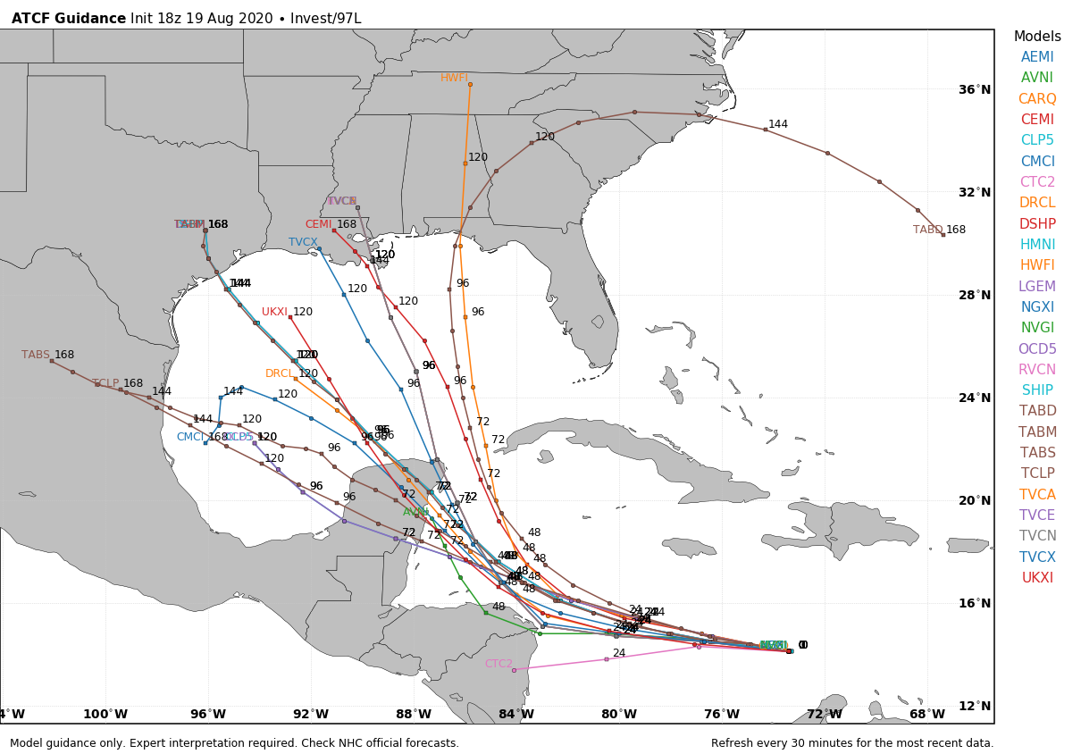
So what happens? The model guidance is of little help and, unfortunately, neither are we until 97L forms a better center, and we get a better sense of some of the factors mentioned above. If something were to eventually track toward Texas the earliest we probably would see effects is Monday or Tuesday. Our advice, as always, is be prepared, not worried.
They T-Swift made me chuckle. I appreciated that detail. Thanks again for the wonderful, no BS, forecast.
Haha dude I’m there with you, that was top notch!
Y’all could be ghost writers for William Shakespeare and come out with a “Much Ado About Nothing II”.
It’ll be a love story where the two main characters aren’t able to conceive and are helped by each of their two best friends – who despise one another. Ike and Allison launch a plot to involve Harvey and Rita to obtain some rainmaking assistance while matchmaking the two together. Grandpa 1900 Galveston tries to rain on their parade by telling them about the “good old days” before hurricanes were rarely – if at all – named.
Really a question. How are these investigations name. I assume invest means investigation but what about the 97, 98 L?
They number investigations 90-99, and then start over at 90 after 99. L is for Atlantic. E is for Pacific.