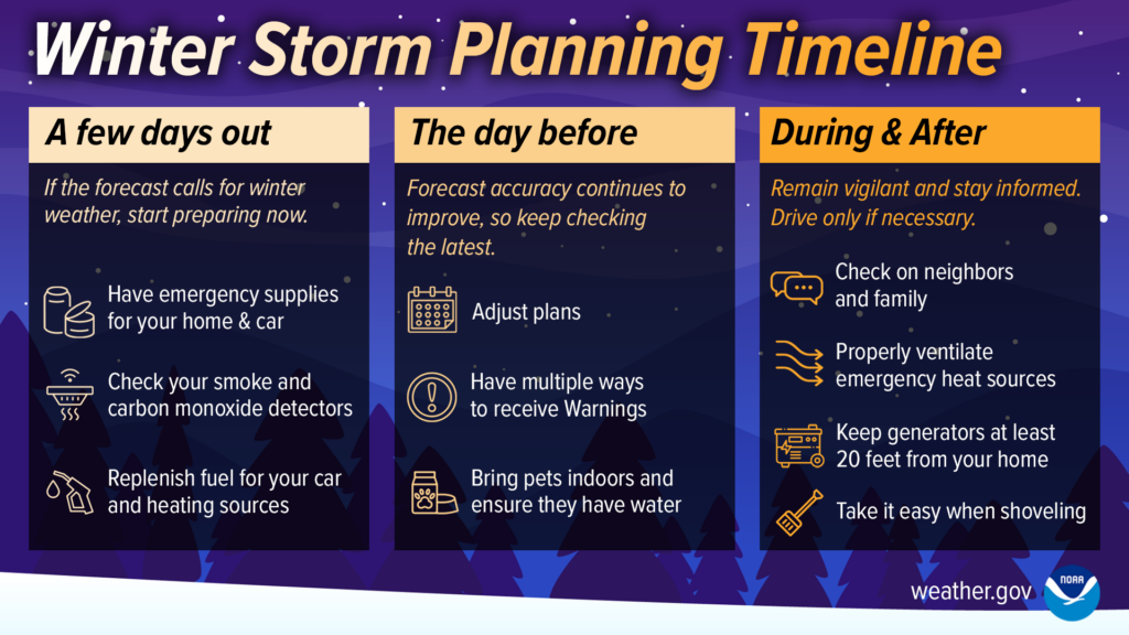
Good morning. The Arctic front is approaching Texas as I write this, and will sweep through the state today and tonight. It will arrive in Houston on Sunday morning, but then may stall near the coast. We’re monitoring a couple of threats from this outbreak of much colder air, including the potential for freezing rain on Sunday night and Monday, and very cold temperatures on Monday and Tuesday nights. Read on below for the latest.
Saturday
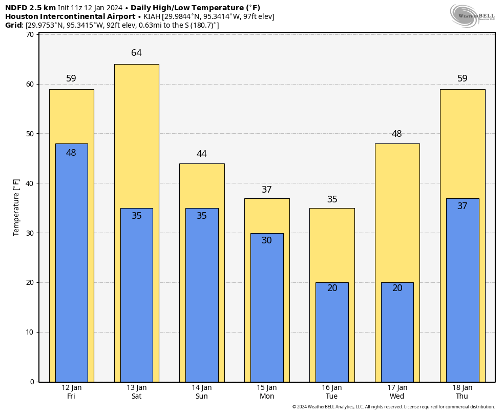
After a cold start, today is going to be sunny and lovely. We’re talking highs in the low- to mid-60s with plenty of sunshine and light winds. If you have final winterization activities to undertake, today is the day.
Sunday
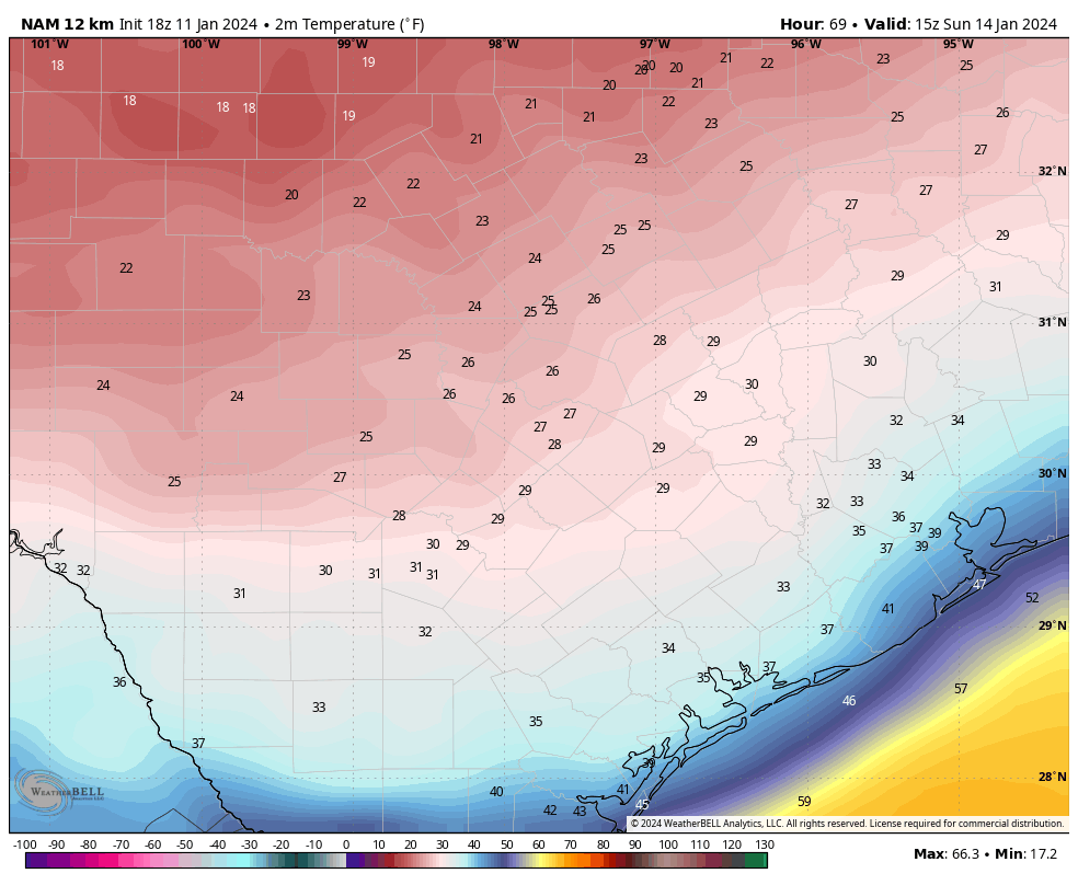
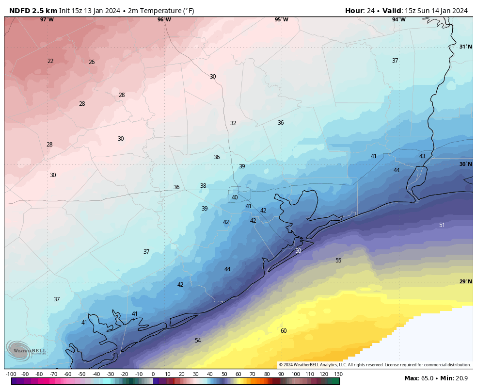
The front should push into the Houston metro area on Sunday morning, reaching The Woodlands and Katy a couple of hours after midnight, and pushing down to the coast by around sunrise or shortly thereafter. The front should more or less stall along the coast, and this may lead to a fairly widespread divergence in high temperatures on Sunday.
Houston Marathon conditions
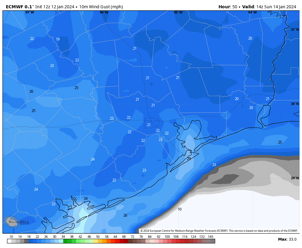
I want to say a few words about the Houston Marathon, and what my fellow runners can expect. At this point conditions don’t look extremely cold for the run, but they do look decidedly chilly. With the front likely arriving just before we call cram into corrals, you can expect race time temperatures of about 40 degrees, give or take. Winds will be out of the north at 10 mph or so, with some higher gusts, so with the wind chill it will likely feel like the mid-30s or so. I expect partly to mostly cloudy skies for most of the morning and early afternoon. The good news is that I don’t anticipate any precipitation with the front, or afterward, so we should stay dry. Please dress accordingly.
Highs on Sunday afternoon will vary depending on your location. Areas near the coast may warm up to about 50 degrees, but locations to the north and west of Houston may stay stubbornly in the upper 30s. In any case, there should be no difficulty getting around.
Sunday night and Monday
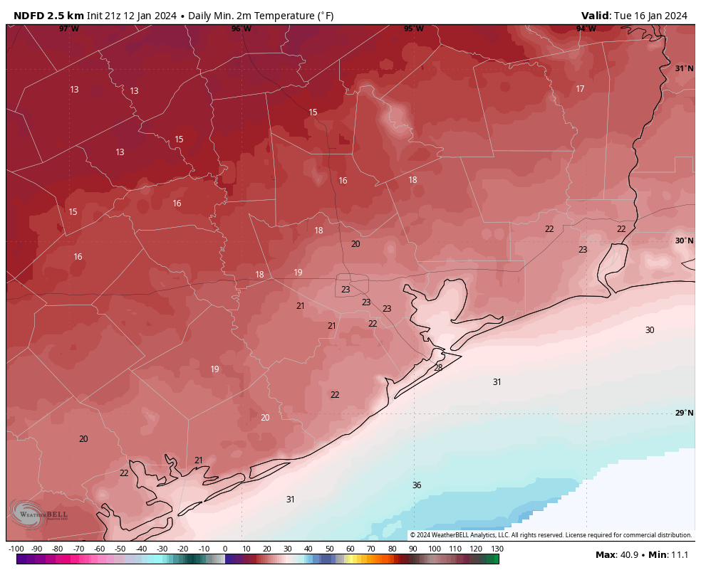
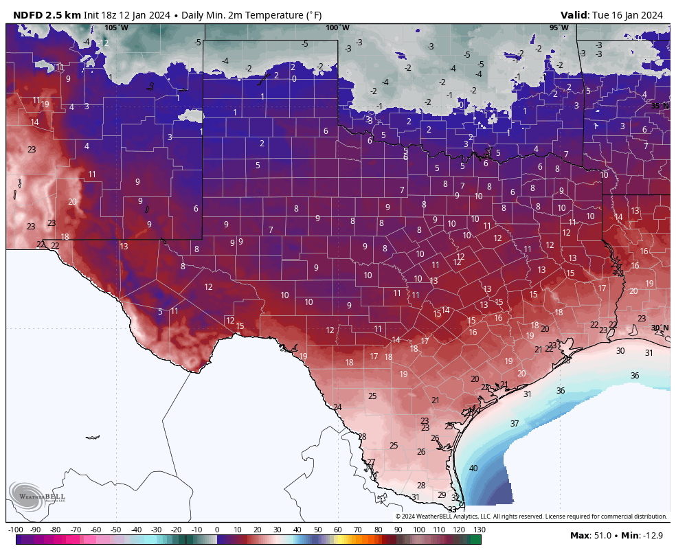
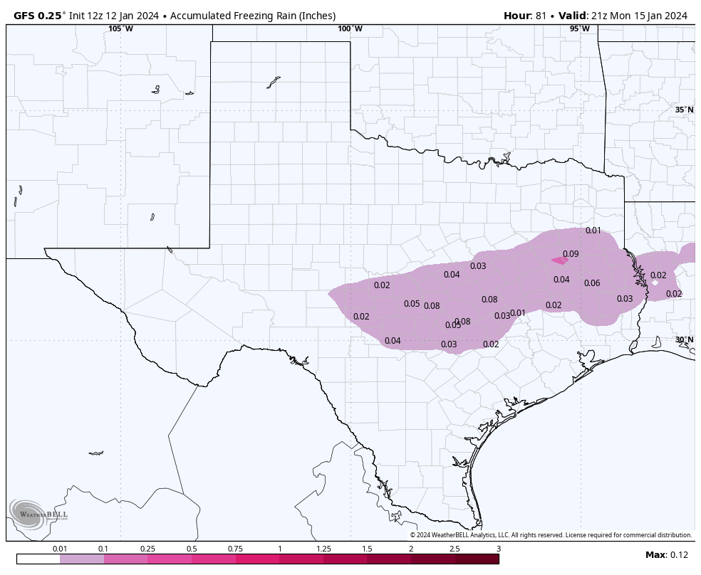
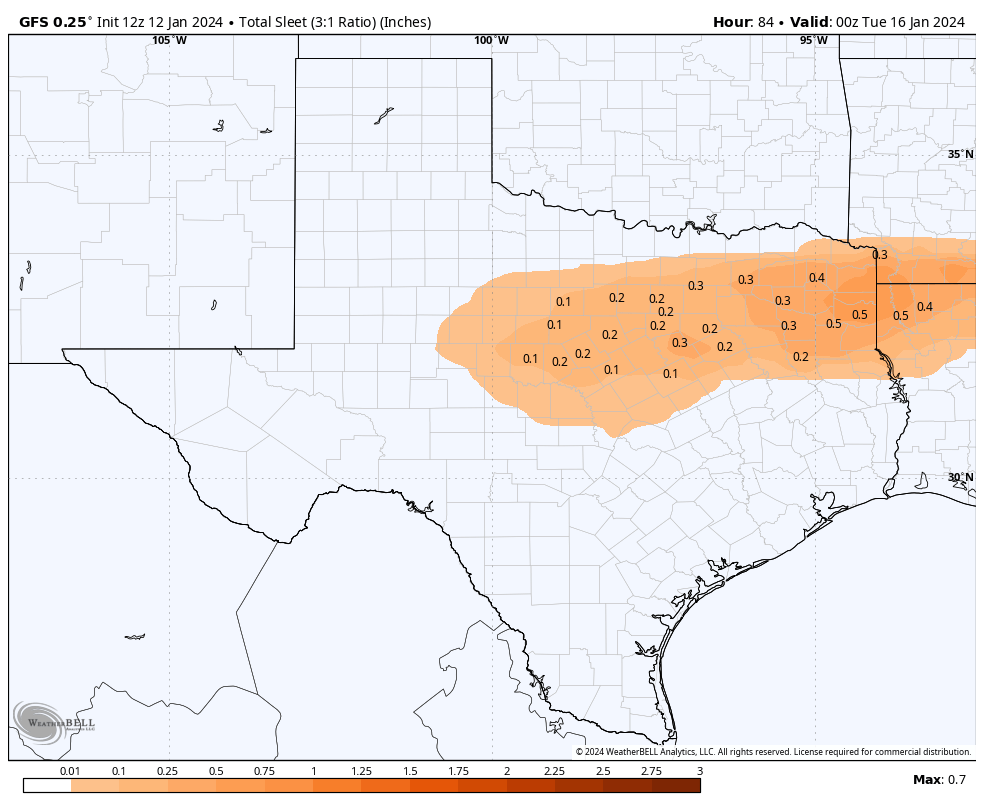
It looks like most of Houston will remain just above freezing on Sunday night and into Monday. It will be quite cold, in the upper 30s, probably. That’s good, because there is a chance of some light precipitation late on Sunday night and Monday as a modest disturbance crosses the area. In terms of accumulations, it’s not going to amount to much. But the concern is freezing rain, and potential icing on bridges and overpasses. All of our available modeling continues to suggest that the threat of this in Houston is low, as temperatures should remain just above freezing on Monday.
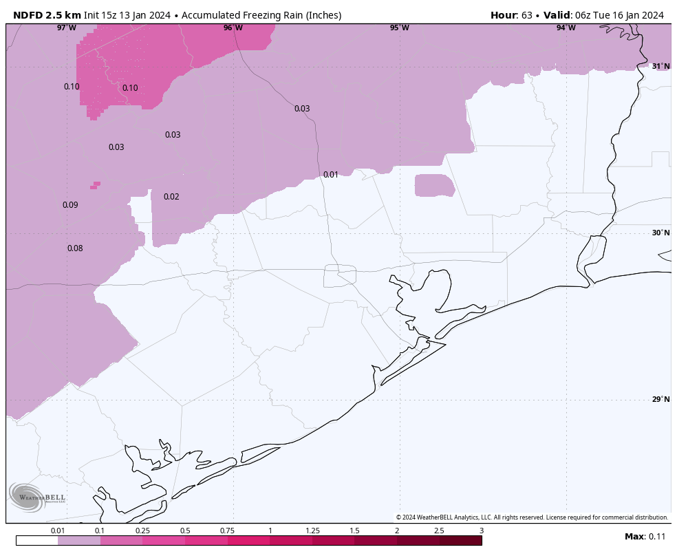
The bigger threat comes to the north of Houston, roughly along Highway 105, and to the west of Sealy. Needless to say we’ll be keeping close tabs on the potential for any freezing rain near or in the Houston metro area as plenty of uncertainty remains. Finally, if you’re traveling to north Texas on Monday, the potential for freezing rain and sleet is much higher as you head that way. Precautions are most definitely warranted for any travel north on Interstate 45 beyond Conroe.
Monday night and Tuesday
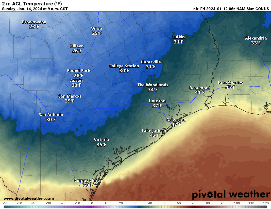
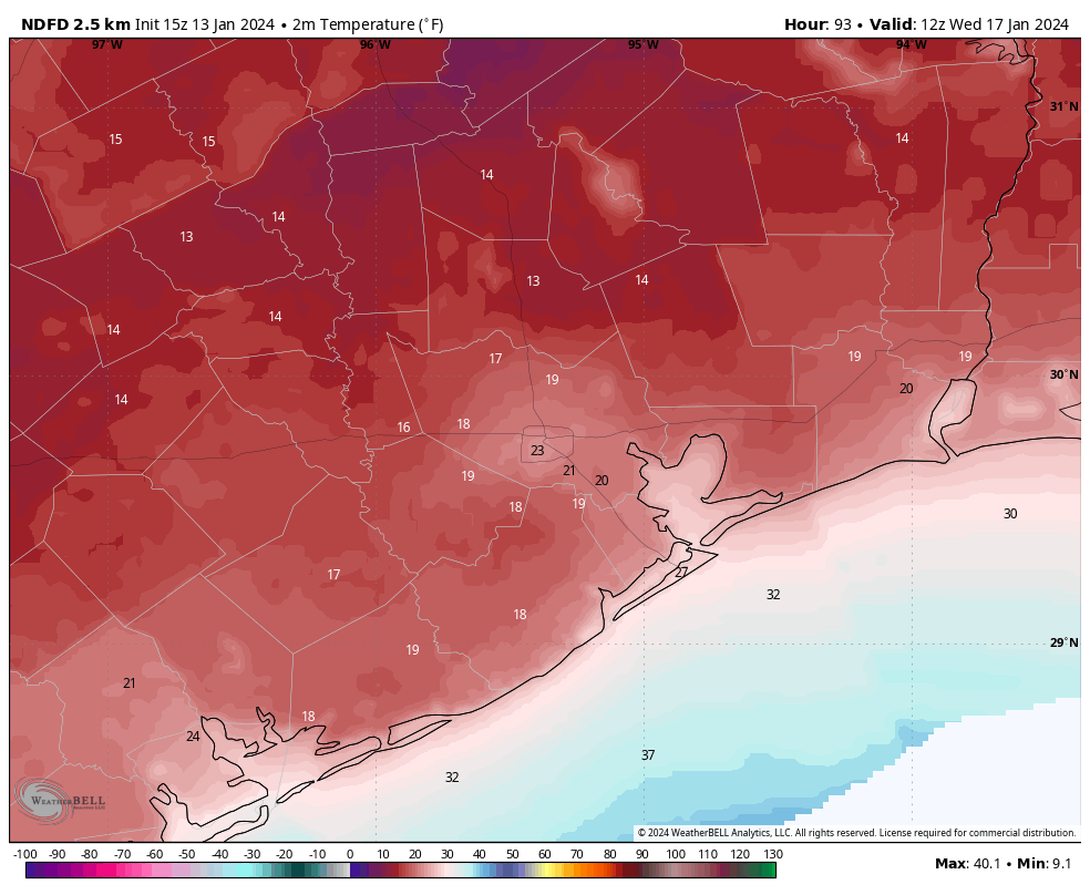
Rain chances end later on Monday, and we’re going to see stronger northerly winds. This is when a second surge of colder air will move in. This reinforcing front will drive lows into the 20s for the Houston metro area on Tuesday morning, but we still have some questions about how cold it is going to get. There is a scenario in which mostly cloudy skies help keep most of the metro area at 25 degrees or higher on Tuesday morning. But if skies clear faster we could see lows bottom out at about 20 degrees, with high teens for Katy and The Woodlands. All of this looks pretty cold, but manageable.
Most locations along and south of Interstate 10 should briefly climb above freezing on Tuesday, but areas further inland may struggle to reach freezing temperatures. In any case, it will be sunny and cold. But with dry conditions it should be fine to be out and about.
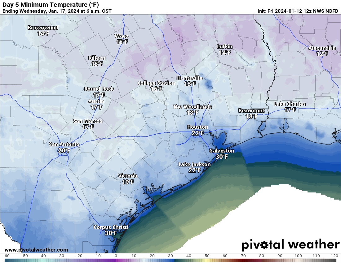
Tuesday night and Wednesday
With clear skies and lighter winds, Tuesday night should bring ideal conditions for cooling into Houston. I expect the urban core of Houston to drop to between 20 and 25 degrees, which will be a hard freeze. Outlying areas, including The Woodlands and Katy, will have a risk of dropping into the upper teens.
By Wednesday afternoon, with lots of sunshine, we should see highs comfortably in the 40s. This will bring an end to the risk of a hard freeze.
We’ll have an update this afternoon to refresh any changes in this forecast. Have a great Saturday, everyone.