In brief: After Monday Houston’s weather will turn to a much wetter pattern that is likely to persist for at least a week, if not longer. We are holding off issuing a Stage 1 flood alert for now, but it is something we’re going to be watching closely in the coming days.
Our pattern is a changin’
The atmosphere above Houston will turn unsettled this week in the absence of high pressure, and with a large scale pattern that will send a series of disturbances into the region through the weekend. When you add in a stalled frontal boundary and very high levels of moisture, you get a recipe for rainfall, and potentially lots of it, through the weekend.
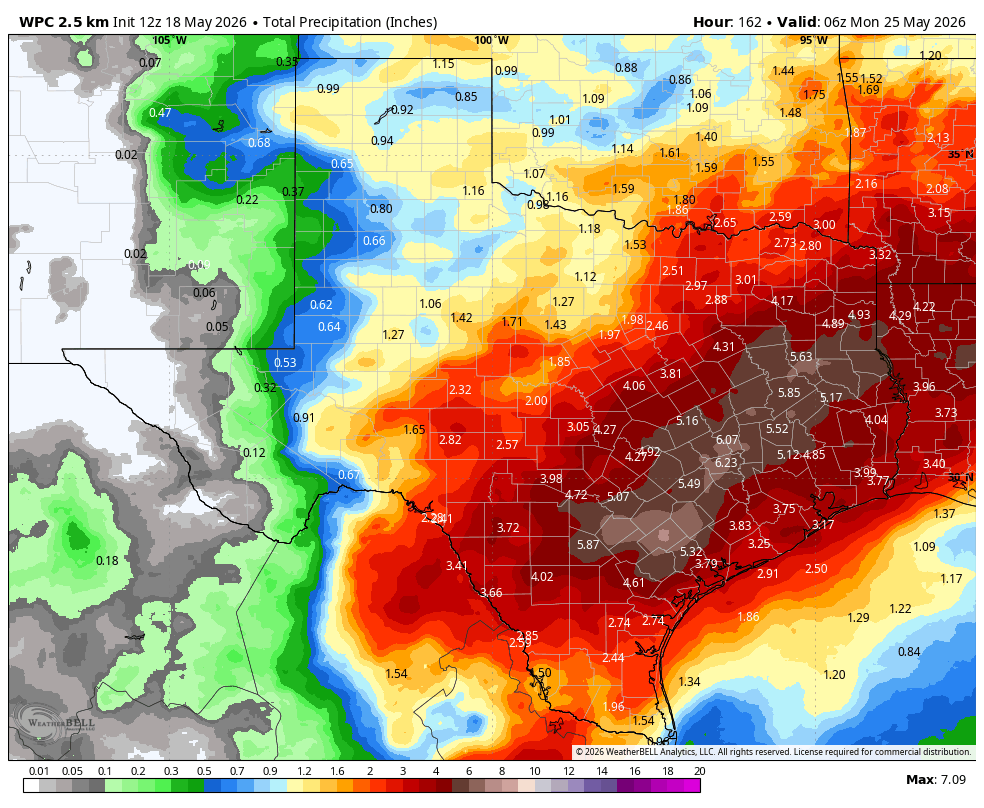
Here’s what we know: The overall pattern will support the development of widespread showers beginning later on Tuesday and Tuesday night, and persisting through the coming weekend. Most of the region is likely to pick up between 3 and 5 inches of rainfall, but there are almost certainly will be some bullseyes above 5 inches as rainfall totals stack up. For now we are going to hold off issuing a Stage 1 flood advisory, but that may well be coming in a day or two as rainfall totals begin to stack up later this week.
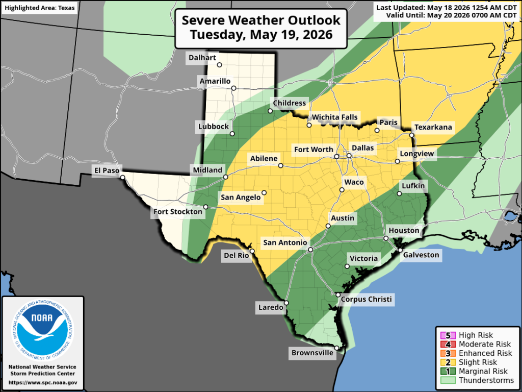
What about severe weather? A weak front is likely to approach Houston, and possibly push into the area on Tuesday evening or overnight. If this happens it could trigger some stronger thunderstorms, some of which become severe in terms of damaging winds and possibly hail. The timing for this is still uncertain, but potentially it could impact the commute home on Tuesday evening or the later hours.
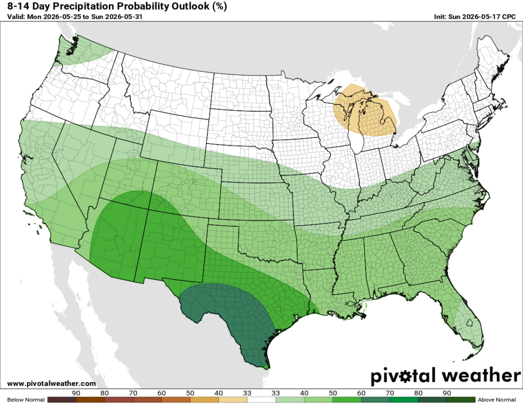
This wet pattern is likely to persist through the weekend, and possibly into early next week.
Monday
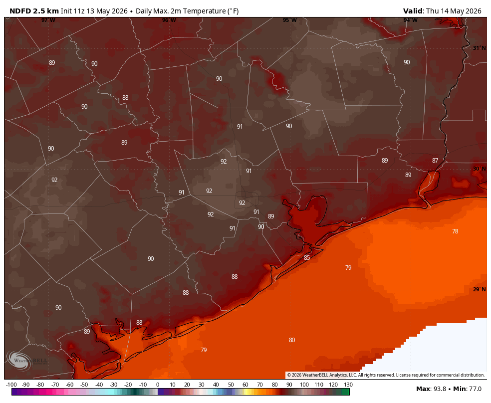
If you’re wondering when it won’t rain this week, today is a good bet. I think we’ll see some isolated showers today, but overall our skies should mostly be cloudy. Even so temperatures are likely to push into the upper 80s, with plenty of humidity, so it will be a warm one. We are going to see those gusty southerly winds again, especially during the afternoon hours. They will die down overnight, with temperatures only falling into the upper 70s (at most) for much of Houston.
Tuesday
Rain chances should again be pretty low during the daytime on Tuesday, perhaps in the vicinity of 20 percent. We also will have a decent chance at seeing a bit of sunshine during the midday hours, probably our best shot at clear skies for the rest of the week. This will help temperatures once again rise into the upper 80s. The uncertainty will come later in the day when a front approaches the area from the west. This will bring a line of storms with it, but at this time it is not clear that the front will push into the city of Houston, or all the way down to the coast. So while there is a chance of widespread showers and thunderstorms during Tuesday evening or Tuesday night in and around Houston, I am not fully committing to it. Lows on Tuesday night should drop into the mid-70s.
Wednesday, Thursday, and Friday
These will be prime time days for widespread showers and possibly thunderstorms. Daily rain chances, for pretty much the entire area, will be on the order of 80 percent. Skies will be mostly cloudy. Again, for now we’re holding off on flood alerts, but we are going to be closely monitoring rainfall totals and a changing forecast. To be clear, for now we expect things to be mostly fine in terms of driving condition most of the time, but we’re just going to have to see. Highs will be in the low- to mid-80s, with overnight lows in the mid-70s. Mid-may could certainly be hotter, so there’s an upside to the showers.
Saturday, Sunday, and beyond
This general pattern is going to persist into the weekend. If I squint, it’s possible that we could see daily rain chances come down to something like 60 percent. But I don’t have much confidence in that. Highs will remain in the low- to mid-80s with mostly cloudy skies. At this point the pattern does not look to change too much next week. Rain chances may come down a bit. We may have some partly sunny and slightly warmer days. But overall the possibility of rain remains in the forecast. Happily, it appears that Mother Nature is preparing to wipe all vestiges of drought from our area before we get into summer proper.