In brief: In this Christmas Eve update we discuss all of the fog recorded by Houston recently. Why has there been so much? When is it going away? Will Rudolph find his way tonight? Also, next week’s cooldown looks fairly stout, sending nighttime temperatures into the 30s.
All about fog, because it’s not going away
Ugh. That’s the typical reaction you’ll get from a meteorologist when it comes to fog. It’s no fun to forecast, and it’s no fun to drive through. About the only thing fog is good for, in my opinion, is establishing a really atmospheric scene in the movies, like the opening battle in the original Gladiator. But aside from that? Ugh. If you’ve got reasons to love fog, I’d like to hear them.
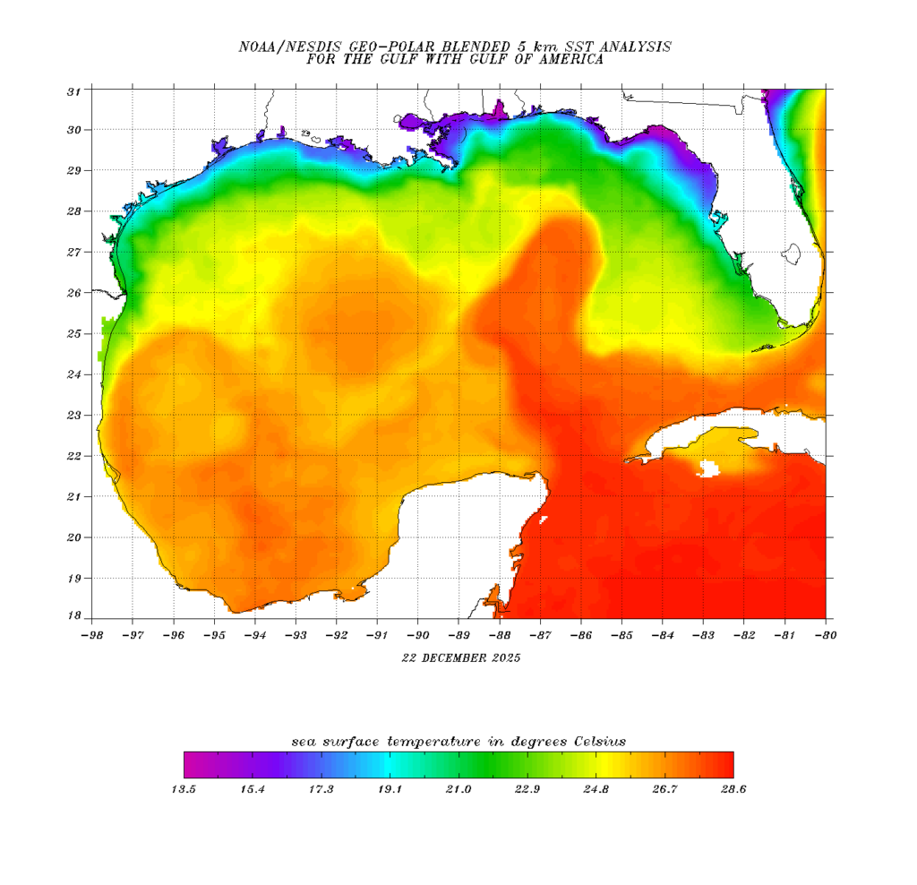
Anyway, the main engine of fog in the greater Houston region during the late fall, winter, and early spring months is the Gulf. By this time of year we have had enough cool fronts come down that the near-shore waters of the Gulf, and Galveston Bay, have generally cooled down to 60 to 65 degrees. (You can check the data for yourself, here).
The important thing is that at night, and in the morning hours, air temperatures remain a little bit warmer than water temperatures, even without the Sun shining. So when we’re in a steamy pattern like we’ve been in, you’ve got this warm and humid air moving over the colder water. This cools the air to the point of saturation, which means the air is saturated with water vapor. This occurs when the air temperature equals the dewpoint temperature. So presto, we’ve got a big fog machine that gets turned on every night. This is known as marine fog.
Houston is susceptible to another kind of fog over inland areas, that forms at night when the air temperature starts to cool. Because the air is already fairly humid, the temperature does not have to drop that far to reach saturation. This process generally needs light winds, so that the lower and more humid air at the surface does not mix with slightly drier air above. This is known as “radiation fog,” and it goes away as the air temperature rises along with the Sun in the morning. This is the origin of phrases like the Sun is “burning off” the fog. In reality, the air temperature is rising above the dewpoint temperature, causing the fog to evaporate.
This foggy pattern is going to be with us until we get a wind shift (from the north rather than southeast), which is likely to happen on Sunday.
Christmas Eve and Christmas Day
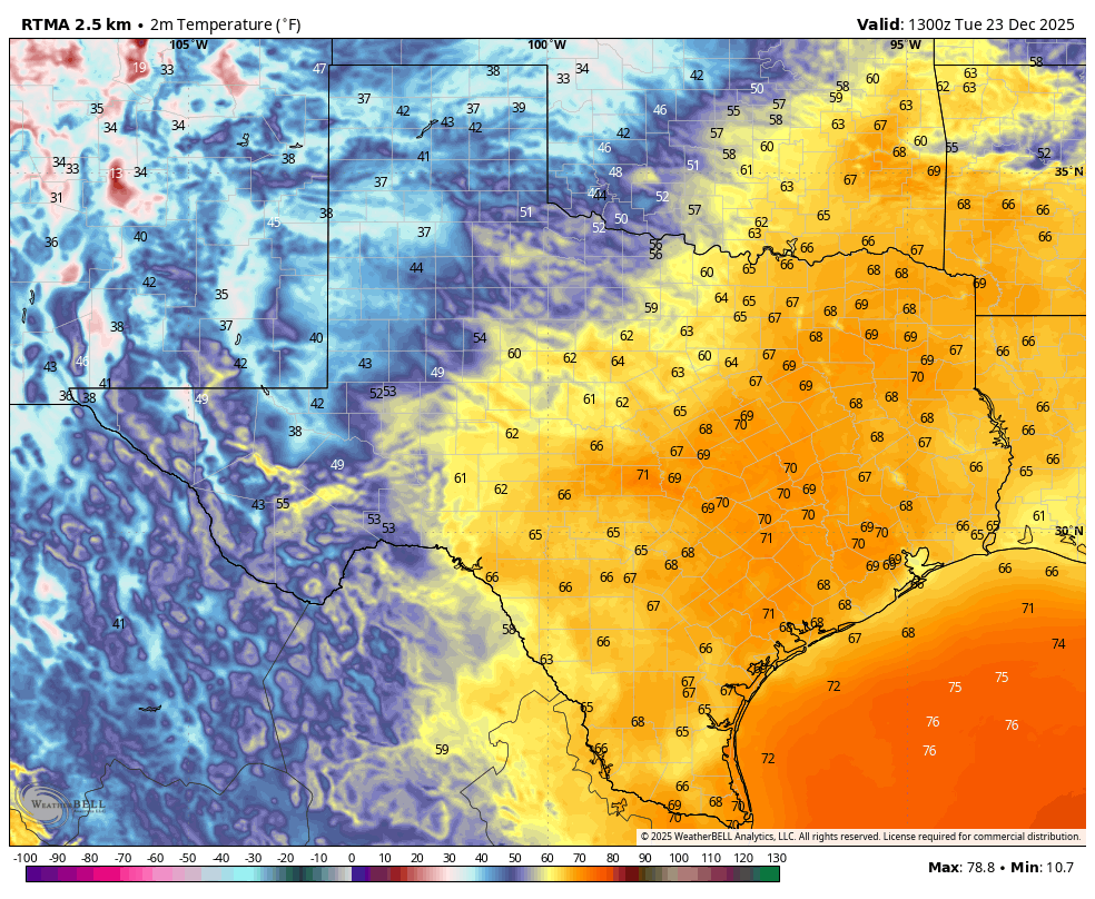
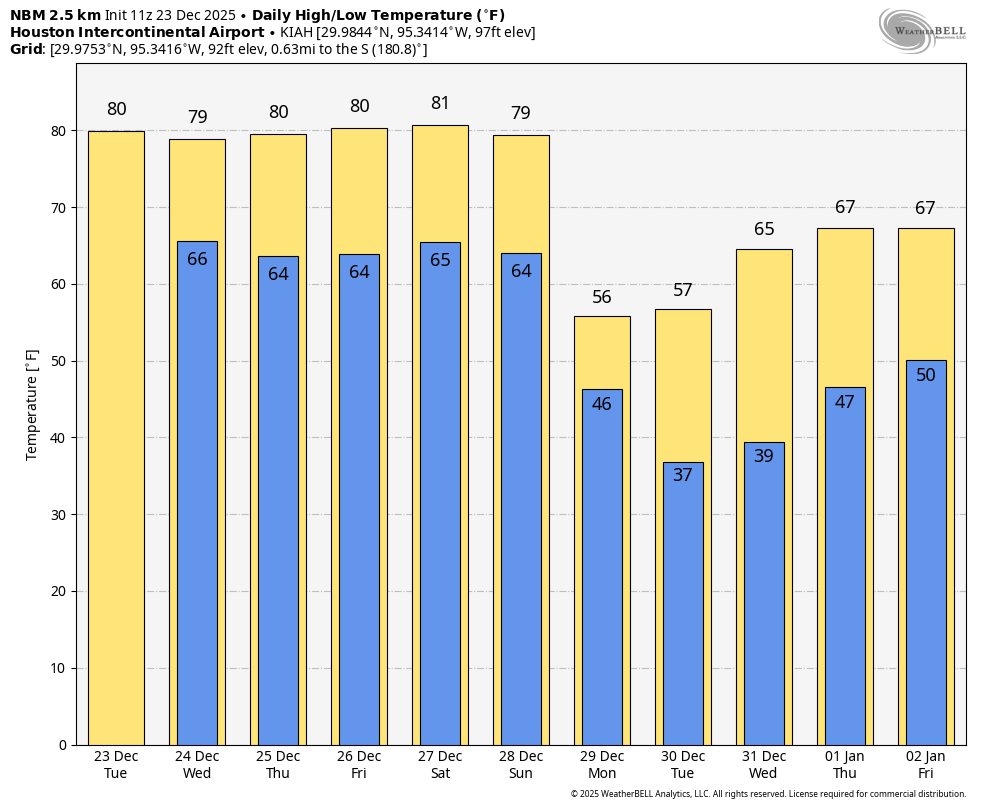
The next two days are going to be more or less the same as we’ve experienced so far this week. They’re going to start out with patchy fog, followed by temperatures rising into the upper 70s to lower 80s, and partly cloudy skies. Nights will be warm, generally in the mid-60s. Rain chances are low to non-existent. If you’re wondering how my long-range Christmas forecast (issued 12 days ago!) did, here you go:
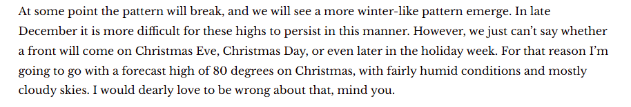
I’m sorry I was not wrong.
Friday and Saturday
The end of the week should continue to see warm and fairly humid weather. If anything, we should see a little more sunshine, and this will push air temperatures to 80 degrees, or the low 80s, for many records. We have already tied several high records this week, and we are apparently gunning for more. Nights remain with, with a chance of patchy fog.
Sunday and beyond
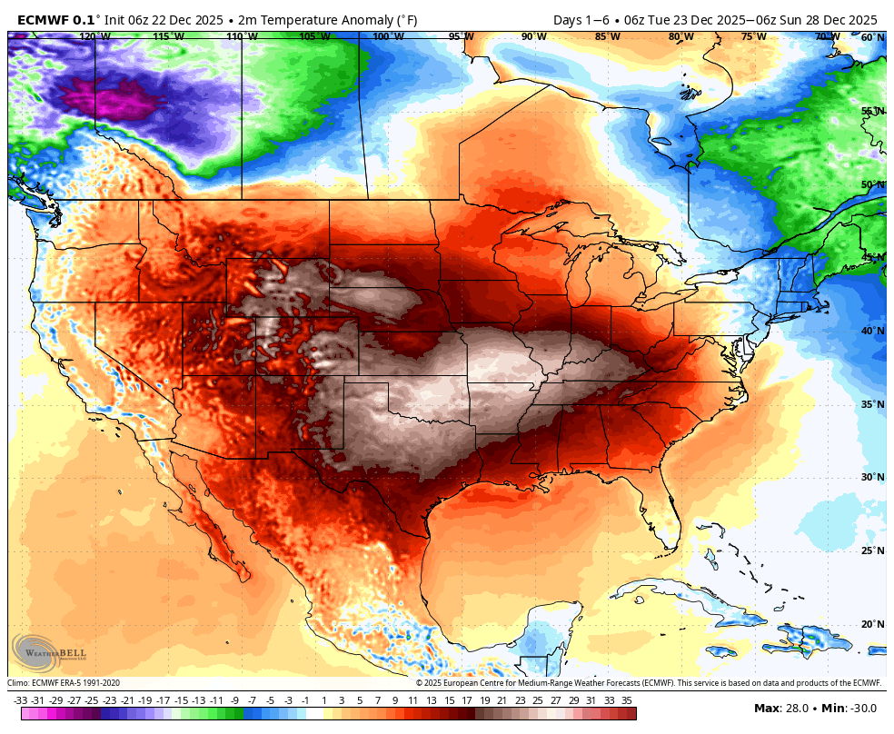
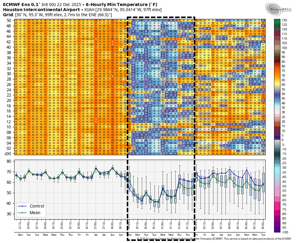
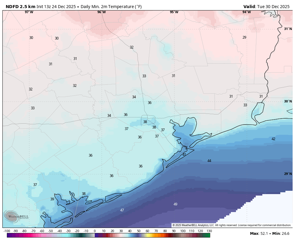
Sunday should be fairly warm as well, with highs pushing into the upper 70s, to possibly 80 degrees. A strong front is coming, but it’s now unlikely to reach our region before Sunday evening or the overnight hours. After this we’ll have a few cold days next week, with highs likely in the 50s, and lows in the 30s and 40s. I don’t think the majority of the metro area will see a freeze on Tuesday morning, but it’s a possibility we’ll be watching for as the mercury bottoms out. Temperatures should rebound a little by New Year’s Eve into the 60s, but at this point I suspect temperatures that night, heading into New Year’s Day will be chilly and in the 40s. So it will be fairly cold if you’re planning to be outside for revelries. The end of next week looks a little warmer.
From all of us at Space City Weather, we would like to wish you a very Merry Christmas and Happy Holidays. See you on Friday morning.