This is a fairly long post that we’ve broken into two parts. First up in a look at what to expect for Texas, for the rest of September, when it comes to hurricane season. The TL;DR there is that things look pretty good, but we’ve still got a few weeks to go. The second part of this post was written by Matt Lanza over at our Atlantic hurricanes site, The Eyewall. It offers a broader look at activity so far in the Atlantic basin, and what that may mean for the rest of the season.
Part I: This is absolutely the heart of hurricane season in Texas
Historically, the majority of significant hurricane strikes on Texas have come in September. Most notoriously, there was the 1900 Galveston hurricane, which made landfall on September 8. More recently there was Hurricane Ike, which made landfall on September 13, 2008. This is the time of year when we see tropical waves forming off the coast of Africa, tracking across the Atlantic Ocean, and moving into the Gulf of Mexico. I never schedule vacations in late August and September for the very reason that this is “go” time for big storms.
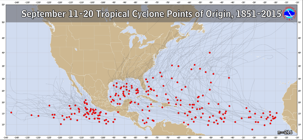
But as quickly as hurricane season peaks, for Texas it ramps down pretty fast. As I have famously—or infamously, in some quarters—written, the odds of a hurricane strike on the state of Texas really drop precipitously after around September 24. It is too early to say whether that will be the case for this year, but the reality is that we probably have about three or four more weeks of prime time hurricane season in Texas. After that, we should be able to breathe a bit easier.
So what’s on the menu for September 2023?
As per usual, we are seeing large and powerful storms developing in the Atlantic Ocean this year. The good news is that, with the exception of Hurricane Idalia, they have steered away from the Gulf of Mexico. We’ve been heavy on fish storms this year, which is just fine. That’s also likely to be the case with the forthcoming Tropical Storm Lee, which should become a powerful hurricane this week. Read below for more details, but the bottom line is that we expect this one to recurve before nearing the Gulf of Mexico.
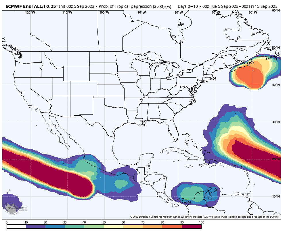
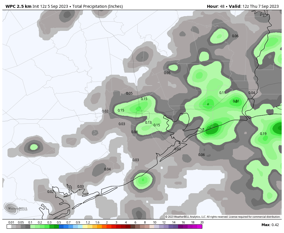
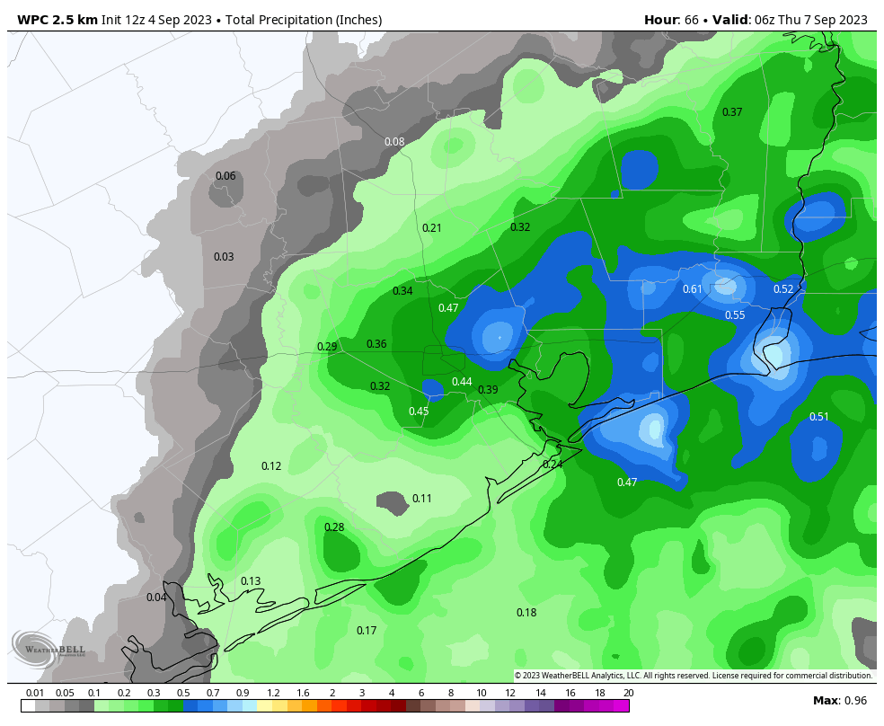
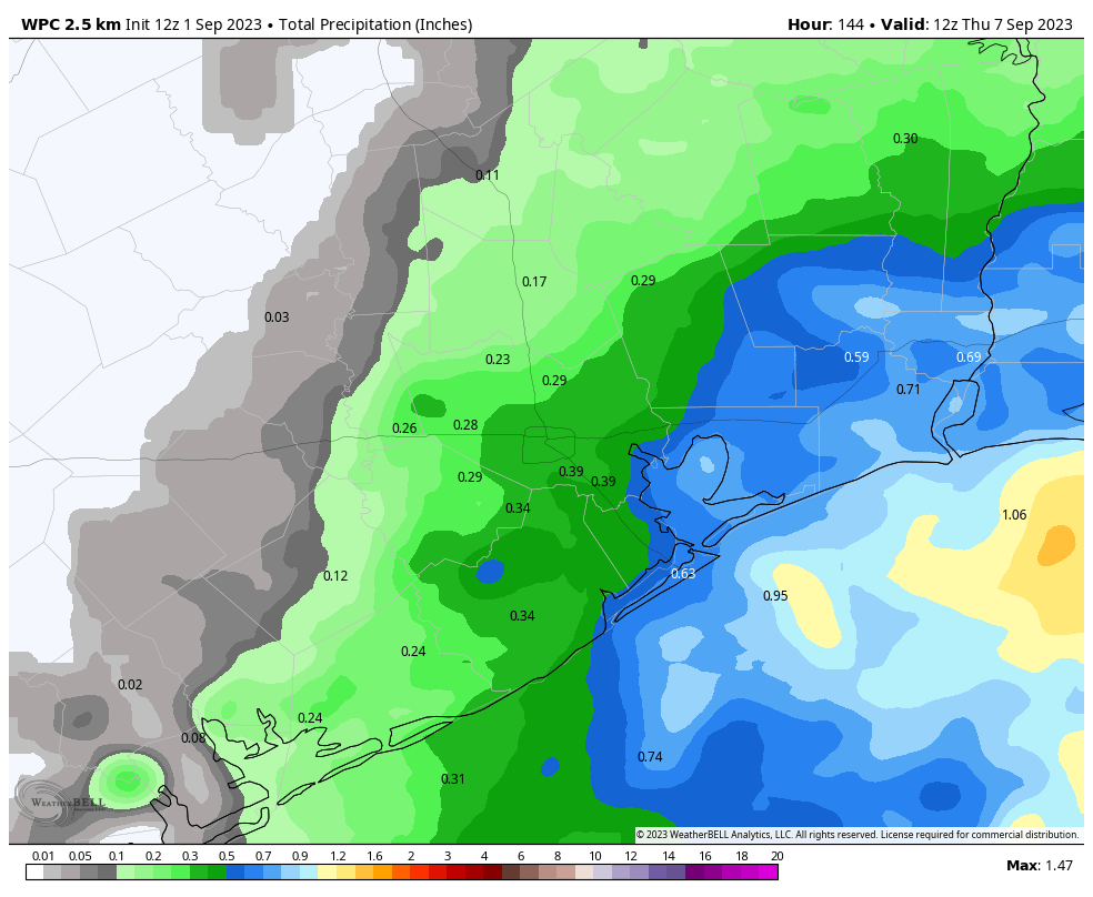
Looking out to mid-September, we don’t see any significant threats to the Gulf, or Texas. Not only are there few indications of storms forming or moving into the Gulf, but wind shear levels look high for the next 10 days or even two weeks. This should preclude any significant activity. However, that leaves open a window of opportunity for the last 10 days of September, during which it will be possible for storm activity. The bottom line is that we’re pretty close to the end of the 2023 Texas hurricane season, but we’re not there yet. Given the very warm seas out there, if wind shear drops down, the end of September could be rocking in the Gulf of Mexico.
So we’ll continue watching things for you, and probably post again later next week when we have a bit more insight into the end of the month.
Part II: Taking stock of the 2023 Atlantic season so far
Back in June when we launched The Eyewall, one of the things we did was dive into the components of the seasonal forecast. We explained that the 2023 hurricane season would be trickier than normal, as the developing El Niño, which typically reduces storm activity would be battling an outrageously warm Atlantic Ocean, a feature that would be good for busy storm activity. So far, that battle seems to be exactly what’s playing out. The “consensus” forecast was 16 named storms, 7 hurricanes, and 3 majors. As of Monday, we sat at 12 named storms, 3 hurricanes, and 2 majors.
Our accumulated cyclone energy for the season, or ACE, sits around 125 percent of normal for the first week of September.
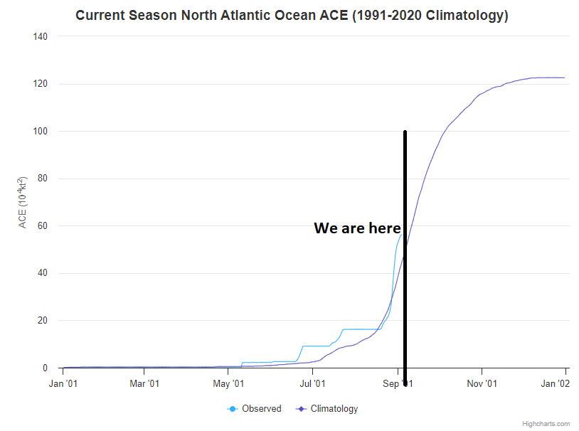
If the season ended right now, we would be sitting in the upper tier of “below normal” seasons. In other words, we already have one heck of a base and seem to be on our way to an average season. Idalia, Don, and Franklin, the season’s three hurricanes, account for nearly 75 percent of the seasonal ACE to date. So three legitimate storms make up the majority of the total.
Back in June we said that we believed the Caribbean would struggle (it mostly has), the eastern Atlantic would be busy (it’s been more the central Atlantic, so that point is a little fuzzier), and that the most concerning items this season would be systems forming close to home (Idalia counts for that). So thus far, this is going mostly as expected, if not a little bit busier. Kudos to the seasonal forecasters for not just going all-in on El Niño.
Where are we going?
Well, this week we are likely to see another big jump in seasonal ACE when Lee forms.
From our morning post, you can read how we expect that to become a major hurricane, likely at least a category 4 storm. This will be a big ACE adder, and I suspect we’ll see things shoot up at least into the 70s once Lee is done, pushing us into the “average” tier of seasons if it ended right there. Behind Lee, we may get another storm in the eastern Atlantic, so there’s an opportunity for a few more ACE units.
But here’s something. If you look at the European ensemble model forecast for wind shear in days 11 to 15, which pushes us out to near September 20th now, you can see that the Gulf and western Atlantic are ripping with shear.
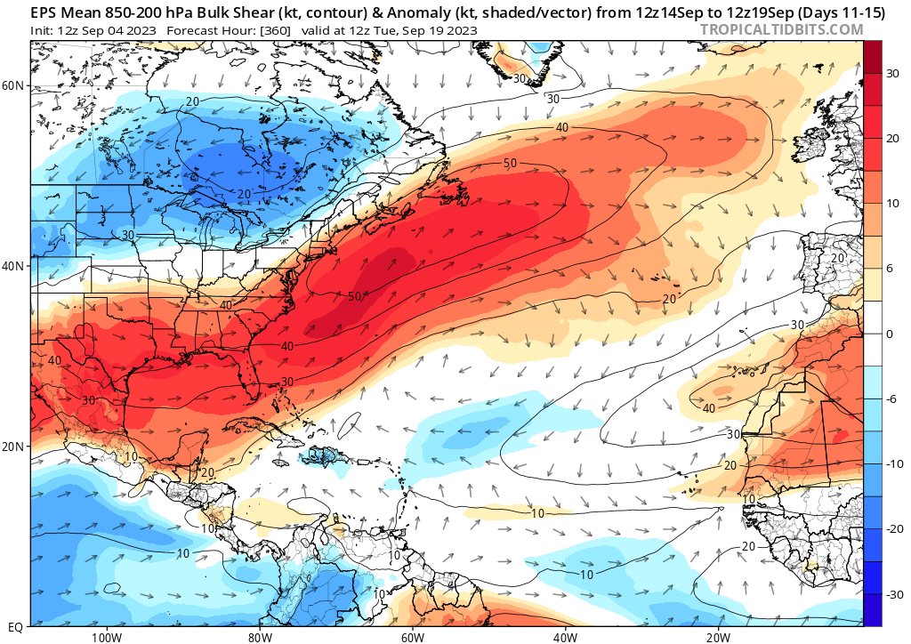
If that happens as forecast, anything in the Gulf will struggle, as would anything coming out of the Caribbean. However, the lower wind shear in the eastern Atlantic and central Atlantic suggests these would be the areas where storms could continue to form, continuing the legacy of the 2023 season to date. We may see less hostile conditions return to the Gulf and western Atlantic in the final days of September, but that’s obviously a long way off.
What does El Niño tell us?
Quite frankly, if we assume that El Niño is up and humming now and the influence is strengthening, then we should expect to see a lot of what we’ve already seen for the remainder of hurricane season. Here is a map of all hurricanes in Septembers and Octobers since 1950 when the Oceanic Niño Index (ONI) was 1.0 or greater for June-July-August (this year’s value is 1.1).
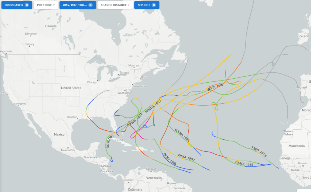
With a couple notable exceptions, this map shows a lot of fish storms and middling systems in the western Atlantic. The two most notable exceptions were Joaquin in 2015 which killed 34 people (33 of whom were aboard the El Faro). And also Betsy in 1965, which killed 81 and inundated New Orleans. Emily in 1987 hit Hispaniola and Bermuda. And I think that sums up the season so far: A lot of middling storms and mostly fish storms with one potent hit in Idalia.
All in all, given what we see on the maps right now and given how this season has gone, there are two primary areas that probably should watch for land impacts: Bermuda and the Greater Antilles. If we can relax shear enough late in the season and get a disturbance in the Caribbean that comes straight north, you never know what you can get out of that, and those often threaten Cuba, Jamaica, Hispaniola or the Bahamas. Bermuda remains in the target line I think for at least one or two more storms. Lastly, the eastern Gulf or off the Southeast coast may be secondary areas to watch, given the warm waters and potential for just the right things coming together at the wrong time, sort of like what we saw with Idalia and to a far less impactful extent, Harold in Texas earlier this season.
Will it be enough to drive ACE above normal for the season in the end? I’m not certain, but it will be close.