Good afternoon. Just a short-ish update this afternoon because, you know, meteorologists want to watch the Texans playoff game as well. Not a whole lot has changed from the forecast we published this morning. So for this post we’re going to summarize the forecast and impacts, and attempt to answer some questions readers have. Be forewarned: We don’t have absolute answers.
Forecast
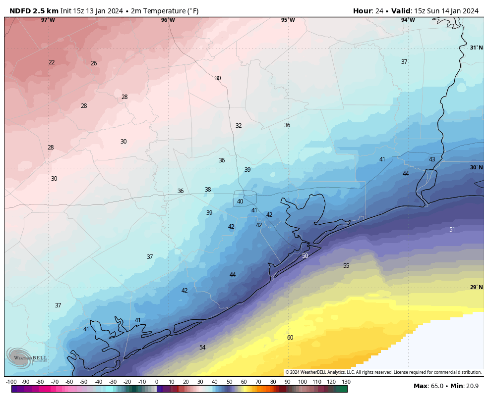
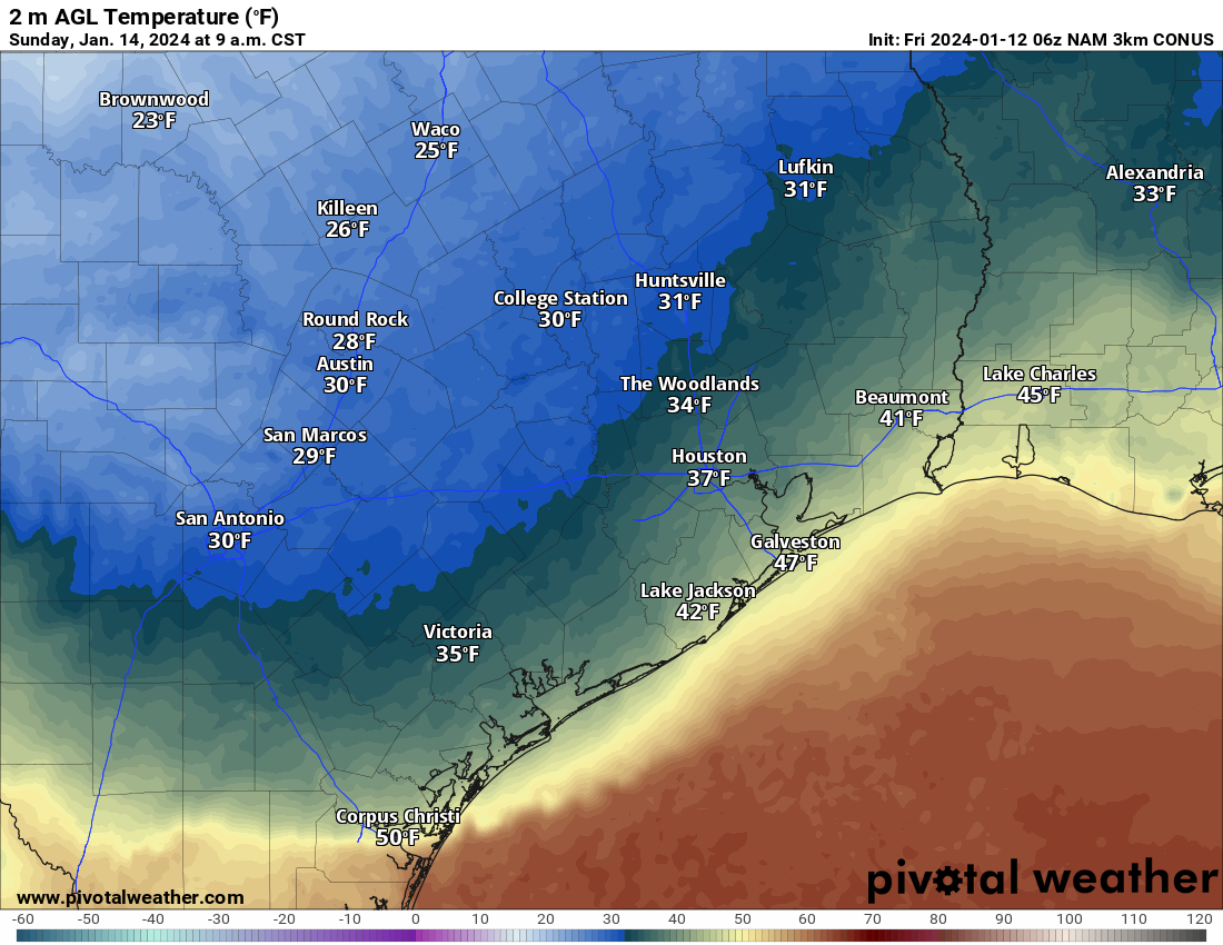
An Arctic front will push into Houston overnight, likely moving through the downtown area before sunrise, and reaching the coast by sunrise or a little bit afterward. This will not be a ‘blue norther’ front in that while the winds will shift to come from the north, they are not likely to be howling. Temperatures will remain above freezing on Sunday, and should remain at or above freezing for the majority of the metro area Sunday night with the usual exceptions, places like Montgomery and Conroe.
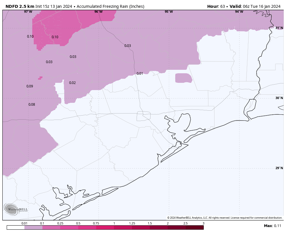
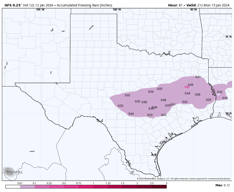
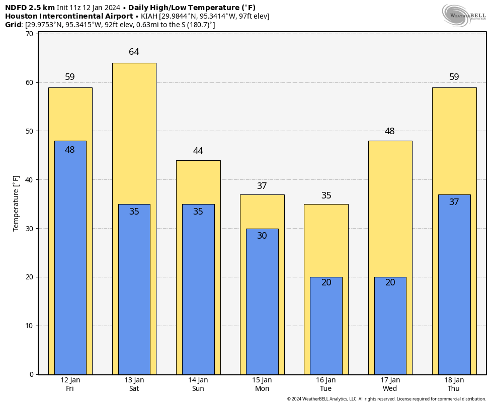
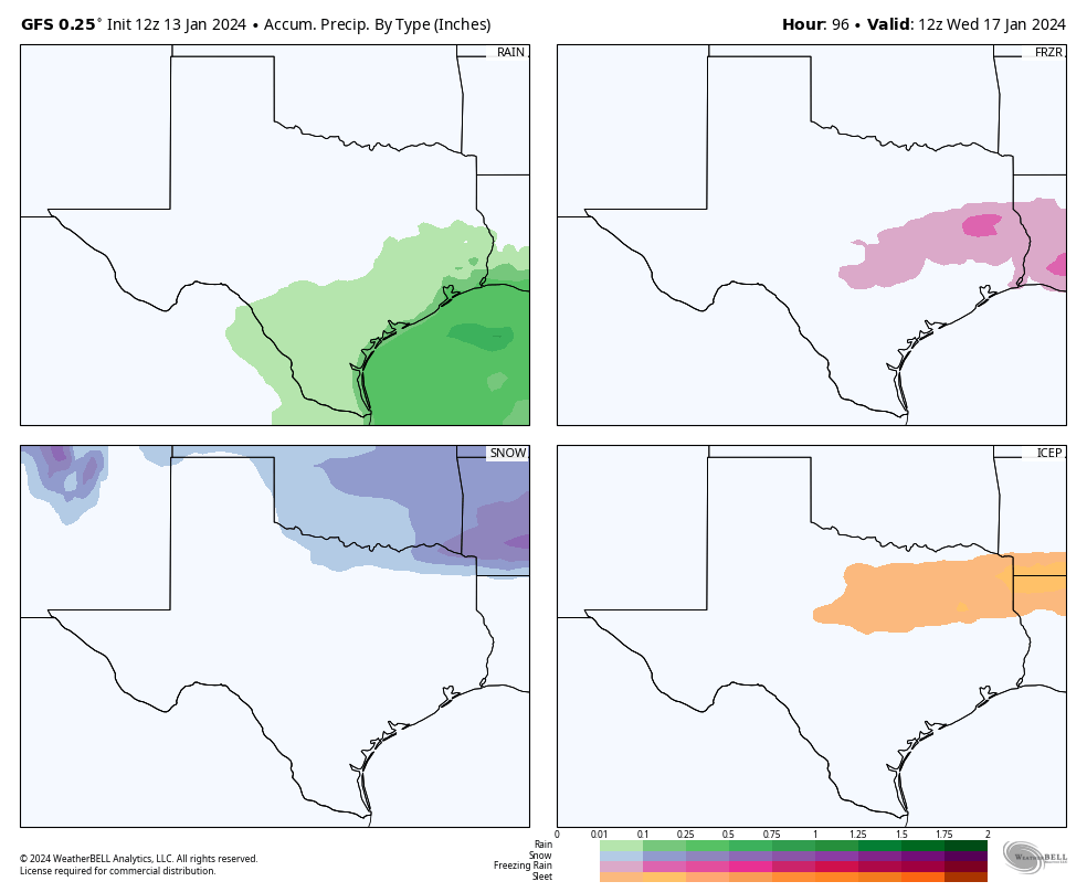
Monday is going to be a cold day. Most of the region will be in the 30s, with mostly cloudy skies. A passing disturbance will bring light, scattered rain showers into the area beginning late Sunday night or early Monday morning. Most of our model guidance still indicates this precipitation will fall as rain in Houston, with a transition to freezing rain northwest of the metro area, perhaps roughly along Highway 105. Bottom line: It’s going to be miserable outside in Houston on Monday, but you should be able to get out and about. We’re continuing to watch the freezing line closely, of course.
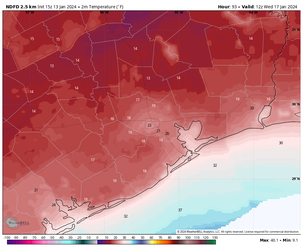
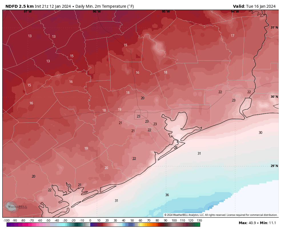
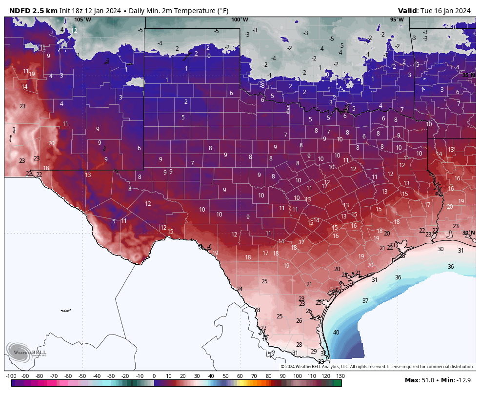
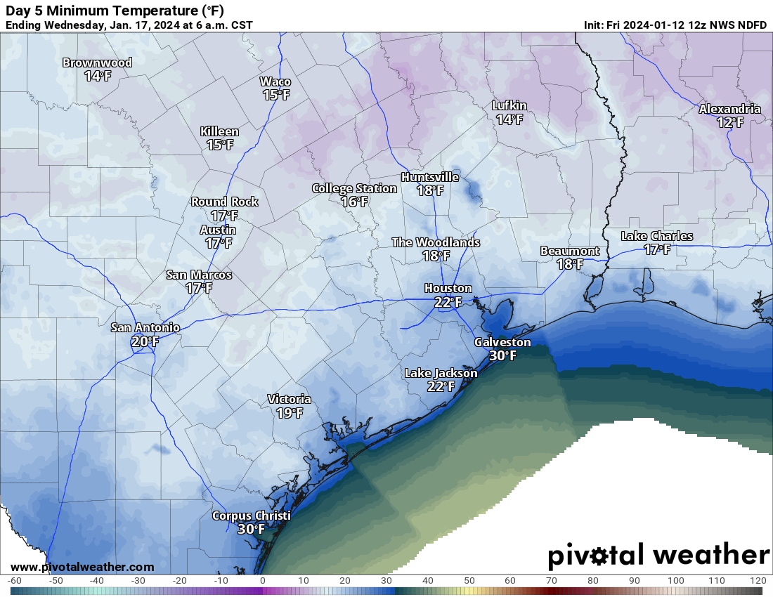
A secondary push of cold, Arctic air will arrive on Monday and that will nudge nighttime temperatures lower on Monday night. But there’s still a pretty broad range of uncertainty on how far the mercury drops on Monday night, depending on cloud cover and other factors. Our advice: prepare for a hard freeze in Houston, but don’t be surprised if temperatures are a little warmer. Tuesday night into Wednesday morning continues to look like the coldest night of the forecast period, when much of the metro area will drop into the upper teens to mid-20s. I don’t feel confident putting a finer point on those temperatures yet. We emerge from the icebox on Wednesday.
Now, let’s try to tackle some questions.
Is the power going to go out?
We’re weather forecasters, not power prognosticators, and so we have limited insight. Statewide temperatures do look 5 to 10 degrees warmer than the exceptional cold that led to widespread power outages in February 2021, and the state has invested in “winterizing” the grid in the three years since that disaster. All of that makes us feel pretty good about the state avoiding prolonged outages.
So far state officials have not called for conservation next week. But it seems like that may be possible, especially on Monday and Tuesday mornings, when the demand forecast from ERCOT is near to the expected supply. In any case, we’ll all see what happens together.
Are there going to be Airport delays?
If we get freezing rain at Bush Intercontinental Airport (or Hobby, for that matter) then yes, there could be some significant flight delays on Monday. But that does not seem likely at this time. For the most part this is going to be the story of cold weather rather than a winter storm. The optimist in me thinks that while there may be some airport delays on Monday and Tuesday, they probably will be due to the destination airports rather than conditions at Houston terminals. The pessimist in me is saying, “Uhh, dude, you’re out of your depth here.” Which is true.
Is school going to be canceled?
Monday is a holiday, to mark Martin Luther King Jr. Day. If our forecast is wrong, and we get more rain than expected on Monday, and conditions are a little colder, than we could see some icy bridges and overpasses on Monday night into Tuesday morning in Houston. That would be a reason to cancel schools in the Houston metro area on Tuesday. But right now we don’t anticipate that happening.
We should have even more confidence in the forecast by tomorrow. Tuesday and Wednesday mornings are going to be blustery and cold, with wind chills in the 20s or teens. Is concern about exposure getting to and from school a reason to cancel it? That’s not my call. But at present our expectation is that roads will remain passable during this winter event.
Should I drive to Dallas or Austin on Monday?
These are going to be difficult calls. Right now there’s a chance of light, freezing rain on Interstate 10 and Highway 290 on Sunday night and Monday. Will there be enough to stick on highways? Maybe a few bridges and overpasses. But I don’t feel great about making that call on driving to Austin right now.
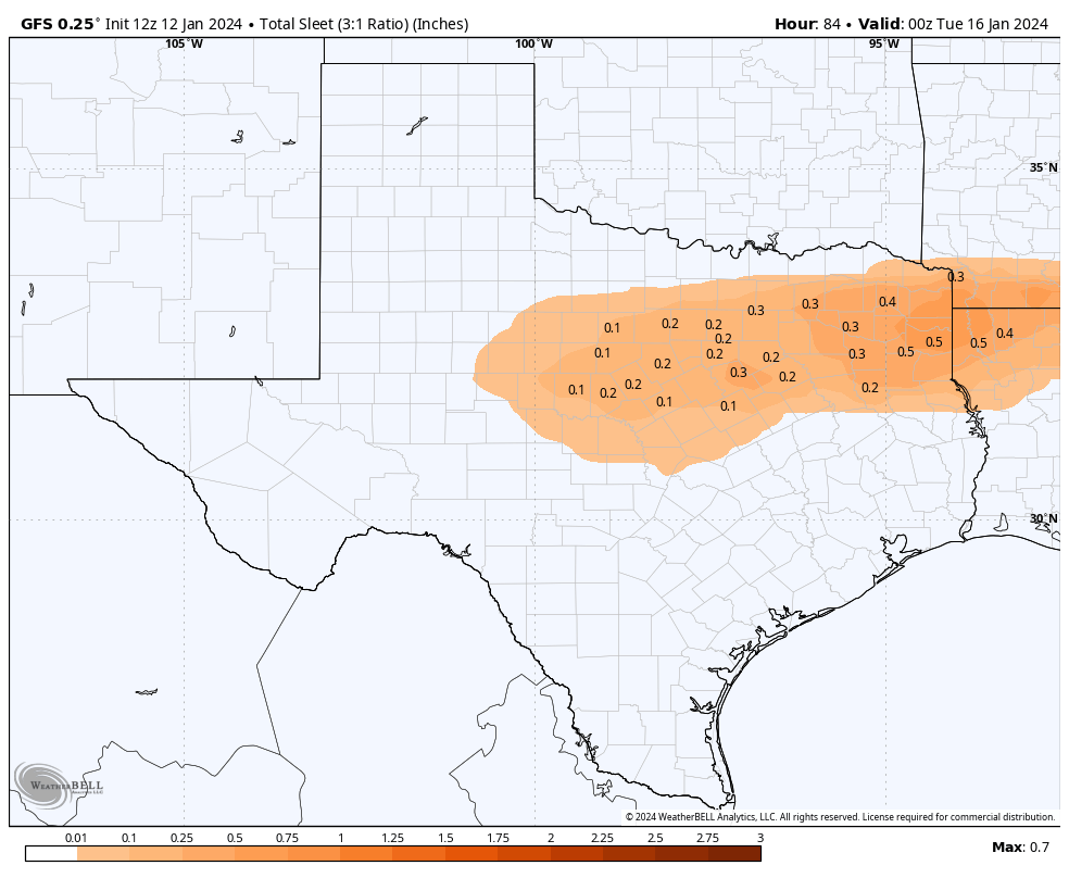
As for Dallas, or places like Shreveport, I’m a little more confident that we’re going to see some decent freezing rain or sleet accumulations that could make travel hazardous. So if you’re heading north of The Woodlands on I-45, or north of Cleveland on Highway 59 on Sunday afternoon or Monday, I’d definitely check road conditions before leaving.
Is it going to snow?
Yes. But not in Houston. For any appreciable totals, you’re probably going to have to travel to Oklahoma or Arkansas on Sunday or Monday. Which, as noted above, is not advisable.