In brief: Following widespread showers this past weekend, the region will see ongoing rain chances through the middle of this week. We’ll see a warming trend heading into the weekend, which looks to be fairly humid.
Saturday rewind
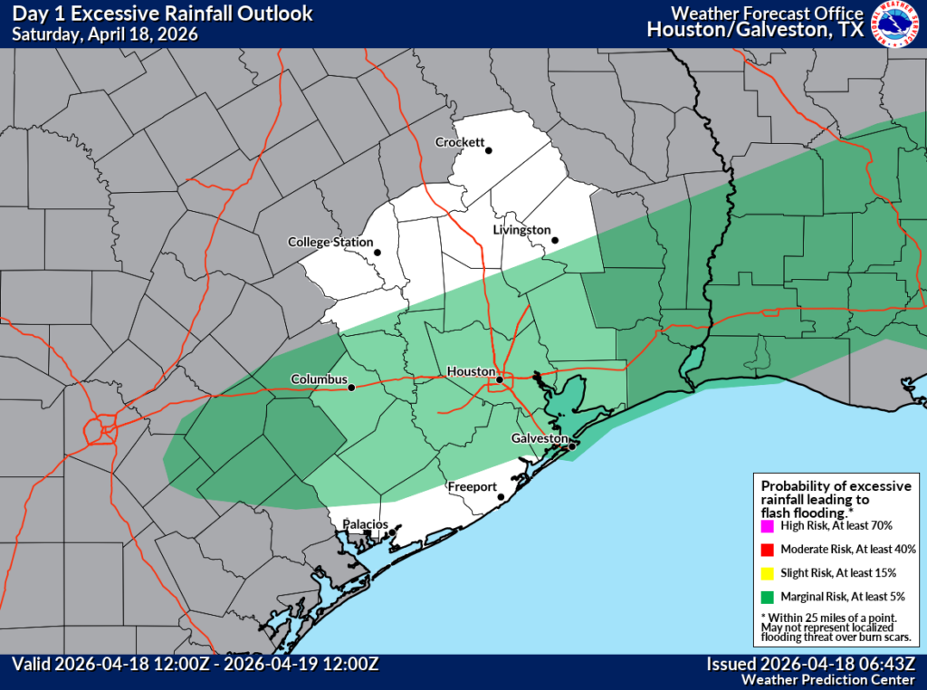
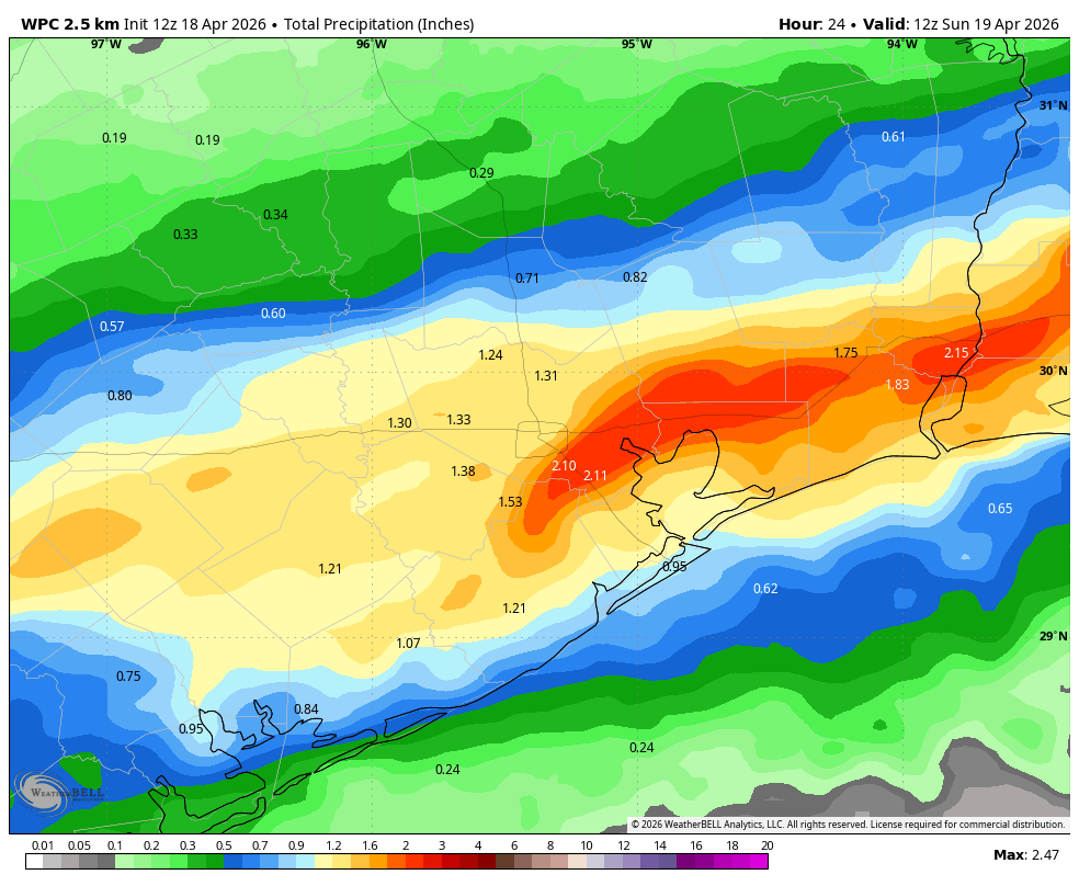
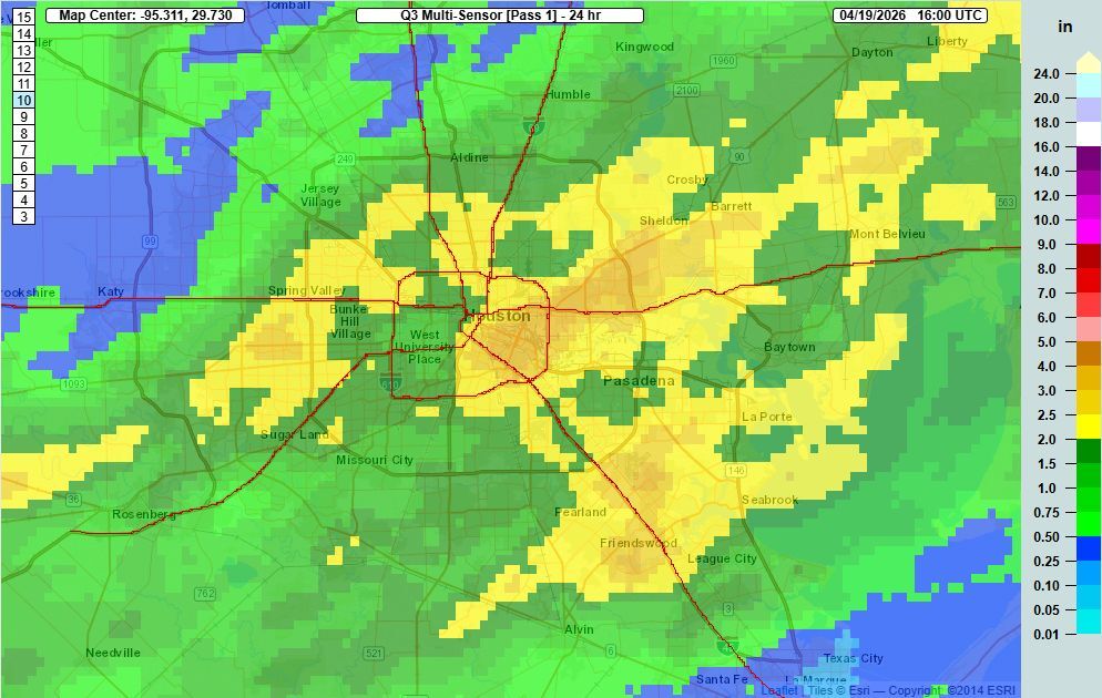
Much of the Houston area received a good soaking on Saturday as a cold front slowly moved into the region. Some areas got a little too much rain, with some street flooding occurring from just southeast of downtown out Highway 90 and Interstate 10 toward Sheldon. Some of these locations received 3 to 5 inches, whereas most of the region picked up 0.5 to 2 inches. Although it came on the weekend, much of this rain was welcome after a dry winter and start to spring. Our overall pattern will now remain fairly wet this week as a moist airmass remains in place.
Monday
Temperatures are generally in the low 60s this morning, with winds shifting to come from the east. Skies are also mostly cloudy and that’s not going to change much over the next several days. It’s possible that we see some sprinkles today, but there’s enough dry air about that any showers may not make it to the ground. In any case, if there is light rain today it most likely will occur to the west of Interstate 45. Otherwise expect a high around 70 degrees, with modest easterly winds. Lows tonight will drop into the lower 60s, and as the dry air edges out of the area our rain chances will go up overnight.
Tuesday and Wednesday
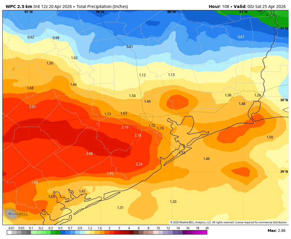
Increasing moisture paired with a disturbed atmosphere will lead to high rain chances on both Tuesday and Wednesday. Most of these showers look moderate in nature, but we certainly cannot rule out some heavier rainfall. I expect much of the area to pick up 1 to 2 inches of rainfall, but there will very likely be some higher isolated totals. I’m not ready to pull the trigger on a Stage 1 flood alert, but it is something that Matt and I will be watching given what happened on Saturday. Anyway, these should be days with highs in the 70s, mostly cloudy skies, and on- and off-showers. Rains should finally ebb on Wednesday evening.
Thursday and Friday
As rain chances diminish we’ll see a little more sunshine to end the work week, and this will allow high temperatures to rise into the low- to mid-80s for most locations. There will still be the odd chance of a shower, but for most of us probably not. Nights will be warm, generally in the lower 70s.
Saturday and Sunday
Skies remain mixed into the weekend, with warming temperatures and plenty of humidity. Expect highs in the mid- to upper-80s. I’ve had several questions about rainfall for this coming weekend. At this point my sense is that shower activity will be fairly limited. So clouds, yes. Rain showers? Probably pretty scattered, in the range of 20 percent each day. Lows remain in the lower 70s. If you’re riding the Texas MS 150 this weekend I’ll have a more detailed forecast for you tomorrow, but the good news is that winds should be from the south-southeast, so there will be a tail, or cross-tail wind most of the way.
Next week
At some point next week, in the Monday to Wednesday time frame, we might see another decent cool front. But the signal is not super strong in our modeling data, and this far out I’m skeptical of pretty much everything. Anyway, expect the week to start fairly warm and humid, and then we’ll see what happens after that.