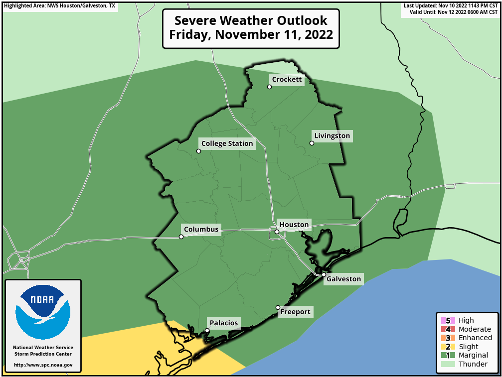
Good morning. We’re jumping in on a Saturday morning to highlight the likelihood of very cold temperatures tonight across the metro area, and the potential for a freeze to the north.
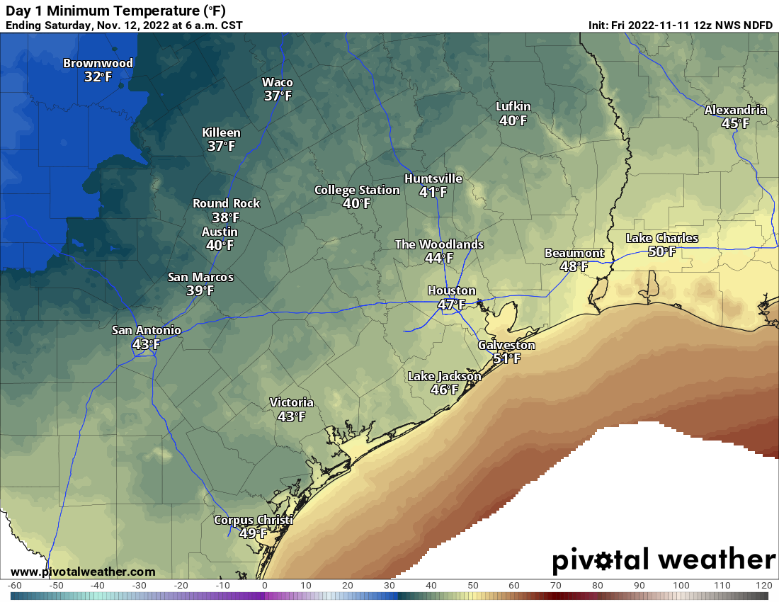
If you’ve stepped outside you already know that it’s rather chilly. This is the result of colder and drier air working into the region during the overnight hours. With brisk northerly winds today, gusting up to 25 mph, more dry air will be moving in today. Highs will struggle to reach 60 degrees. This evening, as winds die down and with clearing skies, we’re going to see ideal conditions for cold weather.
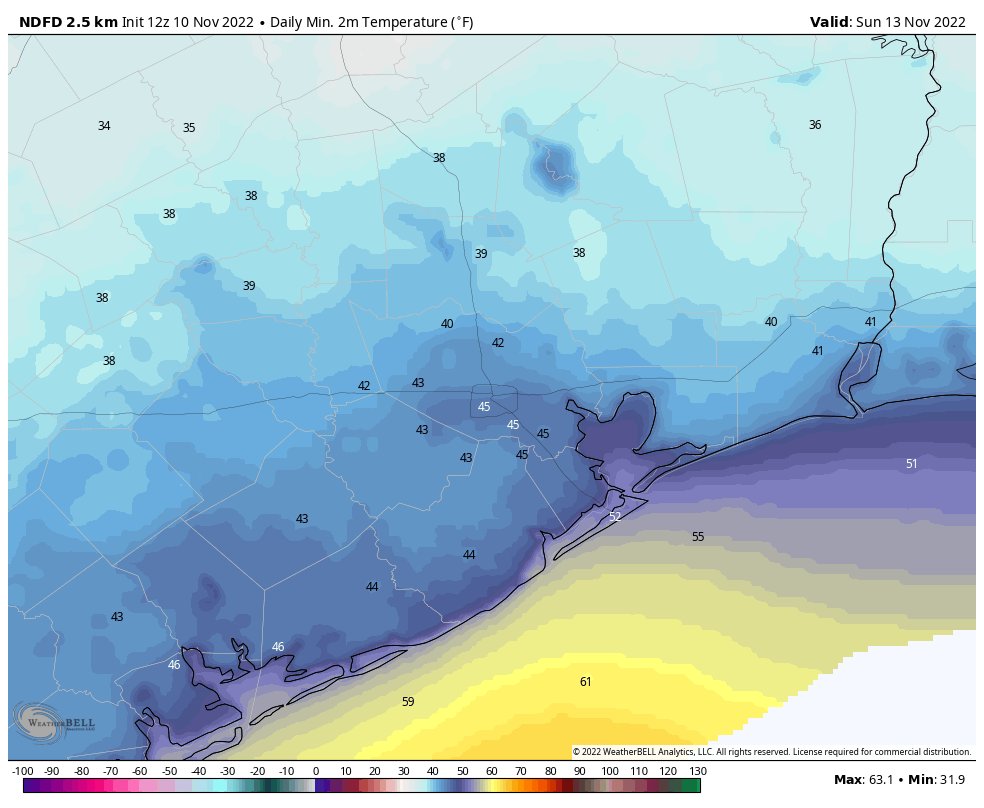
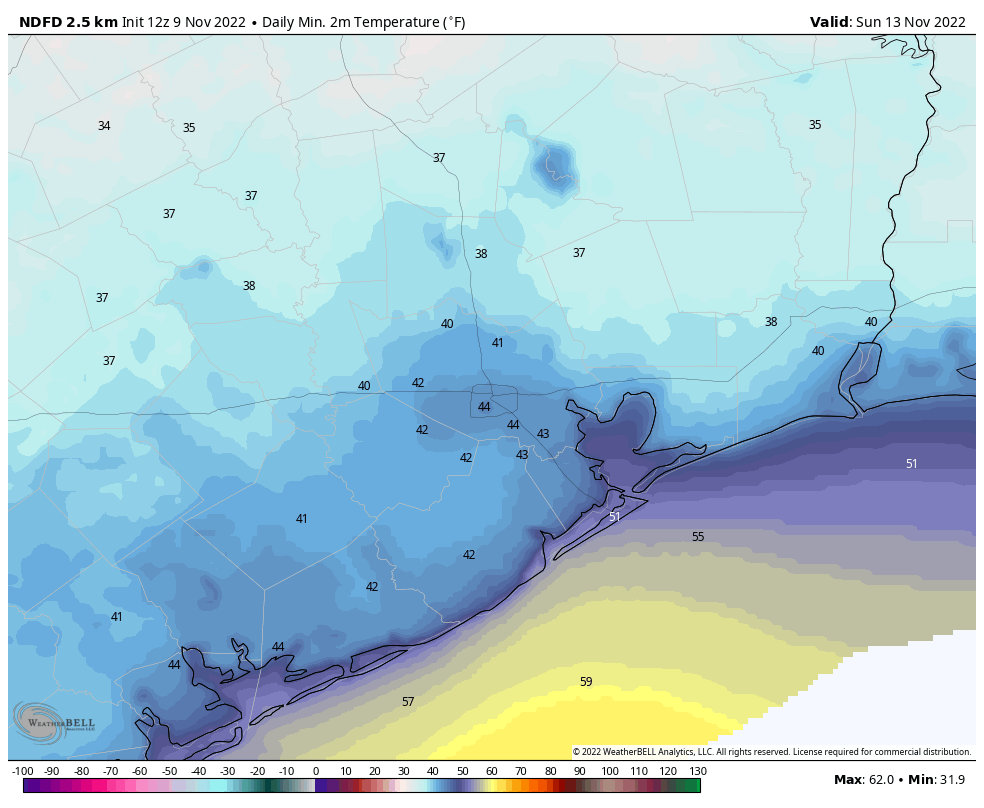
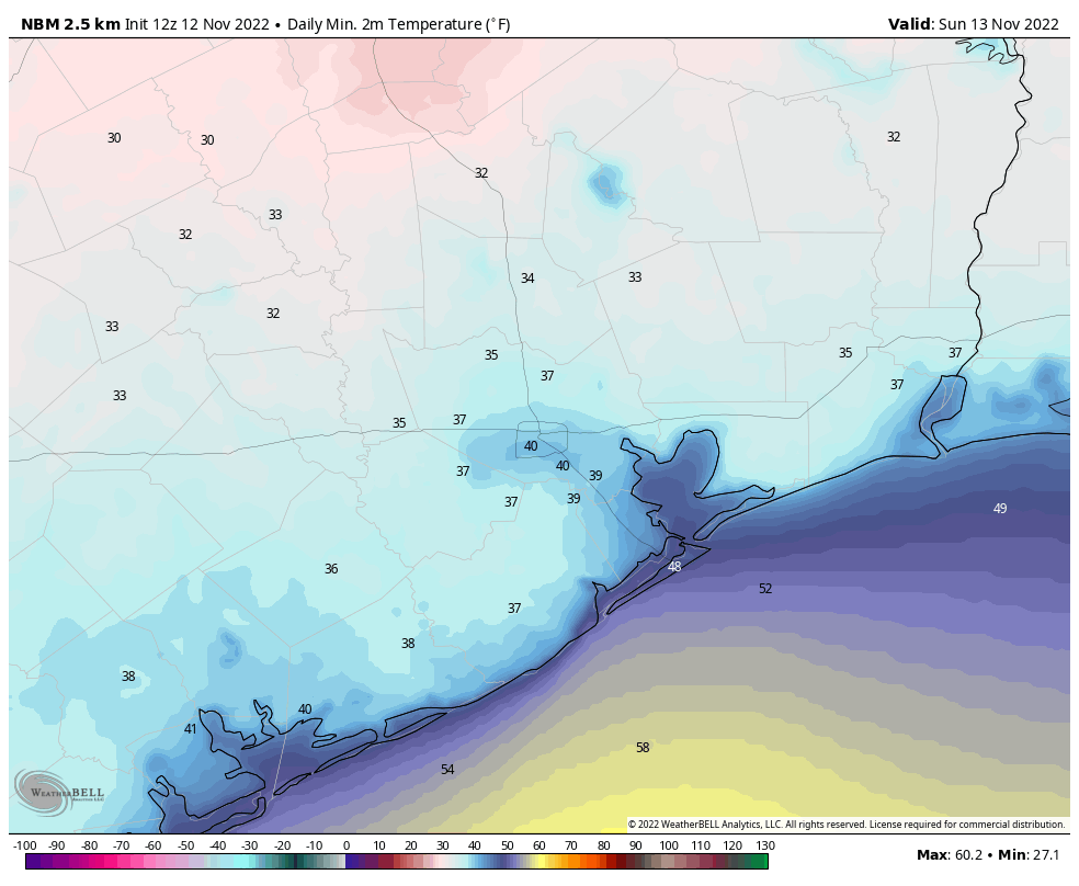
Although I still think the urban core of Houston will remain at about 40 degrees tonight, areas north, west, and east of central Houston will drop into the 30s. Models have been trending colder with this air mass—hence this morning’s update—and we wanted people to be ready. Areas such as Katy, the Woodlands, and Kingwood will probably remain in the mid- to upper-30s tonight. However, areas further inland, including parts of Montgomery County, Brazos Valley, and the Piney Woods, may drop into the lower 30s and have a shot of seeing the region’s first freeze since mid-March.
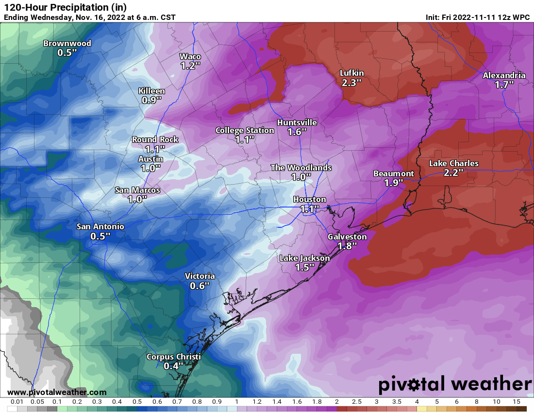
The rest of the forecast is more or less on track, as Matt described on Friday. Sunday night won’t be nearly as cold and we’ll warm up briefly on Monday, at which point we’ll see a healthy chance of showers ahead of the next cold front. That one will keep things on the chilly side for the rest of next week. And by chilly side, I mean most days will be in the 50s, with lows perhaps around 40 degrees. In other words, inland areas will probably be looking at more freezing chances next week. We’ll have more for you on Monday.
Finally, just a brief reminder that we’re in the midst of our Annual Fundraiser. You can buy merchandise or support us with donations by visiting our main page. “Donate only” is any option under any of the merchandise selections. Thank you!