Houston to have its warmest day of 2022 today before a front Wednesday

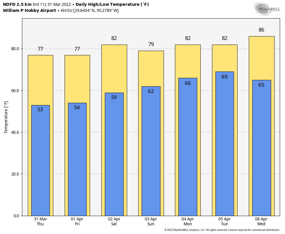
Good morning. Houston is “enjoying” its warmest morning so far of 2022, with lows only falling into the low 70s for much of the region. We’ll have one more warm day before a front arrives on Wednesday to set the stage for a much more seasonal rest of the week, and weekend.

Tuesday

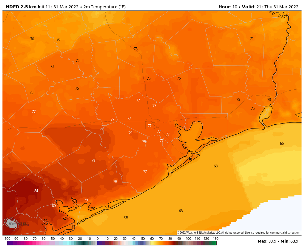
There is some patchy fog across the metro area this morning, but it should lift by mid-morning as temperatures warm. How much sunshine breaks through this afternoon, and how quickly it does, will determine how high our temperatures go. But I feel pretty confident that at least some parts of the metro area will reach 90 degrees for the first time this year, especially areas west of Interstate 45. Winds will generally be light, out of the southwest. Some fog will be possible tonight as temperatures drop to around 70 degrees.

High temperature forecast for Tuesday. (Weather Bell)

Wednesday

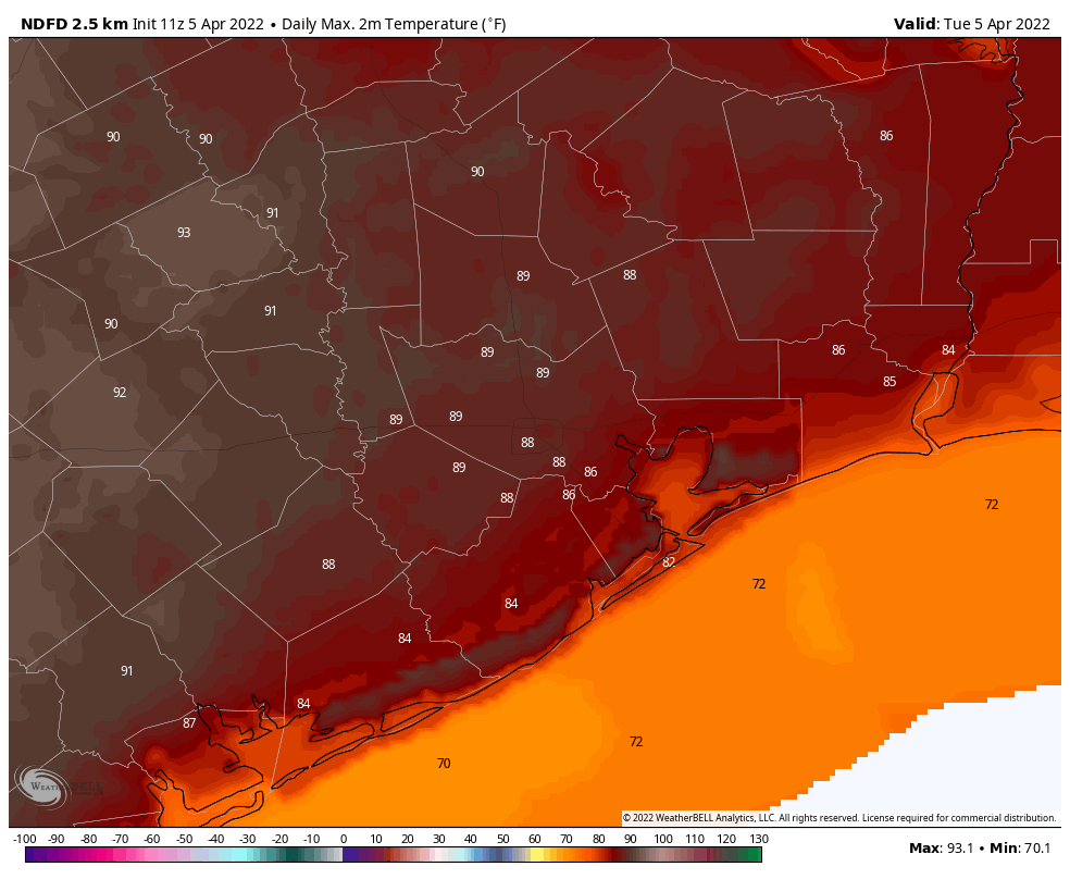
If you’re not quite ready for the heat, relief arrives on Wednesday in the form of a front that likely will reach areas north and west of Houston by late morning, the city itself by around noon, and clear the coast during the afternoon. Northwesterly winds will quickly bring drier and cooler air into the region, with afternoon temperatures around 80 degrees, and overnight lows in the 50s.

Thursday and Friday

The end of the work week should bring a pair of sunny days, with highs somewhere in the upper 70s, and lows dropping to around 50 degrees in Houston, with 40s likely for areas further inland. Both of these days will be fairly breezy, with sustained winds of 10 to 15 mph, and gusts up to 25 mph or so. Even so, these winds mean drier air, with dewpoints dropping to around 30 degrees. That won’t happen too many more times this spring, y’all. If at all.
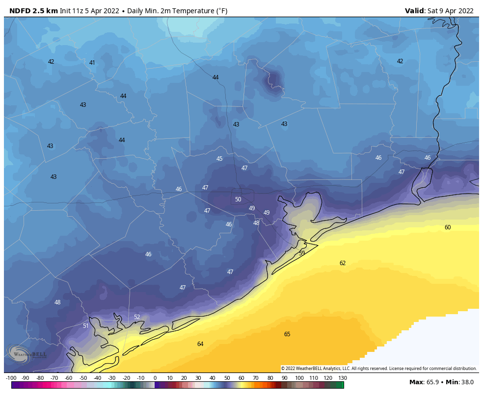
Saturday morning will probably be the coldest of this week. (Weather Bell)

Saturday and Sunday

After a cold start on Saturday morning, the onshore flow returns this weekend. Both days should see partly to mostly sunny skies, with highs in the low 80s. The southerly flow will be a bit stronger on Sunday, so we’ll likely see winds become a bit more gusty. Lows by Sunday night will only drop into the upper 60s, probably.

Next week

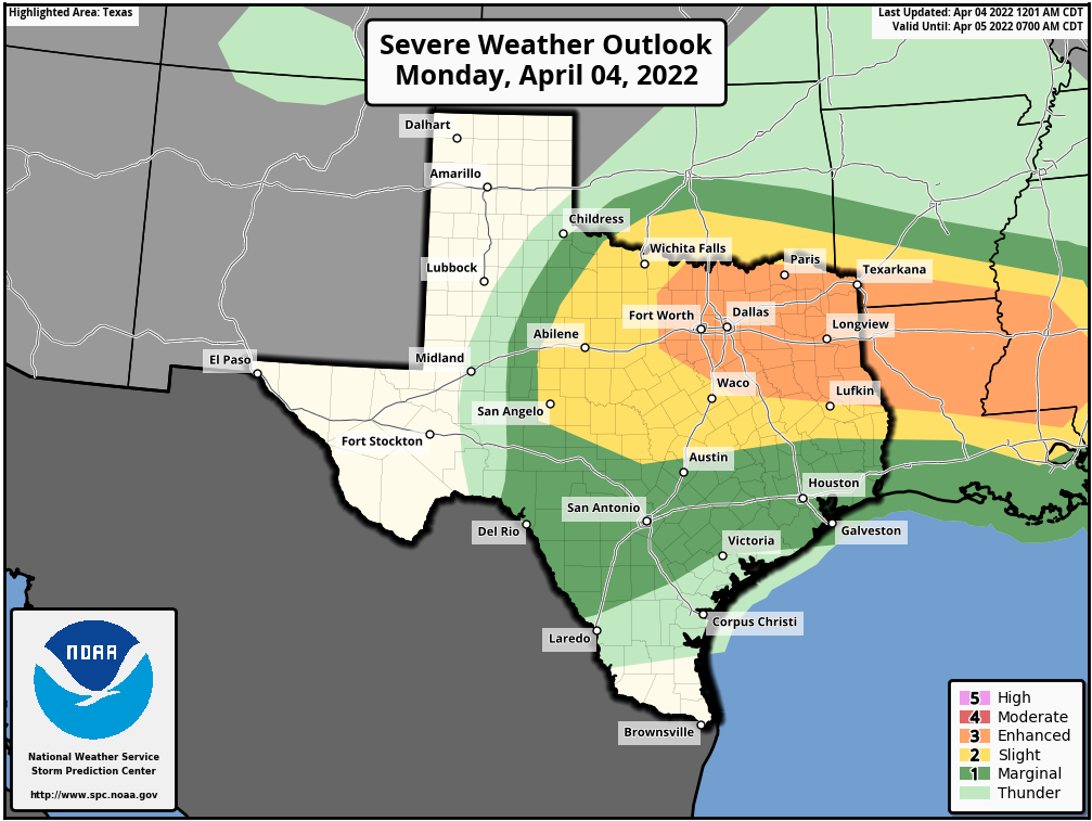
Most of next week looks to be in the 80s, with warmish nights. Some rain chances return by the early part of next week, but they’re nothing to write home about. Another (weak?) front may arrive by Wednesday or Thursday to bring some drier air back into the region. We’ll see.

Highs near 90 degrees are possible before cool front arrives Wednesday

Good morning. The big (bad?) news this week is that we’ll probably see our warmest weather of 2022, with highs of 90 degrees possible on Tuesday and Wednesday. But fret not, a nice front arrives on Wednesday to bring drier air and seasonable weather into the region through at least part of the weekend.

Monday

Increasing atmospheric moisture levels will combine with and upper-level disturbance to bring a chance of showers into the region, probably 20 percent today, and 50 percent tonight. While we cannot entirely rule out a thunderstorm or two, by far the better chance for this lies well north of the Houston region, including Montgomery County. (Dallas and Fort Worth may well be affected, so bear that in mind if you’re traveling north). For those who do see a stray shower today or tonight, accumulations will probably be on the order of a tenth or two of an inch. Highs will reach the upper 70s beneath cloudy skies, with lows only dropping to 70. Winds will be out of the southeast at 10 to 15 mph, with slightly higher gusts.

Severe storms are possible today north of Houston. (NOAA)

Tuesday

Some light rain is possible Tuesday morning before skies clear out. This sunshine should allow temperatures to really pop, likely reaching the upper 80s to potentially 90 degrees. Overnight lows will drop to the upper 60s. Look for warm south or southwest winds of 10 to 15 mph, picking up a little bit more on Tuesday night.

Wednesday

Highs on Wednesday will depend on the timing of the front, which bring cooler and drier air. (It looks like there will be no rain with the front’s passage). For now I’ll peg the front’s push into central Houston around noon, which should help limit highs, especially for areas inland of Highway 59-Interstate 69. However, where the front doesn’t make it by early afternoon, look for highs again in the upper 80s to 90 degrees. The front will shift winds to come from the northwest, with gusts of 20 to 25 mph. Lows Wednesday night should drop into the 50s.

Thursday and Friday

Both Thursday and Friday look fairly breezy, with highs in the 70s to go along with the influx of drier air from the north. Nighttime temperatures should drop to around 50 degrees both nights, with upper 40s possible for inland areas. These days will be quite sunny.

Low temperature forecast for Friday morning. (Weather Bell)

Saturday and Sunday

At this point, and things could change, but at this point Saturday looks to have exceptional weather. We’re talking highs in the range of upper 70s to low 80s, with lots of sunshine and winds dropping off some. The air will still be dry. As the onshore flow gets going, Sunday will probably see the development of more clouds, with highs around 80 degrees, and increasing humidity levels. Next week probably will see this ongoing trend of warmer, and fairly humid weather.

No joke: Mainly nice spring weather continues for Houston

Good morning! We really hope you enjoyed yesterday’s weather. It was truly sublime, though if you’re a seasonal allergy sufferer like me, it was not quite as nice as it could have been. Yesterday was the highest tree pollen value I’ve seen in Houston this year, and as you’d expect it seems to be following a fairly typical pattern for spring. Below is a chart of total tree pollen in Houston from January 1 through April 30 over the last 5 years, plus 2022 so far. Keep in mind that there is no data for weekends or holidays, and there are currently multiple missing days in March unfortunately.

The peak of tree pollen this year is following a typical trajectory but seems delayed by a week or two relative to more recent years. Click to enlarge. (Data from City of Houston)

Where the pattern may be breaking down is on which date the “peak” of tree pollen occurs. I will confirm this once March’s archive is published, but if we go by what data we do have, the peak of tree pollen occurred like this in Houston:

YearPeak Date of Pollen
2022 (so far)March 31
2021March 26
2020March 6
2019March 21
2018March 14
2017March 14

Assuming yesterday was our peak day for pollen, it came rather late. Data in Houston goes back to 2013, and this year would be the latest peak since at least then. That peak date is contingent on numerous things like rain, temperatures, wind, etc. So each year will be different, obviously, but this year does indeed seem to be peaking late. Based on previous seasons, we likely have about 10 to 14 more days of really high pollen before things begin to fall off steadily. There is hope for us.

Today

On to the weather, and today should be another good one. We will likely see some clouds at times, but for the most part today will be classified as mostly sunny. Look for highs around 80, give or take a few degrees. Winds will be mainly light, but up just a notch over yesterday.

Weekend

Saturday should be a fair day for most folks, with a decent amount of sunshine around. There will likely be some showers with a passing disturbance and approaching weak front, but many or most of you may not see much of anything come from that tomorrow. I’m guessing the clouds and shower chance will be highest in the morning hours, followed by clearing for the afternoon.

Sunday should be just fine with plentiful sunshine with daytime highs in the low-80s and morning lows around 60 or so each day (a few degrees cooler outside the city). Winds will be variable but generally 5 to 15 mph.

Early next week

Monday should begin fine with a mix of clouds and sun. We should be able to make the low-80s after a mild mid-60s start to the day. You will notice a bit more of an onshore breeze Monday, with 15 mph winds, and a bit gustier at times near the coast. Additionally, it looks like we’ll see some showers and thunderstorms develop on Monday afternoon.

The Storm Prediction Center has outlooked our area, mainly north of I-10 for a chance of severe weather on Monday. (Pivotal Weather)

The SPC has published their day 4 severe outlook and included the Houston area, primarily north of I-10 as having a chance for severe thunderstorms. We will likely be dealing with some “capping” in the atmosphere, as we normally do down here in spring. This increase in temperatures with altitude normally helps limit our severe weather risk near the Gulf, as opposed to what is normally seen to our north. For now, while severe storms are possible on Monday, we are comfortable saying the highest odds may be north of the Houston metro area. We’ll obviously have an update on this Monday.

Tuesday and beyond

Any storms on Monday will occur well ahead of a cold front. That front won’t actually get here until Wednesday. So we may see lingering showers on Tuesday morning, followed by clearing and warm weather Tuesday, with low to mid-80s. Wednesday could be quite warm with slightly less humidity and sunshine. Wednesday’s high temperatures are forecast to be in the mid to upper-80s right now.

Wednesday is looking rather warm across southeast Texas! (Pivotal Weather)

For those that want more pleasant weather, it should arrive for a couple days behind Wednesday’s front. We will see lower humidity and sunshine, along with slightly cooler temperatures. More on that next week!

The weather today will be nearly perfect, a 10/10 day. We recommend playing hooky

Good morning. Temperatures have dropped into the upper 40s for inland areas, with most of the metro area seeing low 50s this morning. Highs this afternoon will reach the upper 70s, with sunny skies and light winds. For me, this is the kind of very nearly perfect weather we sometimes see during spring and fall in Houston. The only real concern today is tree pollen, but all of the wind and rain on Wednesday should have knocked a lot of that out of the air. In short, if you can spend some time outside today or this evening, you really should do so!

Thursday

Today started brilliantly. If you were up early this morning, that was Venus shining brightly in the eastern sky, near the horizon before sunrise. With weak high pressure in place, winds today will be light, generally out of the north at 5 mph or so. This will provide a nice contrast from the last several days when we were first buffeted by a strong southerly flow, and then winds quickly shifted to come from the northwest on Wednesday with a cold front. Now things will settle down for awhile. With sunny skies, high temperatures will warm into the upper 70s, and lows tonight should drop to within a degree or two of Wednesday night’s lows. With dewpoints in the low 40s, the air will be pleasantly dry. I mean, come on. On a day like this you could almost forgive Houston’s summer.

Temperatures will be in the upper 70s this afternoon. (Weather Bell)

Friday

Another day not dissimilar to Thursday, but as light to moderate winds shift to come from the east, we’ll start to see atmospheric moisture levels creep up, and this will generate a few clouds. Highs will again be in the upper 70s, probably, but overnight lows likely won’t drop below 60 degrees in Houston.

Saturday

We’ll see a warming trend this weekend as the flow remains southerly, but winds should remain fairly moderate in the 5 to 10 mph range. Highs on Saturday will probably top out between 80 and 85 degrees for most areas, with partly to mostly sunny skies, and slightly sticky dewpoints in the low 60s. Lows on Saturday night should drop to around 60 degrees.

Sunday

Another warmish day, like Saturday, with highs in the 80s, and partly to mostly sunny skies. At some point clouds will start to build in response to increasing atmospheric moisture, but at this point I don’t think that will happen until Sunday afternoon or, more likely Sunday evening. Rain chances this weekend are low, probably 10 percent or less.

Houston will warm up over the next week, from lows this morning. (Weather Bell)

Next week

We’ll continue to see warm weather, with temperatures in the mid- to possibly even upper-80s early next week ahead of a cold front arriving later on Tuesday or Wednesday. There are some decent rain chances on Monday night into Tuesday, but right now the forecast models aren’t too enthused about accumulations. We’ll see. At this distant vantage point, the end of next week looks quite nice, with highs in the upper 70s or 80s degrees and drier air. Hopefully the spectacular weather lines up with the weekend!