Congratulations, Houston. You’ve made it to the one day this week that will have truly spectacular weather, with mostly sunny skies and highs in the 70s. A strong cold front will push into the region on Friday, of course, bringing much chillier conditions back into the picture. However, beyond this, overall nice conditions look to be in store for Spring Break, with highs mostly in the 70s next week and plenty of sunshine.
Thursday
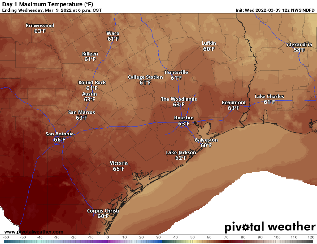
As we’ve been saying for awhile, today will be splendid for outdoor activities. Winds should be fairly light, out of the south, and highs will warm into the low 70s for most areas with mostly sunny skies. As moisture levels come up some this afternoon and evening, we’ll start to see the development of some clouds overnight, and this should help to ensure overnight lows do not drop below 50 degrees for most of our region.

If you’re making the trek out to the Houston Rodeo this evening to see Journey, your migration there should be a smooth sojourn. Temperatures this evening should be in the low 60s, with light winds. Post-show temperatures will be in the mid- to upper-50s, so pretty mild weather for this time of year. Some light showers may develop overnight, but I don’t think they’ll do so until well after the rodeo closes.
Friday
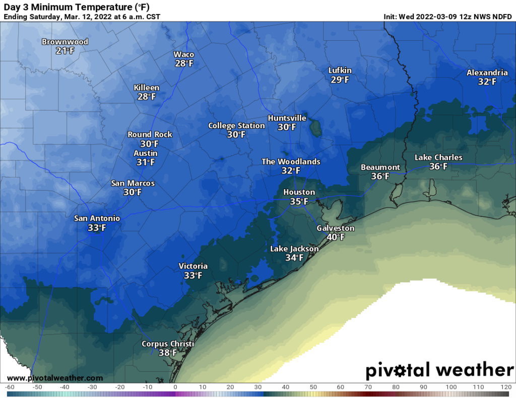
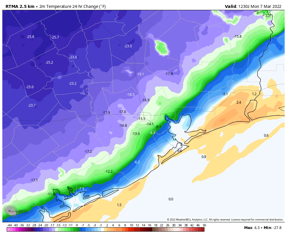
Some light showers will be possible on Friday morning, as moisture surges inland ahead of the cold front. Skies, otherwise, will be mostly cloudy with temperatures likely pushing into the upper 60s. The aforementioned front is on track to push into northwest areas of the region during late hours of the morning, and probably will reach the central part of Houston during the afternoon, and the coast around sunset, give or take a few hours. The front will bring sharply colder air, and winds will blow out of the north at 20 to 25 mph, with higher gusts. As skies clear out, expect temperatures to plunge into the 30s on Friday night, with parts of the metro area seeing a freeze. Just how much of Houston sees a freeze depends on several factors, so it’s impossible to pinpoint a freeze line just yet (see forecast map for the best guess).
Saturday and Sunday
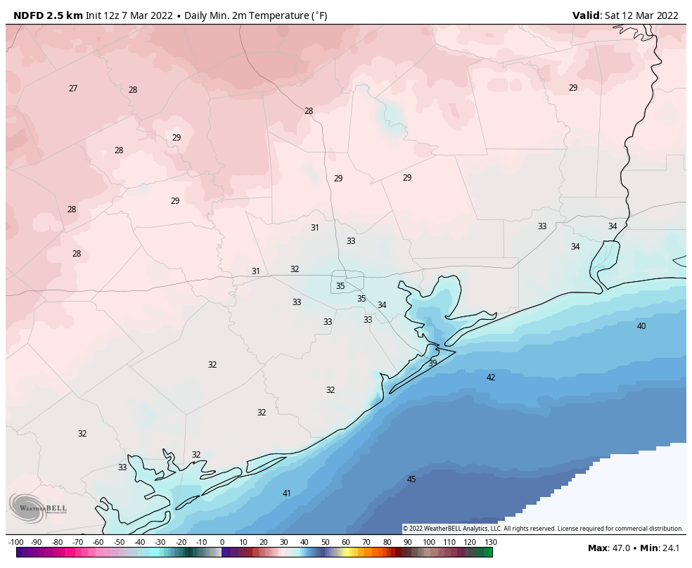
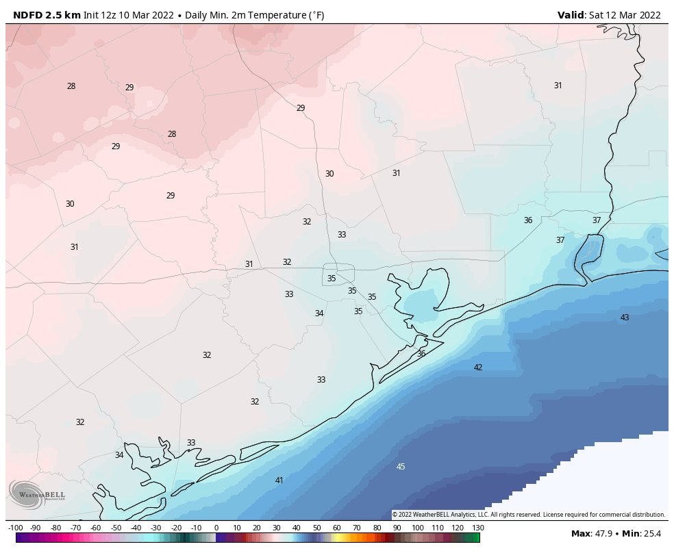
Winds will still be blowing out of the north on Saturday morning, but they won’t be quite as strong as Friday night. Despite sunny skies, highs will only get into the 50s, with another chilly night in store, as lows drop into the 30s. Sunday should be mostly sunny, with highs in the 60s.
Next week
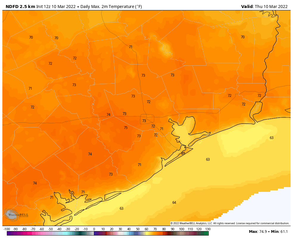
Monday will warm up quite a bit, with highs in the mid-70s, in response to a southerly flow. This will help to increase cloud cover. However, a weak front should arrive Monday night, or thereabouts, and this will help bring mostly sunny skies and somewhat drier air back into the region. As a result, most of the rest of the week probably will see highs in the 70s, lows in the 50s, and a fair amount of sunshine. Enjoy!