Eye on the Tropics: It’s beginning to look a bit like August

The tropics are beginning to resemble what is more normal for this time of year, but the good news at least for us is that there’s nothing of immediate concern on our radar. We will start to pick up the cadence a bit, however.

Tropical outlook in a sentence

While no activity is anticipated to directly impact Texas, there are several disturbances we will be watching over the next week or so.

Invest 97L

The first item up for discussion is Invest 97L, way out in the deep Atlantic. Recall, invests are just a naming convention for disturbances that the National Weather Service believes merit further investigation. They cycle from 90 to 99 and then repeat. It allows us to see more data, input better data into our regular weather models, and see some initial runs of specialized tropical models on the disturbance.

In this case, Invest 97L is chugging along southwest of the Cabo Verde Islands.

A look at Invest 97L this morning is rather uninspiring. Nevertheless, some models do develop this as it comes west. (Weathernerds.org)

The satellite image above does not inspire much enthusiasm for this disturbance at this point. It has a minimal amount of thunderstorm activity (convection) around it, and it seems to be struggling a bit in a rather hostile Atlantic environment. If the first batch of wind shear near it does not completely shred it, the second batch just east of the islands probably will.

Wind shear is quite expansive and impressive between the Caribbean and the open Atlantic, which will make life difficult for any developing systems as they come west until it dissipates. (University of Wisconsin)

With this sort of wind shear around right now, it would seem that anything coming west is going to struggle. Weather models are split on how this looks over the next week or two, with the GFS knocking back the shear some, and the European model keeping the party going. But as long as this shear is in place, it’s good news for us with respect to anything coming off Africa.

The starting lineup

Speaking of, the “wave train” predicted to emerge off Africa is rather congested right now. We have two in line to emerge over the next week or so, and there’s a third in eastern Africa that should emerge sometime next week.

There are several disturbances waiting in the wings to emerge off Africa over the next 10 days or so. While none appears to be a significantly viable development candidate, it’s August, which means we’ll be watching. (NOAA)

While these disturbances are lined up and ready to play in the Atlantic, again, the wind shear story is one that will have to change for any of them to have a chance. It’s also somewhat notable that there’s a pretty healthy gap between the first two disturbances and the third one. Quiet in late August would be rare. All in all, you probably couldn’t paint a better picture right now in the Atlantic; some activity to watch but nothing imminent.

Gulf update

Seasons like this can lull you to sleep, but I want to just close today with a look at the Gulf. Because of the situation in the Atlantic, the most risk in Texas for the rest of August may come from something much closer to home in the Gulf. Do we see anything worth watching? The short answer is no.

The longer answer is that we have a couple fronts trying to nudge their way to the coast over the next week or two that we should probably keep a side eye on. But at this point in time, there’s nothing signaling anything of legitimate concern.

Houston to enter a somewhat wetter pattern over the next few days

Our summer-long battle with high pressure has mostly been futile, but over the next several days the good guys should win. We’ll see an influx of moisture from the Gulf of Mexico, which should in turn drive up rain chances and bring down temperatures slightly. I don’t think we’re looking at any type of flooding conditions, but much of the region should pick up one-half to one inch of rain through Sunday, and after today high temperatures should be more reasonable, in the lower 90s for much of the area, for a little while.

Tuesday

Highs today should reach the mid- to upper-90s for inland areas, as mostly sunny skies prevail. However, as the sea breeze kicks up we’ll see some isolated to scattered thunderstorms move inland from the coast, and for some locations that will bring the mercury down this afternoon. Rain chances are probably about 20 or 30 percent. Winds will generally be light today, out of the south or southeast at around 5 mph, except where storms develop.

Wednesday

Conditions will be slightly cooler, with slightly higher rain chances on Wednesday as Houston’s weather starts to become more influenced by the Gulf. Look for highs in the mid-90s, with rain chances in the 30 to 50 percent range. Nighttime temperatures will remain sticky, only briefly dropping below 80 degrees for most locations.

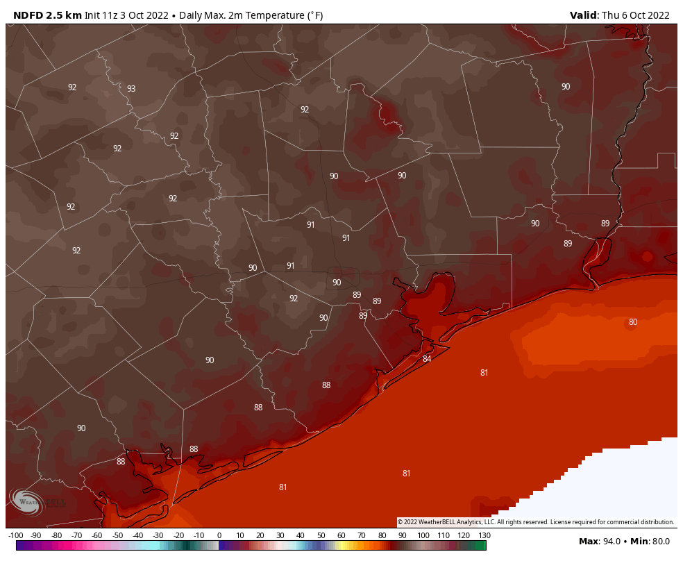
High temperatures on Thursday should be a couple of degrees cooler than normal for many locations. (Weather Bell)

Thursday and Friday

A couple of atmospheric disturbances will combine with Gulf moisture to raise rain chances to around 70 percent for both of these days. While chances will be moderately higher closer to the coast, and east of Interstate 45, much of the region should see intermittent light to moderate rain showers. Both days should bring partly cloudy skies, and in addition to this, rain-cooled air may hold highs in the upper 80s to 90 degrees. Rain showers will be most likely during the afternoon hours on both days.

Saturday and Sunday

Rain showers will be more hit or miss this weekend, with slightly better coverage on Saturday than Sunday. I’d expect these to be mostly sunny days, with highs generally in the low 90s for Houston, and likely a bit warmer further inland in places like College Station.

NOAA rain accumulation forecast for now through Saturday. (Weather Bell)

Next week

It appears as though high pressure will start to reassert itself next week, with high temperatures likely to push back up into the mid- to upper-90s for much of the Houston area, to go along with diminished rain chances. I don’t think we’re looking at a ridge-of-doom type scenario, but it’s the middle of August so generally that means rather hot weather around these parts.

Houston has passed the historical “peak” of summer heating

Good morning. Based upon the last three decades of weather, the historically warmest time of year for Houston runs from July 29 through August 12. During this approximately two-week period, the city of Houston averages a high temperature of 96 degrees, and a low of 76, at Bush Intercontinental Airport. And if we drill down further, the climatological peak of summer during the last 30 years has come on August 6, which was Saturday.

Although we cannot say anything definitive about the rest of summer in Houston, we continue to see indications that conditions will not be excessively hot like we saw in June and July. Nevertheless, summer is still summer in Houston, and during the next four to eight weeks, as we await fall’s first front, you can expect plenty of heat and humidity. We’re also at our greatest risk of hurricanes, historically. So, fun.

Monday

After wetter conditions for some areas on Friday and Saturday, high pressure has begun to assert control over the region again. Accordingly, we’ll see highs near 100 degrees across much of the city today to go along with partly to mostly sunny skies. The sea breeze will produce a 20 to 30 percent chance of showers this afternoon, or during the early evening hours. Winds will generally be light, out of the south to southeast at 5 to 10 mph. Lows tonight should fall briefly below 80 degrees.

This high temperature forecast for this week? Not terrible for the climatologically hottest part of the year. (Weather Bell)

Tuesday

This day will be a lot like Monday.

Wednesday

The upper Texas coast should start to feel the influence of moisture from the Gulf of Mexico by midweek, with an increase in cloud cover and rain chances bumping up to about 40 or 50 percent. Look for highs in the mid-90s.

Thursday and Friday

These look to be cloudy and cooler days, with highs perhaps peaking at 90 degrees, or in the low 90s. We’ll see healthy rain chances in the 50 to 70 percent chance each day, with most areas likely picking up between 0.25 and 0.75 inch, and higher isolated totals. As of now totals look higher for coastal counties, but I don’t think inland areas will be entirely shut out.

Saturday, Sunday, and beyond

More typical summertime weather should return this weekend, with highs in the mid-90s, partly cloudy skies, and perhaps a 30 percent chance of rain. At this point it appears probable that we’ll start to see the influence of high pressure, with highs in the mid- to upper-90s returning for much of the area during the early part of next week.

Tropical outlook for Monday morning. (National Hurricane Center)

Tropics

Expect to see some chatter about a tropical disturbance in the far eastern Atlantic over the next few days. But really, this is not something we need concern ourselves with because a) ultimately this system is going to struggle with wind shear over the central Atlantic Ocean, and b) the steering currents are likely to pull it north before the system approaches any landmasses. Overall, the tropics remain is a pretty quiet posture as we head toward mid-August. Matt will have more in his weekly tropics update on Tuesday.

Cooler weather and decent rain chances return to Houston, but will it deliver?

We officially topped off at 101° yesterday for the third straight day, but we think the next few days will feature more tolerable temperatures, as rain chances inch upward. And it’s needed, as drought has expanded across the Houston area with 12 percent of the area in exceptional drought (level 4/4).

Over 65 percent of the Houston region is in extreme or exceptional drought as of this week. (NOAA)

This was underscored by the deadly grass fire in the Cypress area yesterday. Grass fires can happen in the Houston area, so please use caution, even if you get a good bit of rain in the coming days.

Today

With a disturbance in the middle levels of the atmosphere moving toward Matagorda Bay, we are already seeing numerous showers and storms develop — over the Gulf.

Rainfall is almost entirely offshore this morning, but we should see trends bringing some of this onshore throughout the day. (RadarScope)

As the day goes on, we’ll see rainfall expand onshore. I still don’t think everyone will see rain today, but most places near the coast should see showers, with more scattered coverage as you go inland from there. Storms should move slowly but steadily today, so areas with the most persistent rains could see an inch or two, while some neighborhoods will only hear distant thunder. But coverage will be greater than it has been in recent days.

With clouds and showers nearby, look for highs ranging from the upper 80s at the coast to low 90s in Houston to middle or upper 90s to the north and west.

Weekend

We’re going to maintain pretty healthy rain chances into Saturday. Again, not everyone will see rain tomorrow, but there should be coverage along the lines of what we see today; initially at the coast in the morning, spreading inland as the day progresses. Rain totals will range from nothing to an inch or two in the most persistent or slowest moving storms. Morning lows in the 70s will give way to daytime highs similar to today, with upper-80s to low-90s for Houston south and east, building to the upper-90s to near 100 or so from Columbus to College Station to Madisonville.

Sunday looks to see very similar weather, with hit and miss storms and temperatures about where they will be on Saturday.

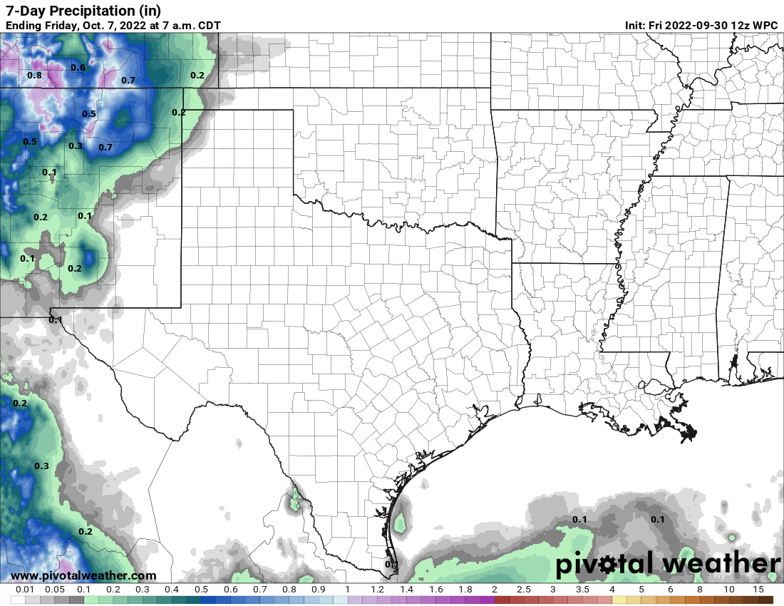
While some places will see more rain and others less rain than shown here, this NWS outlook gives you an idea of how rainfall should be distributed today through Sunday, highest at the coast, least inland. (Pivotal Weather)

Overall, rain totals should average a quarter to half-inch or so across the area, with some neighborhoods seeing several inches of rain and others seeing next to nothing. Yes, someone will end up disappointed from this period of higher rain chances, but it’s our best opportunity in some time.

Early next week

Rain chances should ebb heading into Monday and Tuesday, or at least be more co-located with the daily sea breeze off the Gulf. So coverage should diminish but not disappear completely. Temperatures will respond, back up to the low-90s along the Gulf, mid-90s in Houston, and near 100 well inland.

Later next week

The back half of next week is sort of in flux right now. One model (the Euro) is trying to bring a front into our area, which would enhance shower and storm coverage, though it would be unlikely to bring heat relief. The GFS keeps that away, but it does have higher rain chances later next week. Bottom line? We need a couple days to sort out late next week. But expect some rain chances and hot (but not extremely hot) weather.

Tropics

All remains quiet into early next week.