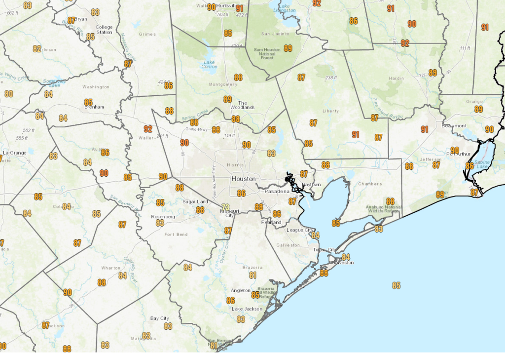
There was nothing inherently special about yesterday. We had some sun, some clouds, some haze from passing wildfire smoke. But we only managed to hit 89° officially at Bush Airport with dew point temperatures in the 60s for the majority of the day.
For August, that is almost as good as it gets around here. We are going to see changes this weekend, and a return to more typical summer weather should be expected over the next few days.
Friday
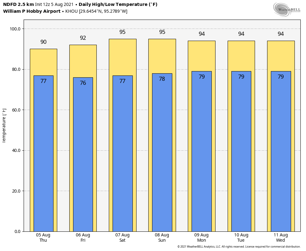
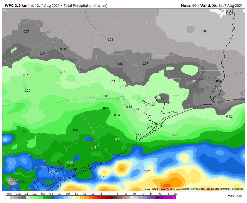
Today looks like a bit of a transition day. We bring back some humidity. We bring back some temperatures. And we bring back at least a smattering of hit or miss showers, downpours, or thunderstorms. Not everyone will get wet today, but about 30 to 40 percent of the region should see at least something. The highest odds for showers should be south and west of Houston initially, but some areas north and east may see some showers by afternoon. Highs will top off in the low-90s.
Weekend
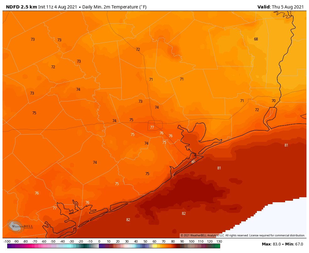
We’ve had a lot of high clouds and passing moisture overhead this week that’s blocked out the sun at times. We should lose that for the weekend. Expect a return to mainly sunshine, high humidity, and highs in the low to mid-90s and lows in the 70s to near 80 degrees. It will feel like 105° or a bit hotter at times this weekend when you factor in the humidity.
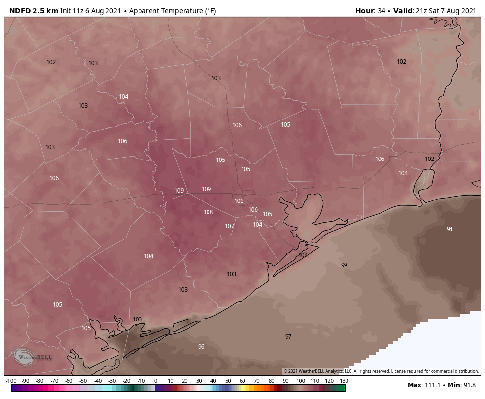
Showers will again be possible both days, but coverage should slack off some, maybe peaking at 20 to 30 percent chances. In other words, if you see some rain, consider yourself lucky. There should be a slight breeze each afternoon but nothing too special.
Next week
There’s nothing particularly interesting about the weather next week as it stands right now. That’s good news in August and September, right? Expect daily chances of thunderstorms to perhaps increase a little each afternoon. But some areas will get drenched while others just hear the distant booms of atmospheric acoustics. Otherwise, expect sun and clouds with highs in the low to mid-90s each day and lows in the 70s, fairly typical for August.
Tropics
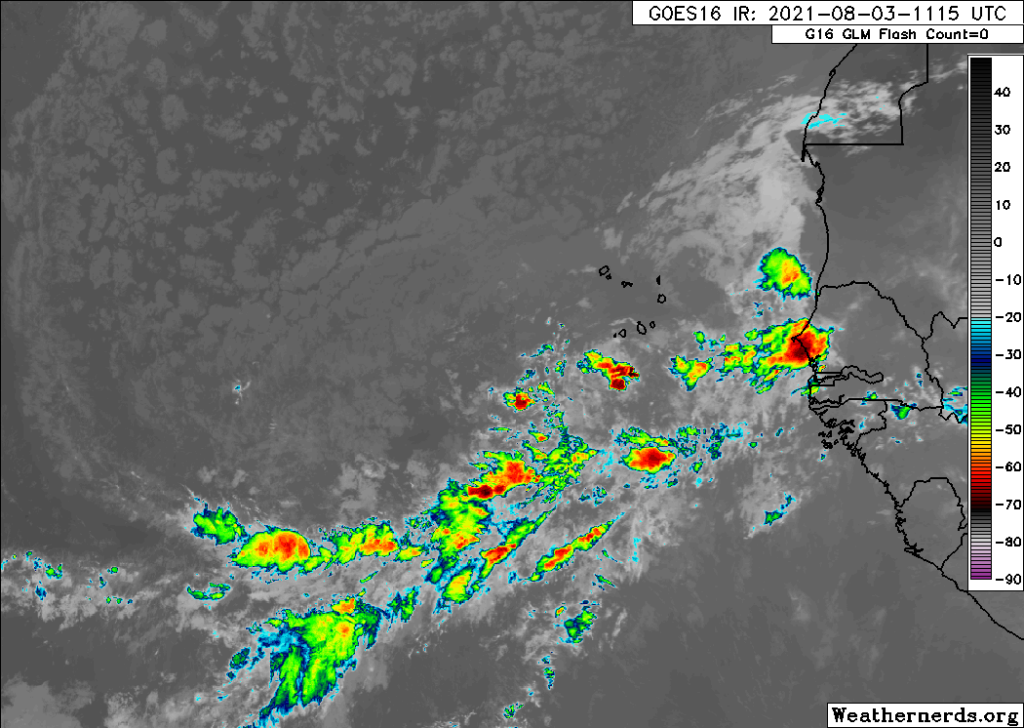
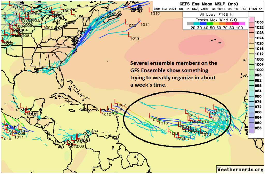
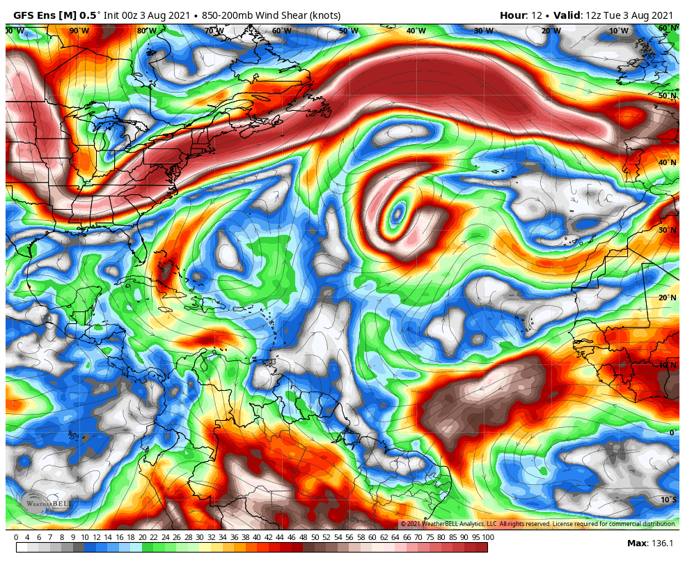
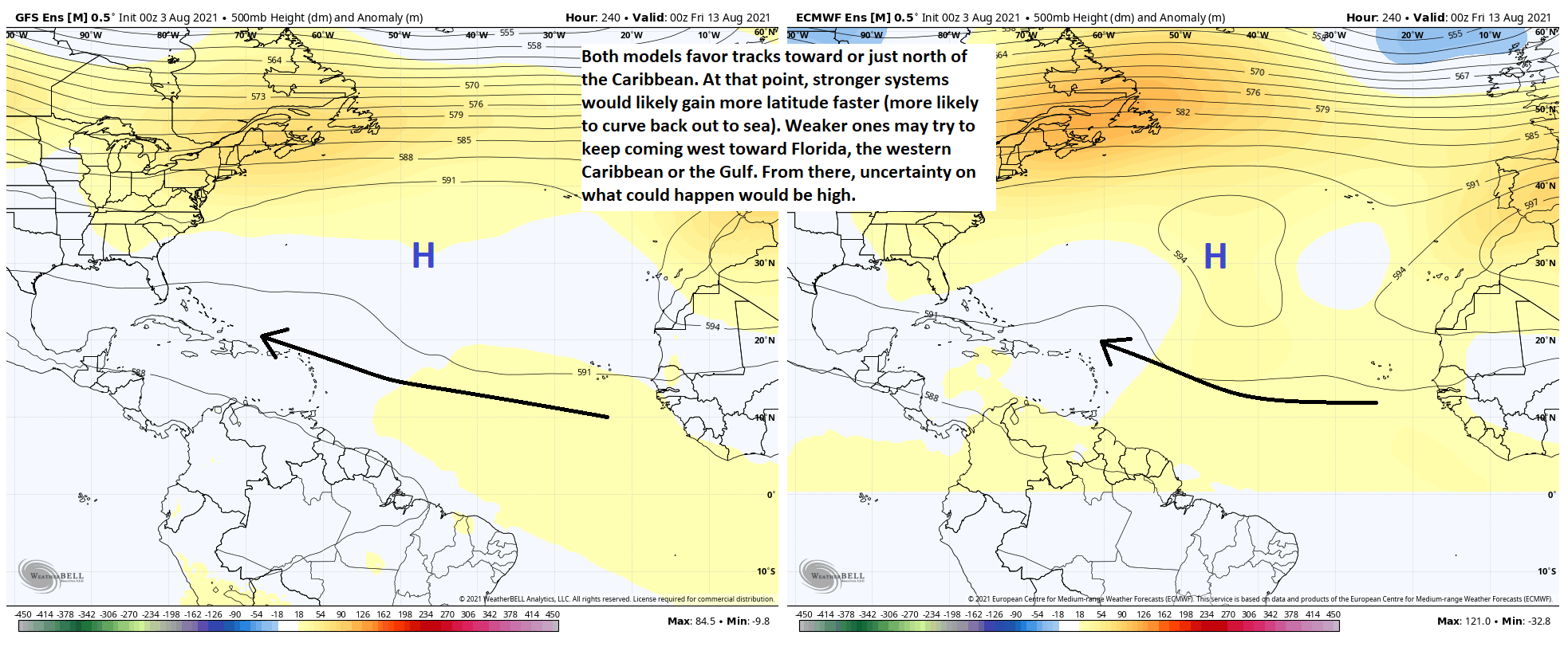
It’s tough to make much out of what’s happening in the Atlantic right now. There are a number of possible options for development over the next 5 to 7 days, and maybe one area that’s more clear cut than others (which is assigned a 60 percent chance to develop this morning according to the NHC). We’ll have an update on this Monday and Tuesday. But as of right now, there’s not any model or group of models that’s especially bullish on any one outcome, let alone one that brings it to the Gulf. So we have some time to watch.
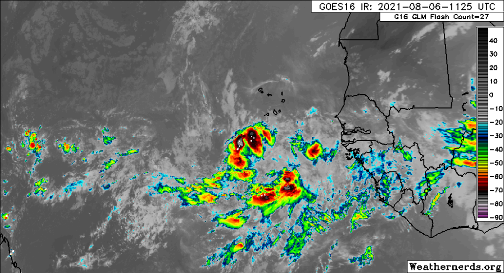
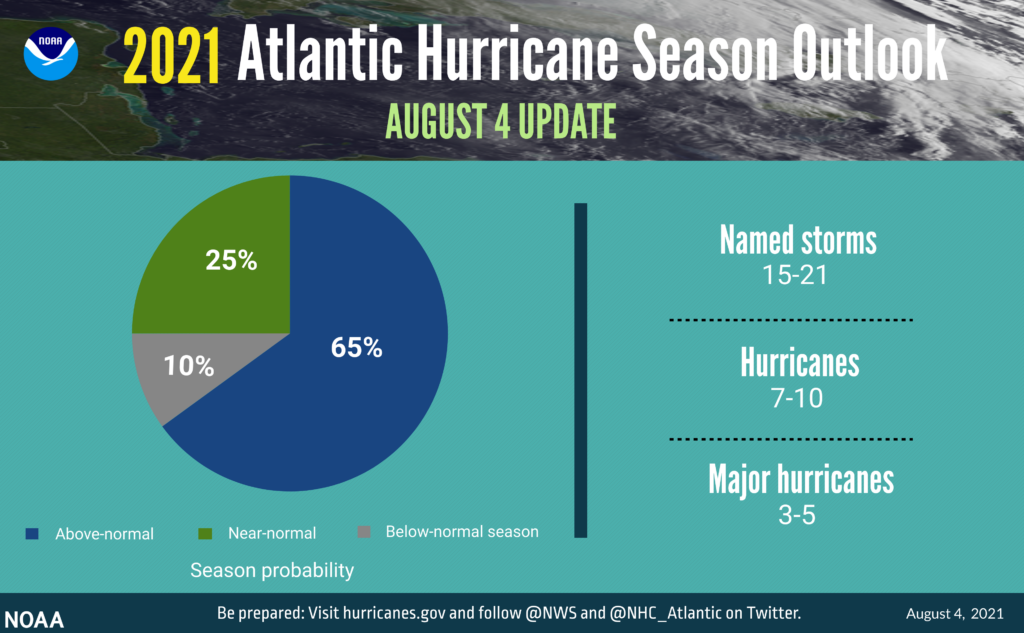
Following up on Eric’s post yesterday about NOAA’s seasonal forecast update, Colorado State followed suit on Thursday. They actually reduced their forecast a smidge, though they’re still calling for a season that ends up fairly active in the end. They also released a “subseasonal” outlook, which looks out at the next 2 weeks or so, and it unsurprisingly is calling for a period of above average activity in the Atlantic, something we’ve talked about for a little while now. So we’ll see. The setup in the Atlantic reminds me a bit of what we sometimes see in the western Caribbean or over Central America with what we call a “gyre.” You get a lot of storminess, models hinting at development, but little agreement on which portion of the broader mess becomes dominant. The good news is that it all continues to look mostly sloppy and disorganized for at least several more days.