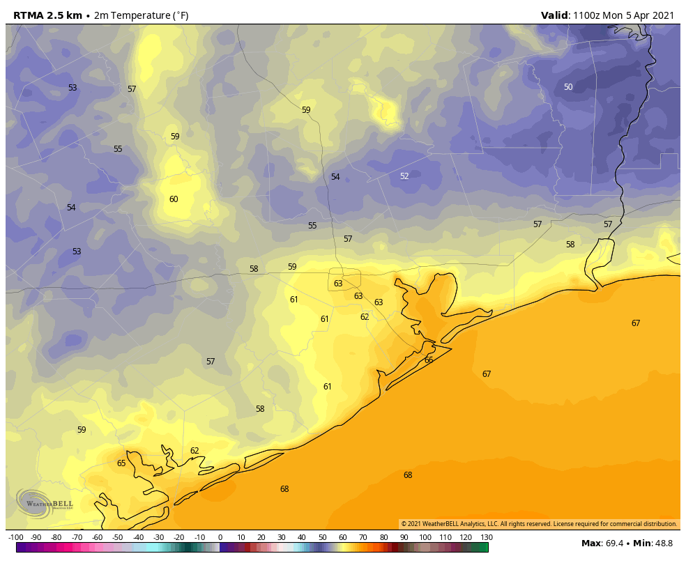
Good morning. After what turned out to be a rather pleasant Easter Sunday, Houston will now begin a warming trend that will culminate with temperatures at least in the upper 80s toward the end of this week. We have unresolved questions about when the next cold front will push all of the way through Houston, and when the region might see a meaningful amount of rainfall—something we need after a dry late winter and early spring have led to an emerging drought.
Monday
Winds are very light out of the southeast this morning, and will only slowly pick up to around 5 to 10 mph later today. After a cool start for some, temperatures will rise into the upper 70s, with partly sunny skies. Like on Sunday, a slightly disturbed atmosphere will do battle with a drier upper atmosphere, with the result likely producing some very scattered, light showers later this afternoon. Low temperatures tonight will again drop into the low- to mid-60s.
Tuesday
This will be another day a lot like Monday, albeit with daytime highs a few degrees warmer, and overnight lows in the upper 60s to low 70s. We’ll again see a chance of light, scattered showers to go along with our partly sunny skies.
Wednesday
More clouds will build overhead on Wednesday, and a cold front will approach the region. However, it’s likely to stall around the College Station area, rather than pushing into Houston, or all the way down to the coast. As a result, we’ll likely see highs in the low- to mid-80s, with a slight chance of showers and thunderstorms in the city and surrounding areas. Lows will be sticky, in the upper 60s.
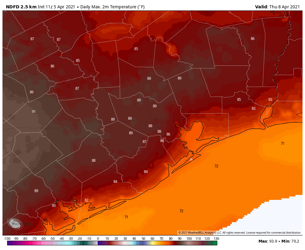
Thursday and Friday
Houston’s warm pattern will intensify toward the end of the week, with highs likely ranging from 85 to 90 degrees for most areas to go along with partly to mostly sunny skies. Nights will be quite warm, not dropping below the 70s for much of the region.
Saturday and Sunday
The weekend forecast is a bit of a mess. The most likely scenario is that a weak cold front pushes into Houston on Friday night, bringing with it a decent chance of rain (a few tenths of an inch for most). This would knock back temperatures into the mid-80s, with a smidge of drier air and sunny skies, for the weekend. But it’s nearly as likely that the front won’t make it, and we’ll stay in a more humid, warmer pattern without much of any rain. Feel free to flip a coin on this one.