In brief: Houston’s flood risk has ended, but we’re tracking a flash flood emergency in Central Texas, near Kerrville, that is unfolding just a year after catastrophic flooding in similar areas. Locally, clouds will give way to sunshine in the coming days, bringing Houston some of its hottest weather of the year.
Guadalupe River flooding
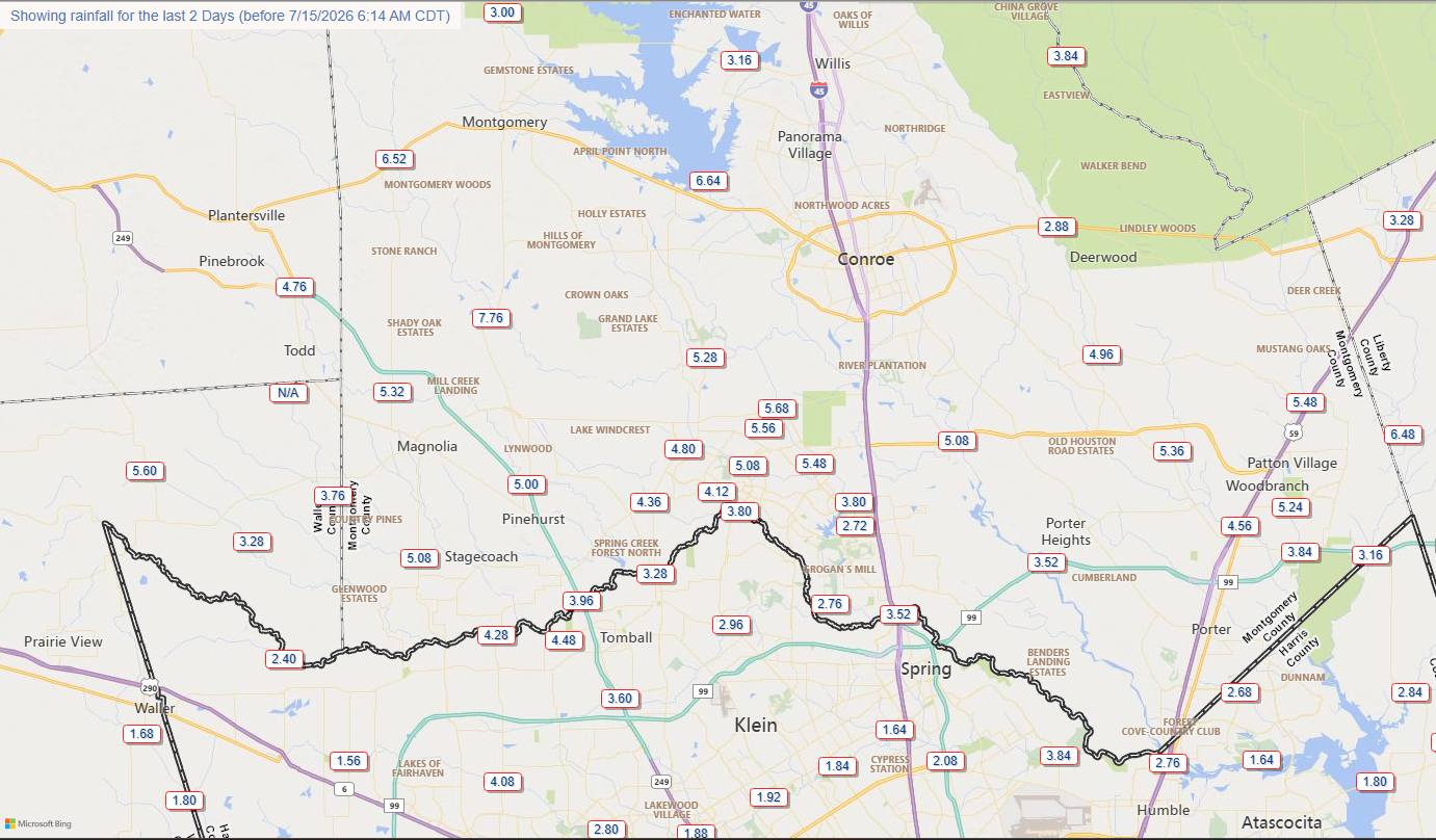
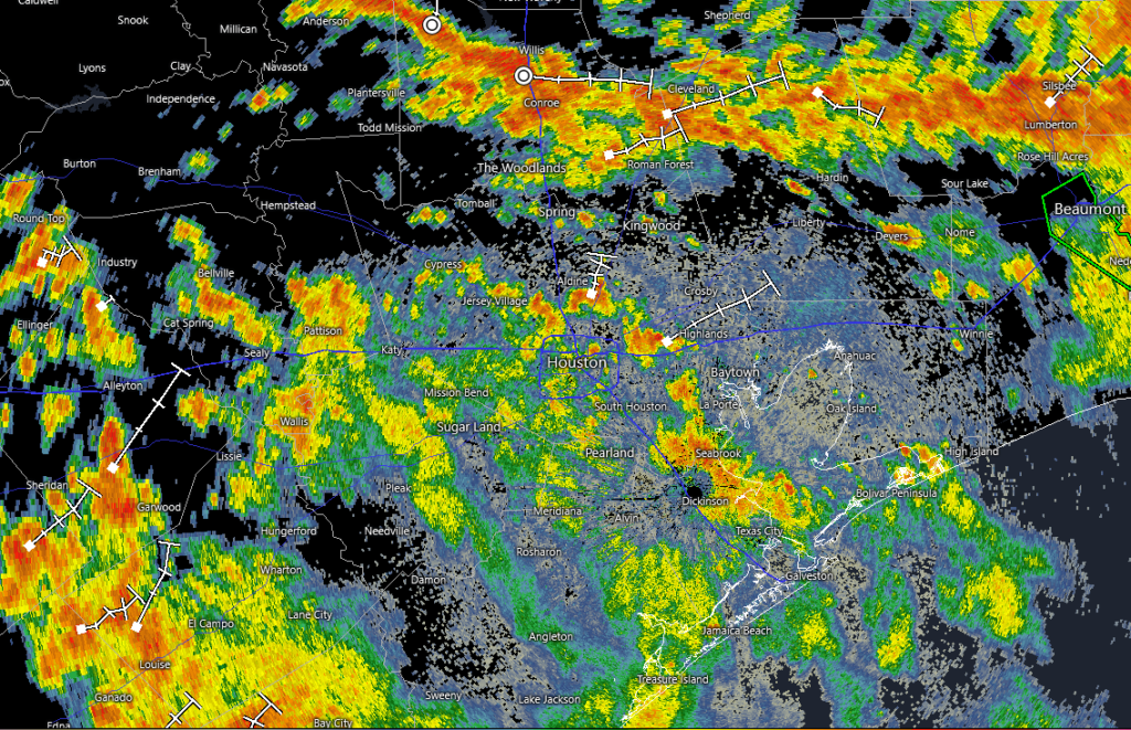
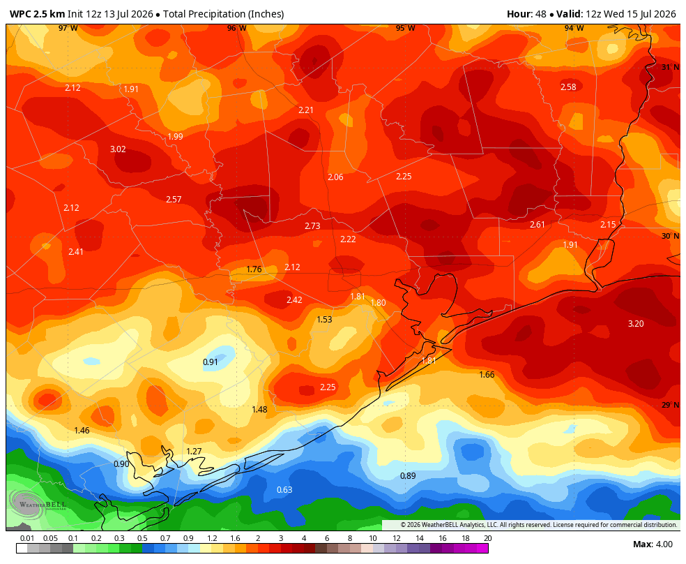
Things have quieted down in Houston over the last 24 hours, and although we are likely to see some scattered showers over the next couple of days, the region’s flood risk has ended. The story is not the same in Central Texas, where a significant flooding event is unfolding.
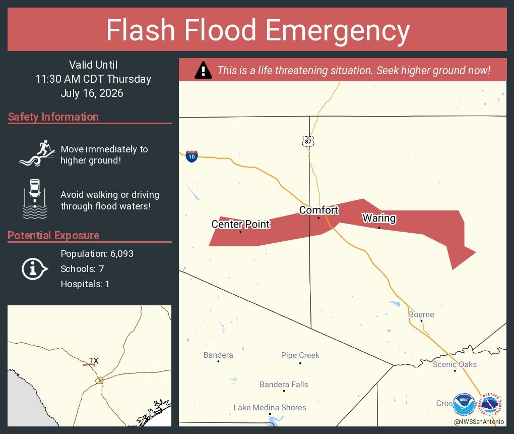
At 5:30 am CT this morning the National Weather Service office there issued a “flash flood emergency” for a stretch along the Guadalupe River, to the north of San Antonio. The emergency area runs from the town of Center Point through Bergheim. A gauge at Center Point has risen 32 feet during just the last four hours. According to forecasters, the river is expected to reach a crest similar to the July 4, 2025 catastrophic river flood in that region. Additionally, for Uvalde County, catastrophic flooding is likely along the Frio, Leona, Sabinal, and Nueces rivers.
A flash flood emergency is the weather service’s highest level of flood alert, and they are rarely issued. Such alerts are triggered by rapidly rising water that poses an imminent threat to people.
Thursday
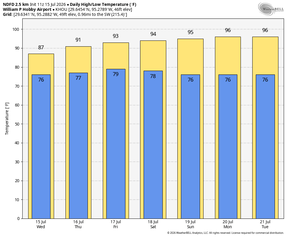
Closer to Houston this morning we are seeing some additional showers to our southwest, near Victoria and El Campo. Generally, I don’t expect these to move into the Houston region, and for the metro area we should only see isolated to scattered showers and thunderstorms today. Your overall chance of seeing rain is probably about 20 percent. Our skies will likely remain partly to mostly cloudy, however, and this should help limit high temperatures in the lower 90s. Winds will be light, from the southeast. Low temperatures tonight will only briefly drop into the upper 70s.
Friday
We’ll have another slight chance of showers and thunderstorms on Friday, but the trend will be toward clearing skies. Accordingly I expect high temperatures to reach the low- to mid-90s across Houston. Low though it may be, this is probably our final chance for rain for a week.
Saturday and Sunday
Summer proper returns to Houston this weekend, with mostly sunny skies and highs in the mid- to upper-90s. Need I say more? Prepare yourselves accordingly.
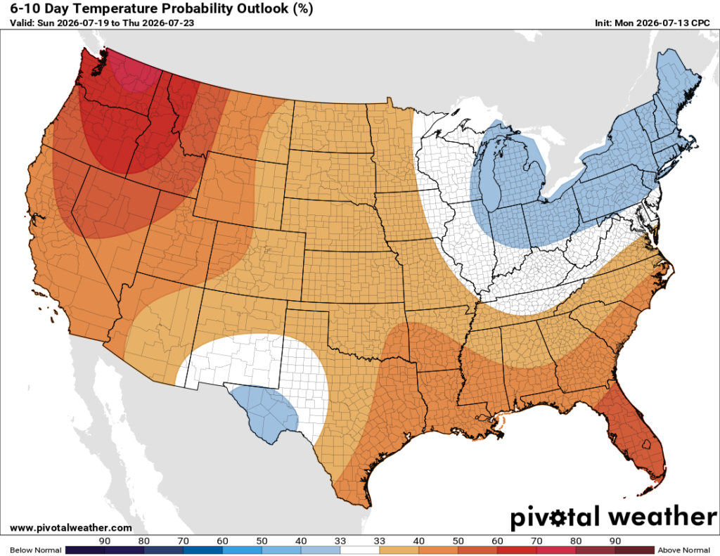
Next week
We are going to see our hottest weather of the year, to date, next week. Highs for several days will push into the upper 90s, and some inland areas may touch 100 degrees for the first time. I expect mostly sunny skies. If there’s a silver lining it’s that dewpoints will not be quite as high as they can get during the summertime in Houston, so our nighttime temperatures may cool into the mid-70s rather than just falling to 80 degrees. It’s not much, I know. Rain chances remain near zero until at least Thursday or Friday of next week.