In brief: In today’s post we discuss the end of a very cold period of weather in Houston, which will now turn warmer into mid-February. I’m continuing to get excited about conditions for this weekend, which look to be exceptional.
End of very cold weather
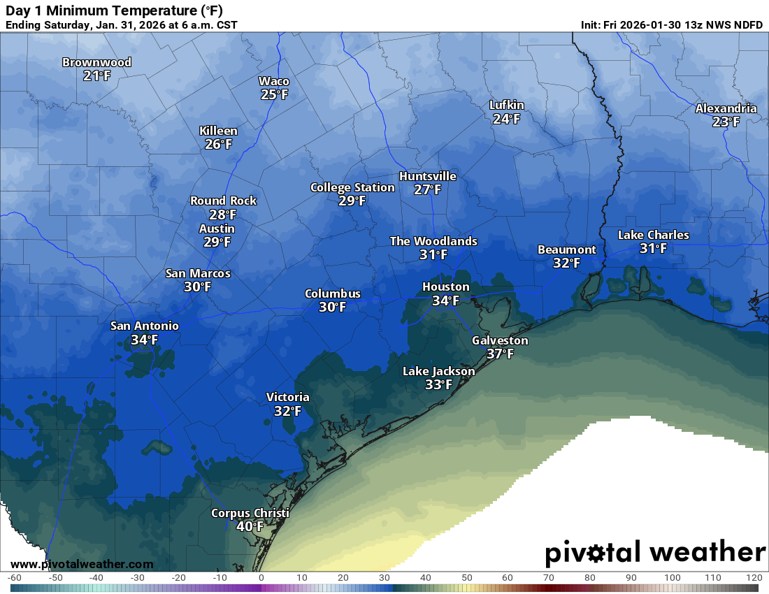
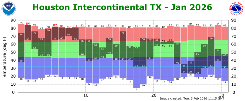
Over the last 10 days Houston has experienced sharply cold weather, with seven freezing nights and four nights with low temperatures in the 20s. This undoubtedly will be the coldest spell of the 2025-2026 winter season, and it is also equally clear that we are headed for much milder conditions into at least mid-February. A number of readers will want to know whether the region has recorded its final freeze of the winter, and it’s a valid question. The answer is maybe—but we simply cannot say anything definitive about this in early February. Let’s get to the end of this month and see where we are.
Tuesday
Temperatures have only fallen to about 60 degrees this morning, and the overall airmass is fairly humid. High temperatures today will reach about 70 degrees under mostly cloudy skies. We are going to see breezy southerly winds, with some gusty conditions this afternoon. We will also see some light, scattered showers throughout the day. A more organized (but likely broken) line of showers and thunderstorms may form north of Houston around sunset, and drop down through the city this evening. This will herald the arrival of a front that will move through tonight. Any lingering rains will end before sunrise, with temperatures dropping into the upper 40s late tonight.
Wednesday
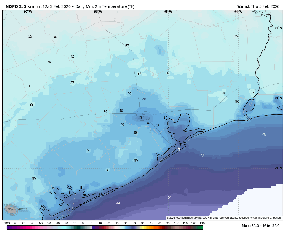
A sunny and cooler day, with highs generally in the low 60s and somewhat gusty northerly winds. Lows on Wednesday night will drop to around 40 degrees in Houston, with slightly cooler conditions for inland areas. I’m pretty confident that even typically colder areas like Conroe will remain a few degrees above freezing, however.
Thursday
This will be another sunny day with high temperatures in the low 60s, although winds will be lighter. Lows on Thursday night should drop into the mid-40s.
Friday, Saturday, and Sunday
This looks to be a gorgeous weekend, with highs ranging from about 70 degrees on Friday to the mid-70s on Sunday. Overnight lows will generally be in the 50s, with fairly dry air. Skies will be mostly sunny throughout the period, with the possibility of slightly more sky cover by later on Sunday. Regardless, it looks to be a splendid weekend for outdoor activities.
Next week
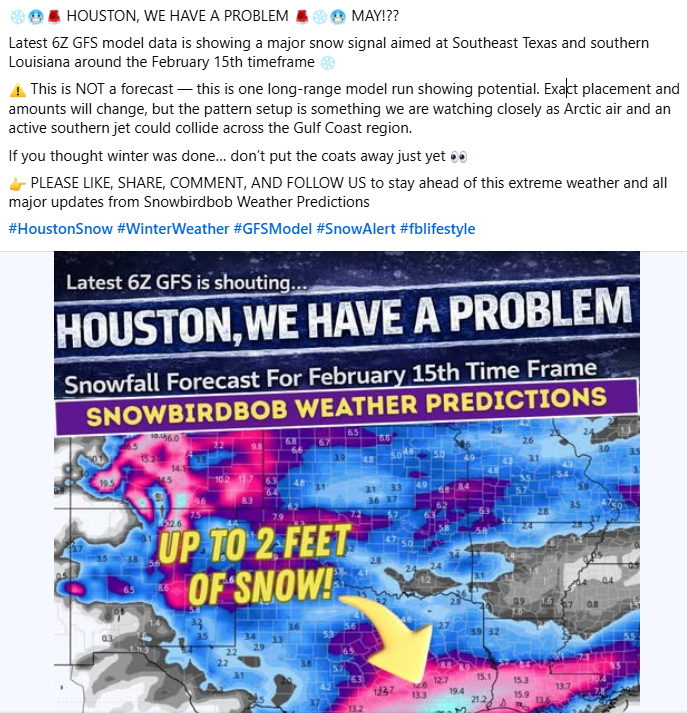
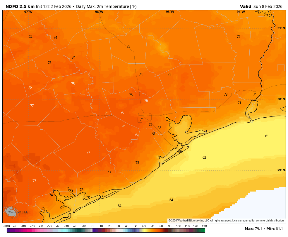
Most of next week looks warmer, with highs in the 70s and lows around 60 degrees. We’ll probably see a few more clouds and some scattered shower chances, but nothing crazy. Some sort of a front may try to push through ahead of next weekend, but at this point it doesn’t look particularly cold. If you’re wondering how conditions are looking for the “snow bomb” reported by some social mediarologists on or around February 14, here’s the temperature outlook for that period.
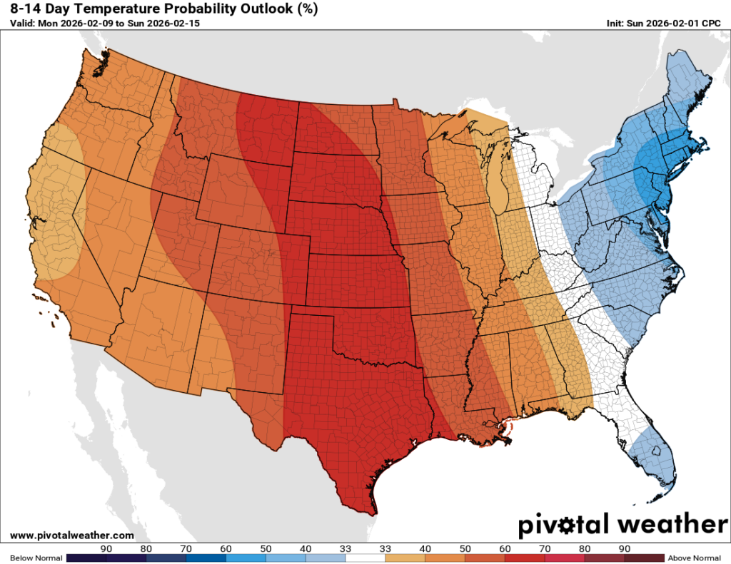
That’s right, we can expect above normal temperatures.