In brief: After our coldest weather in nearly a year this morning, the region will thaw out and warm up today with plenty of sunshine. We will then have a few milder days before another strong front arrives Thursday night. By Sunday morning we could see temperatures nearly as cold as this morning, although we have no wintry precipitation concerns with this round.
Cold status
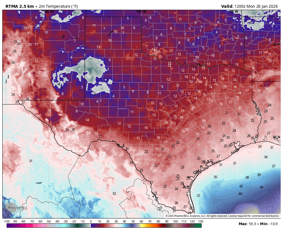
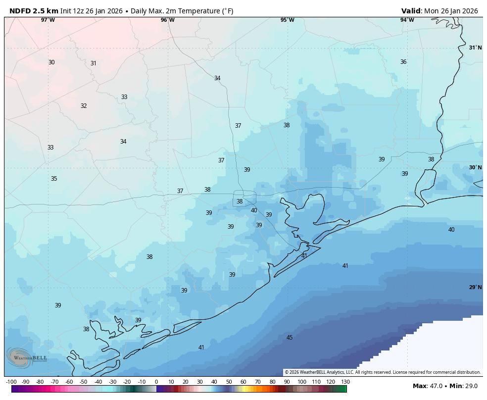
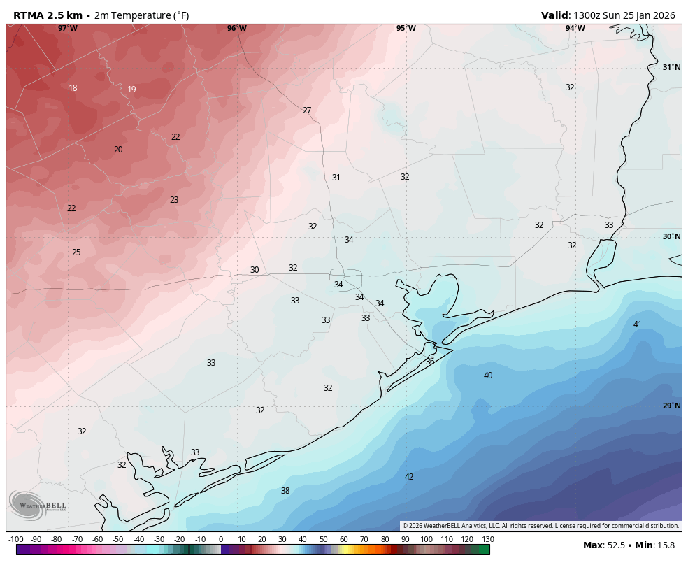
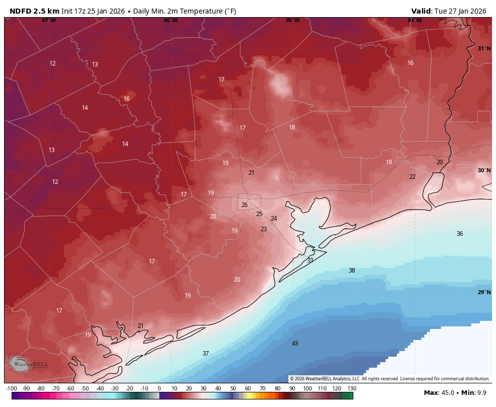
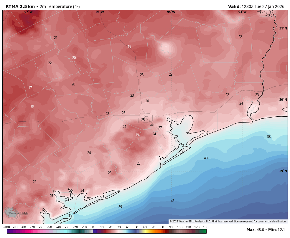
We are at the tail end of impacts from this past weekend’s Arctic front, but paradoxically we are also seeing the coldest temperatures of the event, ranging from 18 degrees in Conroe to the low- to mid-20s across much of the Houston region. We’ve waited this long for the coldest air because skies finally cleared last night, and winds died down to nearly zero. This created ideal conditions for cooling temperatures. However we also will see a fairly quick rebound in conditions today, with sunny skies leading to highs of around 50 degrees.
Tuesday
We are going to see calm winds all day, to go along with our sunny skies. Accordingly conditions will feel quite a bit warmer this afternoon. Lows tonight will drop to around freezing in the metro area, probably just at or above 32 degrees along and south of Interstate 10, and a degree or two below inland of the freeway. Regardless, after mid-morning today, the threat of a hard freeze will have passed for a few days.
Wednesday and Thursday
These will be warmer days. Wednesday should be mostly sunny, with highs in the upper 50s and light winds. Wednesday night will be cold, in the 30s, but likely above freezing. Thursday will see highs all the way in the low- to mid-60s, but with building cloud cover. However by Thursday evening or early Friday another strong front will surge into the area. You’ll notice this with gusty northerly winds. Fortunately this looks like a dry frontal passage, so we don’t have many concerns about a wintry mix. Even if there are a few passing showers, temperatures will be warm enough to preclude a freezing mix. Lows on Thursday night will drop to around 40 degrees.
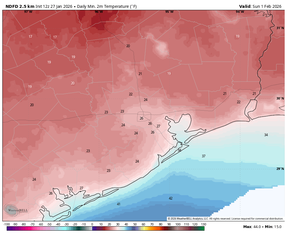
Friday, Saturday, and Sunday
The weekend looks mostly sunny and cold. Highs on Friday will probably reach about 50 degrees, but Saturday will be colder, perhaps only in the low 40s as cold air continues to advect into the area. Sunday may be slightly warmer. So what about nighttime temperatures? Friday and Saturday night look to be the coldest. There’s the potential for a hard freeze on Saturday night, when we once again see ideal cooling conditions. Right now I would predict lows between 25 and 30 degrees in urban Houston, with slightly cooler conditions for outlying areas. But we will see.
Next week
Monday should also be clear and chilly, but after this a warmer and wetter pattern will take hold. I expect highs in the 60s next week, with a healthy chance of rain showers from later on Tuesday through Thursday. Details are to be determined, but additional rain to help with the region’s drought would not be unwelcome.