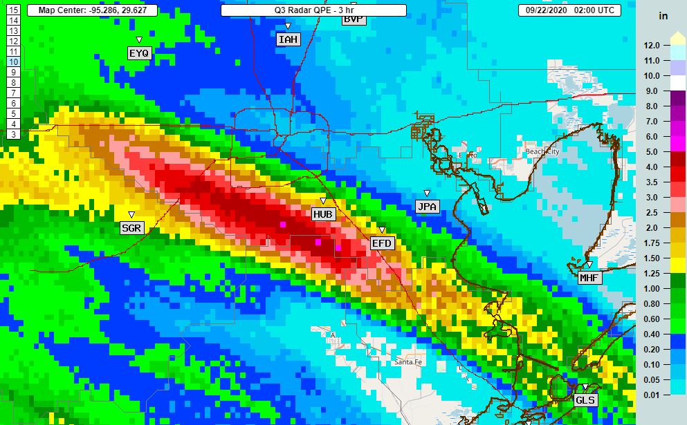
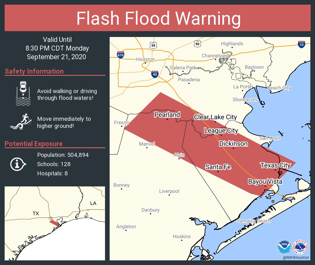
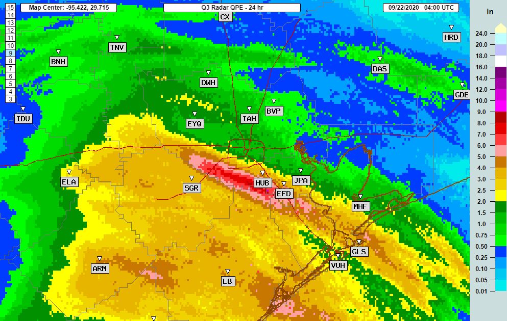
11:55 pm Monday: Congratulations, everyone. We survived Monday—although for the southern half of Houston it was a rainy mess. Rainfall estimates show that some areas near the border between Harris County and Fort Bend and Brazoria counties received 6 to 8 inches of rain during the preceding 24 hours, and it has brought some waterways to bankfull. It did not help that the heavy rains on Monday night came just as a high tide was pushing into Galveston Bay, making it more difficult for area bayous to drain. Otherwise, as expected, areas north of Interstate 10 generally received 2 inches of rain or less.
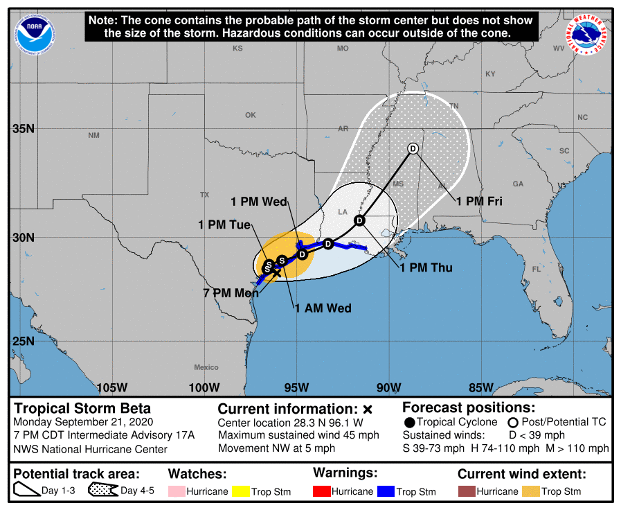
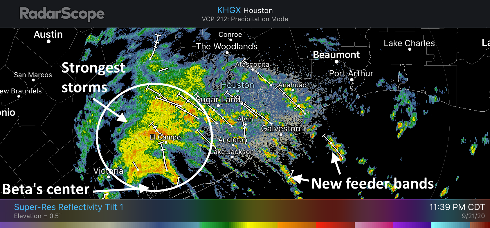
So far, even in the hardest hit areas, this has been a mostly street flooding event. But what happens next? We think the next 24 hours will produce plenty of precipitation as well. This is because although Tropical Storm Beta made landfall at 10 pm CT Monday on the southern end of Matagorda Bay, it’s center should now remain nearly stationary for the next 24 hours or so. This means the Houston region will lay within the storm’s northeast quadrant.
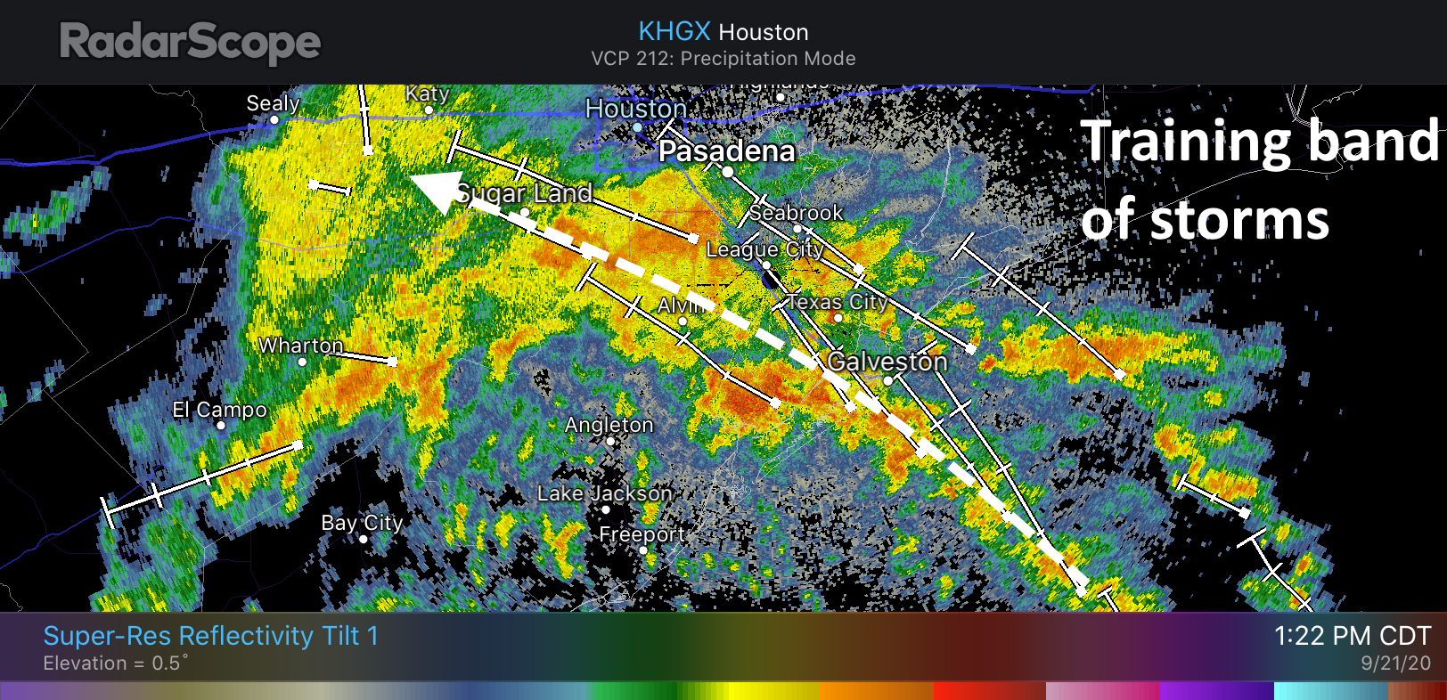
We’re most concerned about the areas that have already received 5 or more inches of rain during the preceding day (pink and reddish hues on the map above). As hoped, showers now moving into this area near midnight are lighter and a bit more scattered than earlier on Monday. The storm’s heaviest rains are now more tightly clustered near its center, further to the southwest of the Houston metro area.
Some of our mesoscale models suggest this clumping of heavier rains could gradually build northeast toward Sugar Land (in a few hours) and Houston and the Interstate 45 corridor by around sunrise on Tuesday. I don’t have great confidence in these models, but it seems as plausible scenario as any. We may also see more feeder bands develop offshore and move inland into metro region during the overnight hours. Additional rainfall amounts of 3 to 6 inches for parts of Houston cannot be ruled out through Tuesday morning.
Our next update will come no later than 7 am CT on Tuesday.