In brief: In today’s post we note Tuesday’s record high temperature, and the potential for more today. We also discuss the possibility of thunderstorms on Friday and Friday night as a front pushes into the area. Following this front winter should stick around for awhile.
Record high update
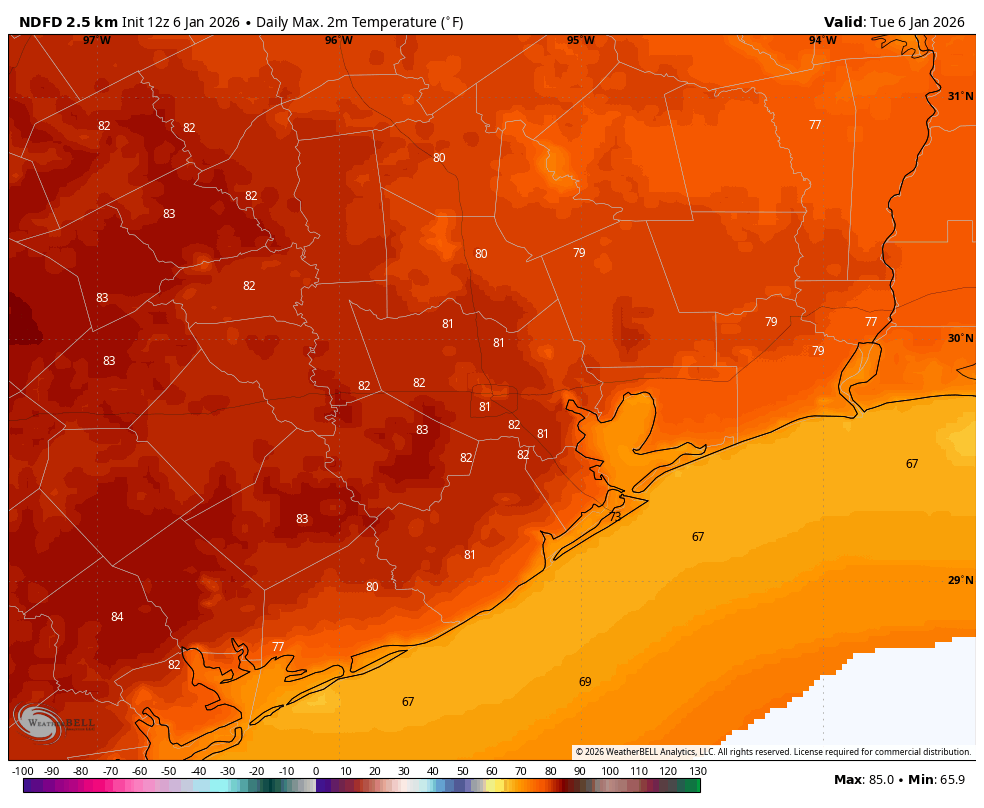
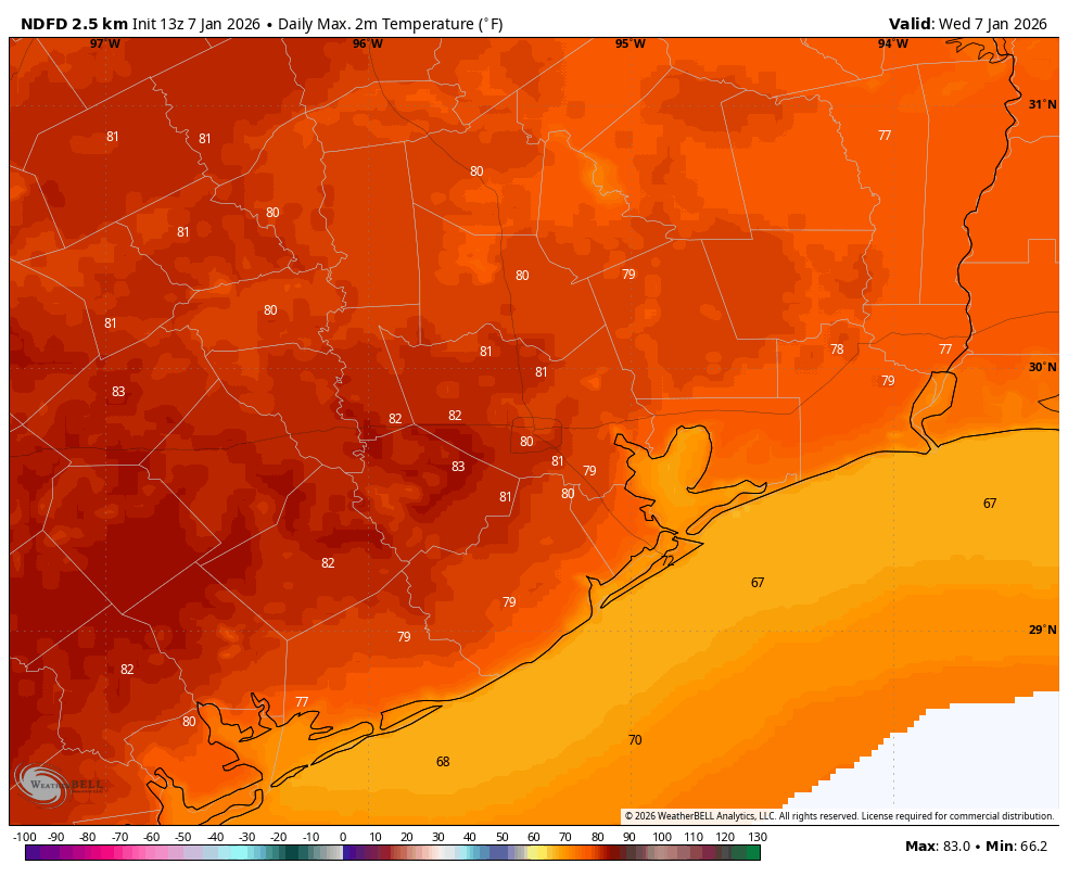
Houston has now set two record highs in 2026. On January 2, the high of 84 degrees broke the old record of 81 degrees, set in 1965 and 2000. And yesterday, January 6, the high of 82 degrees broke the previous mark of 80 degrees set in 1956 and 1989. Today will be close, with a forecast high about on par with the record of 81 degrees, set back in 2023.
Wednesday
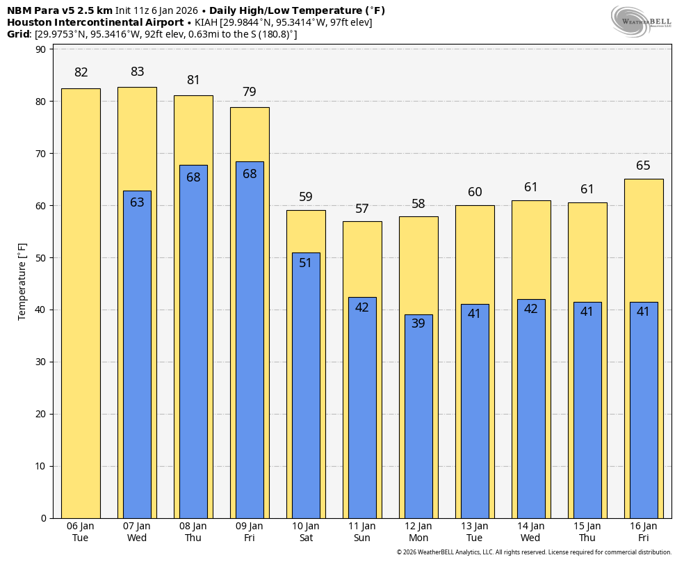
We are once again seeing fog this morning, as dewpoints and temperatures have both fallen into the mid-60s. These soupy conditions will be with us into Friday before a front pushes through. After the fog clears we should have mostly sunny skies later today with highs around 80 degrees. Winds will be light, generally from the southwest. Lows tonight will again only drop into the 60s, with mostly cloudy skies.
Thursday
This will be a cloudy and humid day, with highs ranging from the upper 70s to around 80 degrees for most locations. There will be a couple things of note. First of all winds will surge from the south in response to a nearby front, gusting up to 25 or perhaps even 30 mph. These winds will be highest on Thursday afternoon. We also will have a slight chance, perhaps 20 or 30 percent, of light rain during the afternoon and early evening hours. Thursday night will be warm and muggy again.
Friday and Friday night
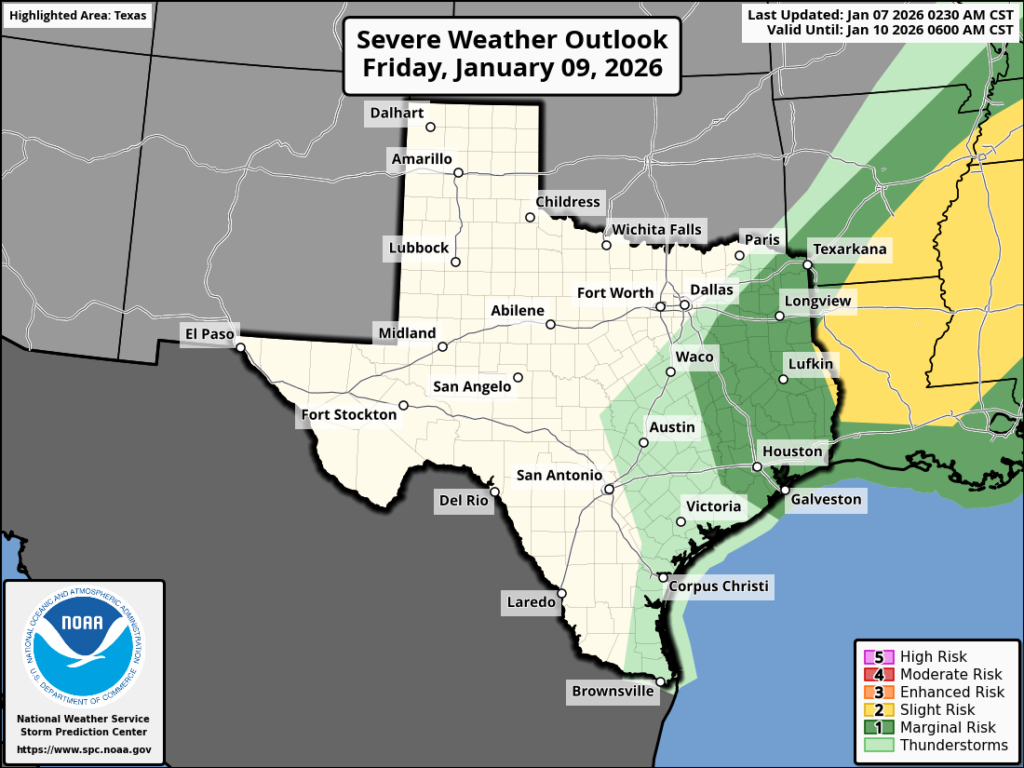
We can’t say precisely what will happen Friday night, but generally I expect a warm and humid day, similar to Thursday with mostly cloudy skies. However, rain chances will be higher on Friday than Thursday, with scattered mostly light to moderate showers. There is also a chance for severe weather, primarily in the form of thunderstorms. This is most likely to occur between late evening on Friday and sunrise on Saturday, as the front itself moves into the Houston region. This is when we could see some briefly heavier rainfall. Most of our modeling is all over the place, but some locations could pick up 0.5 to 1 inch of rain whereas other locations see hundredths of an inch. We all need some rain, so good luck everyone.
Saturday
This will be mostly cloudy and cooler day, with a few showers possibly lingering during the morning hours. Temperatures at midnight will likely be in the 60s for most locations, falling to the 50s at sunrise and then staying there throughout the day. Skies will be mostly cloudy with modestly gusty northerly winds, perhaps up to 25 mph or so before ebbing during the late afternoon or early evening.
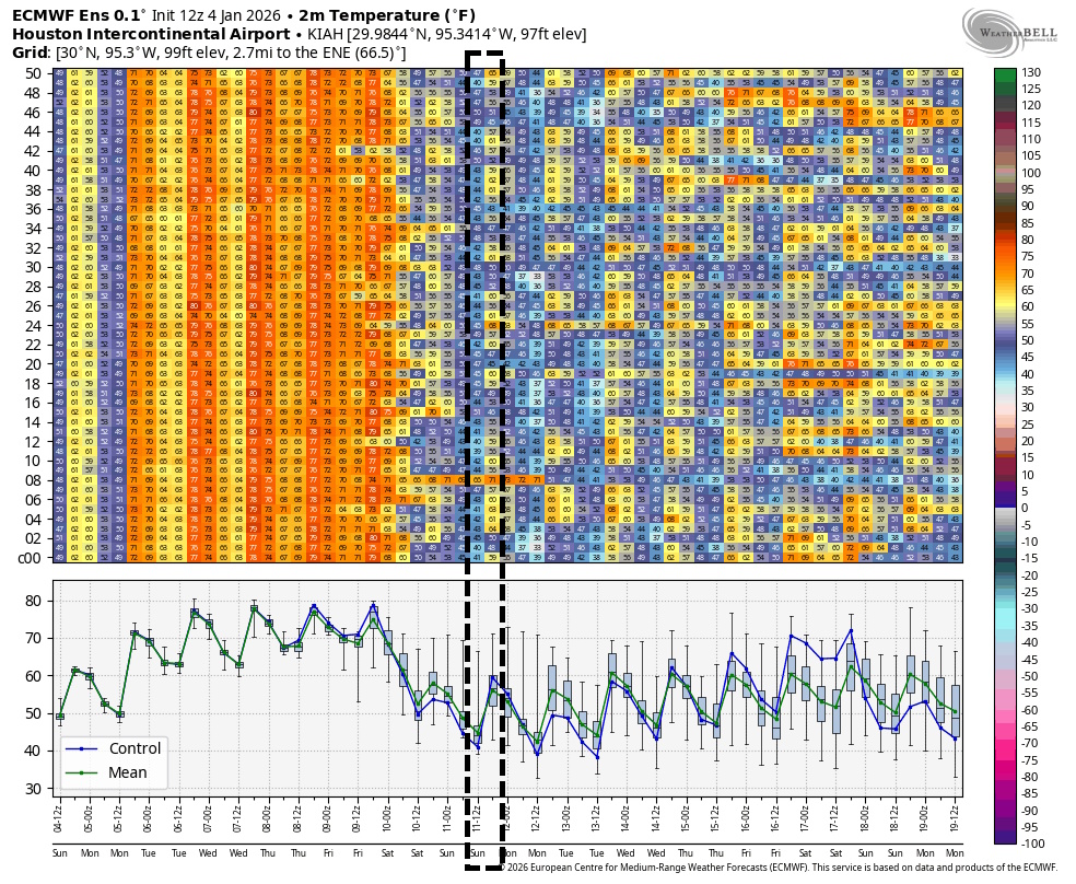
Sunday
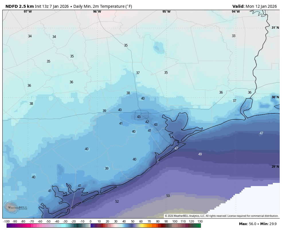
Sunday morning will be cold. Start line temperatures at the Houston Marathon should be in the mid-40s, with dry air and mostly cloudy skies. Winds will be from the north at 5 to 10 mph, with slightly higher gusts. Rain chances are basically zero. Highs will likely climb into the upper 50s for most locations on Sunday afternoon. Sunday night will be chilly, with lows falling to around 40 degrees for most of Houston, with cooler conditions still for inland areas. A freeze is very unlikely, however.
Next week
Houston will feel like winter next week with highs generally in the 60s and lows mostly in the low- to mid-40s for much of the week. Skies should be partly sunny most days, with low rain chances. This pattern should prevail through the middle of the month.