In brief: Houston will see favorable conditions for widespread showers and thunderstorms today and Tuesday, and accordingly we have put a Stage 1 flood alert into place. On Wednesday we should transition to warmer and drier conditions. By this weekend, and into next week, we can expect hot and sunny conditions to prevail.
Stage 1 flood alert
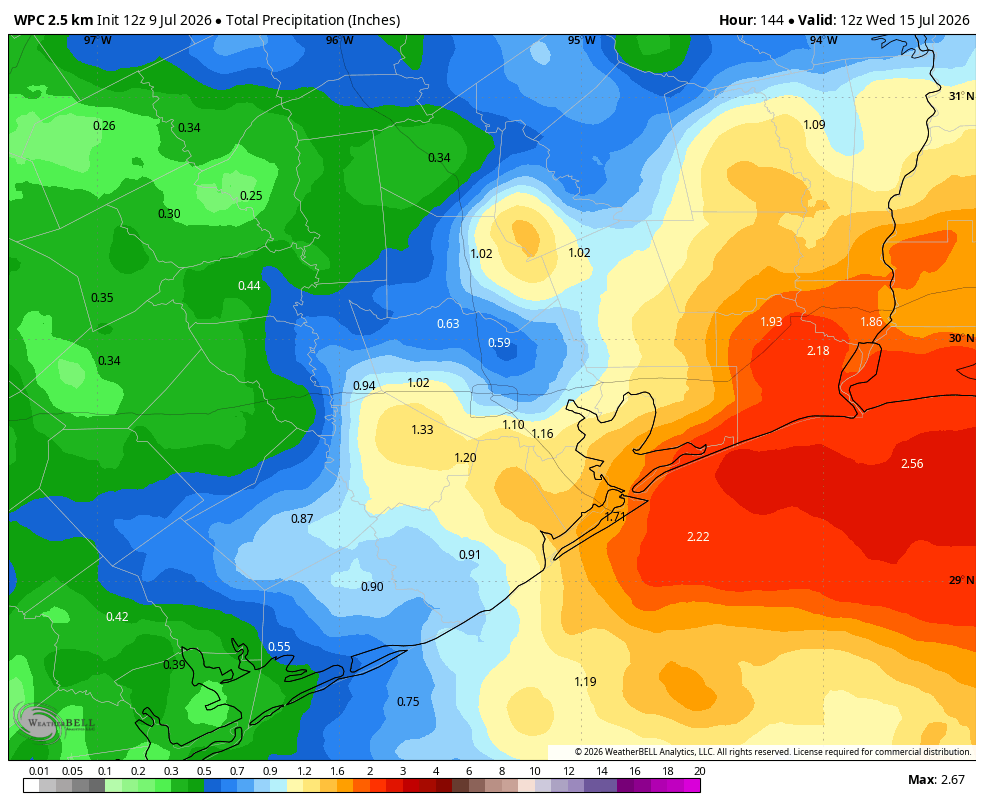
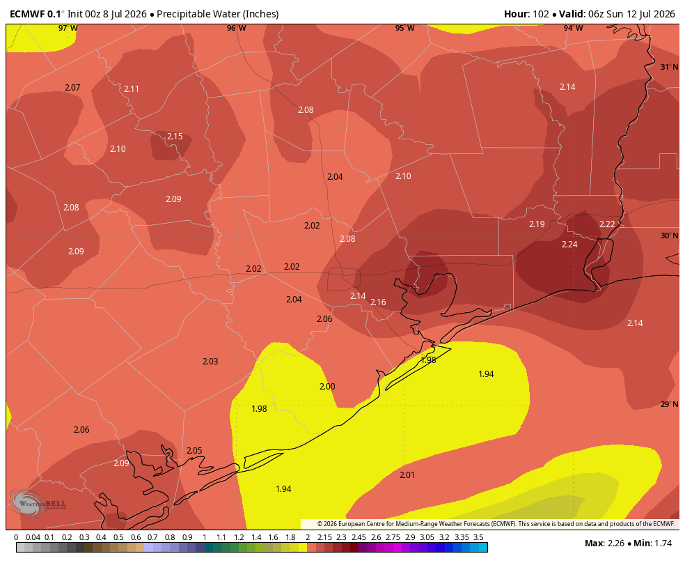
Atmospheric moisture levels will surge today and Tuesday, and the absence of high pressure will support the development of widespread showers and thunderstorms. Generally, beginning later this morning, we expect rounds of storms to develop and slowly propagate through the region. Some of these storms may be slow moving. Although there will be some thunder and lightning, the primary threat will be heavy rainfall.
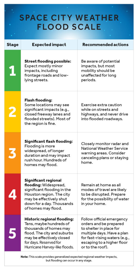
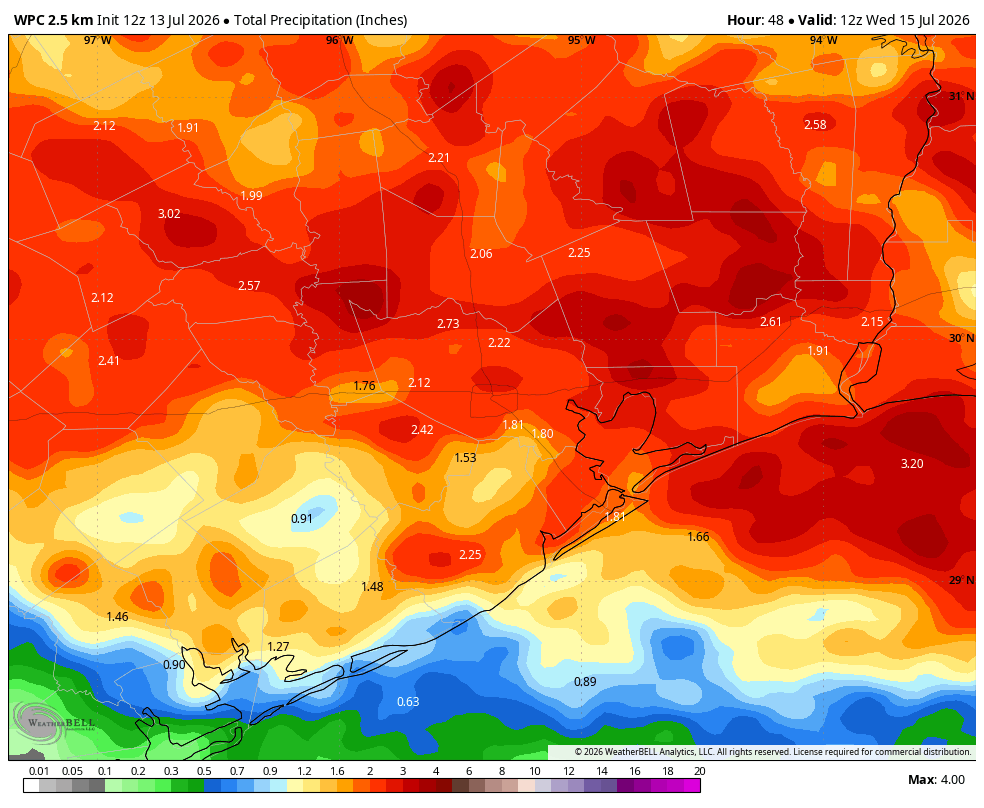
Most of Houston will pick up 1 to 3 inches of rainfall over the next couple of days. These are manageable totals. However some locations, beneath slower moving storms, may see as much as 5 inches. For this reason we are putting a Stage 1 flood alert into place through Tuesday night. Essentially this means we are concerned about flooding on freeway frontage roads and low-lying streets.
Monday and Tuesday
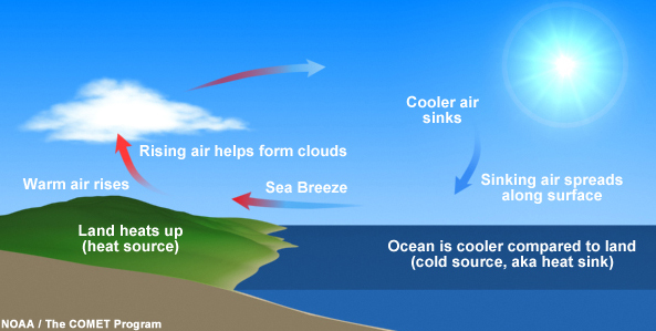
Generally, we expect storms to develop offshore this morning and then move inland. By around noon, or the early afternoon, we should see showers and thunderstorms develop across the majority of the region. There may be a brief pause later this afternoon or evening before another round of showers later tonight. This pattern will likely repeat itself through Tuesday.
Skies will be mostly cloudy when it is not raining, and the storms should should help to limit high temperatures. Today will likely reach the upper 80s for most locations, with mid-80s possible on Tuesday. Except in stronger thunderstorms, winds will be light. Basically, you’ll want to be weather aware the next couple of days, and give yourself a little more time before venturing to work or running errands.
Wednesday
This will be a bit of a transition day, with some additional showers possible, but less coverage and intensity than previous days. High temperatures will likely be around 90 degrees, or a tick higher, for most of the region.
Thursday and Friday
Skies will turn partly to mostly sunny to end the work week, with rain chances falling to around 10 percent. Expect highs in the mid-90s.
Saturday and Sunday
Temperatures this weekend will be quite hot, with sunny skies. Expect highs in the mid- to upper-90s as high pressure builds in. If you have outdoor plans on Saturday and Sunday make sure they involve a lot of sunscreen. Rain chances are near zero so it will be good weather for the beach or a backyard pool.
Next week
I expect this hot and sunny pattern to prevail through at least the first half of next week. Our next chance of rain would probably not come before Thursday or Friday of next week, and even then, who knows? Bottom line is that rains over the next couple of days will be beneficial for our soils before a drier period settles in.