After rather sedate weather on Christmas Day, Houston will fall into a more dynamic weather pattern beginning later on Wednesday, with a front tonight and some potentially severe storms. No one wants a system like this, but at least it’s likely to strike during the overnight hours when most people are at home rather than out and about.
Wednesday
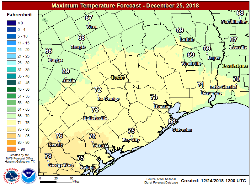
Temperatures are warm and muggy this morning, generally in the low 60s, which is more typical for highs this time of year rather than lows. Some showers and a few thunderstorms will be possible later this morning and this afternoon, but we’re not too concerned about accumulations (probably one-half inch or less for most areas). Highs today will probably top out at about 70 degrees under cloudy skies.
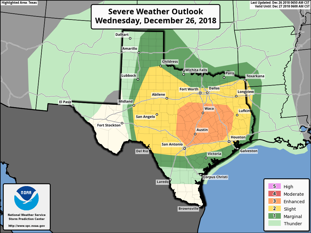
After any daytime showers, we think there probably will be diminished rain chances this evening through at least about midnight. However, after that time a line of (likely) strong showers and thunderstorms will sweep from west to east, ahead of a cold front. It seems likely the line of storms will reach the College Station area between midnight and 3am, and push through the Houston area between 3am and 6am. The storms should be clearing the area by around sunrise or shortly thereafter. The primary threat is damaging winds, with a lesser threat of tornadoes (which should be short-lived).
In terms of rainfall, I don’t have a great amount of confidence in the forecast. A lot of models show a fairly progressive system, that should limit accumulations to 1-2 inches for most of the metro area. On the other hand, a few models are showing 2-4 inches, and several recent rain events have out-performed the model forecasts. My best guess is for 1-3 inches today and tonight, with higher isolated totals of 5 inches possible. The threat of heavier rain is generally to the north and west of metro Houston.