Houston temperatures have steadily been on an upswing for the last 10 days, climbing from the 40s for three days, into the 60s, the 70s, and finally on Wednesday reaching 80 degrees at Bush Intercontinental Airport. Despite the warming trend, temperatures this month are still running nearly 8 degrees below normal for November. We’ll have another warm day, plus some of Friday, before a decently strong front arrives to bring chilly weather back.

Thursday
Conditions today should be similar to Wednesday, albeit with more clouds and a little wind. Even with mostly gray skies, temperatures today should push into the upper 70s to possibly 80 degrees with plenty of humidity. Some scattered, mostly light showers may move through the region today from the southwest, but any heavier rain should wait until Friday’s front. Low temperatures tonight may not fall below 70 for some parts of the metro area.
Friday
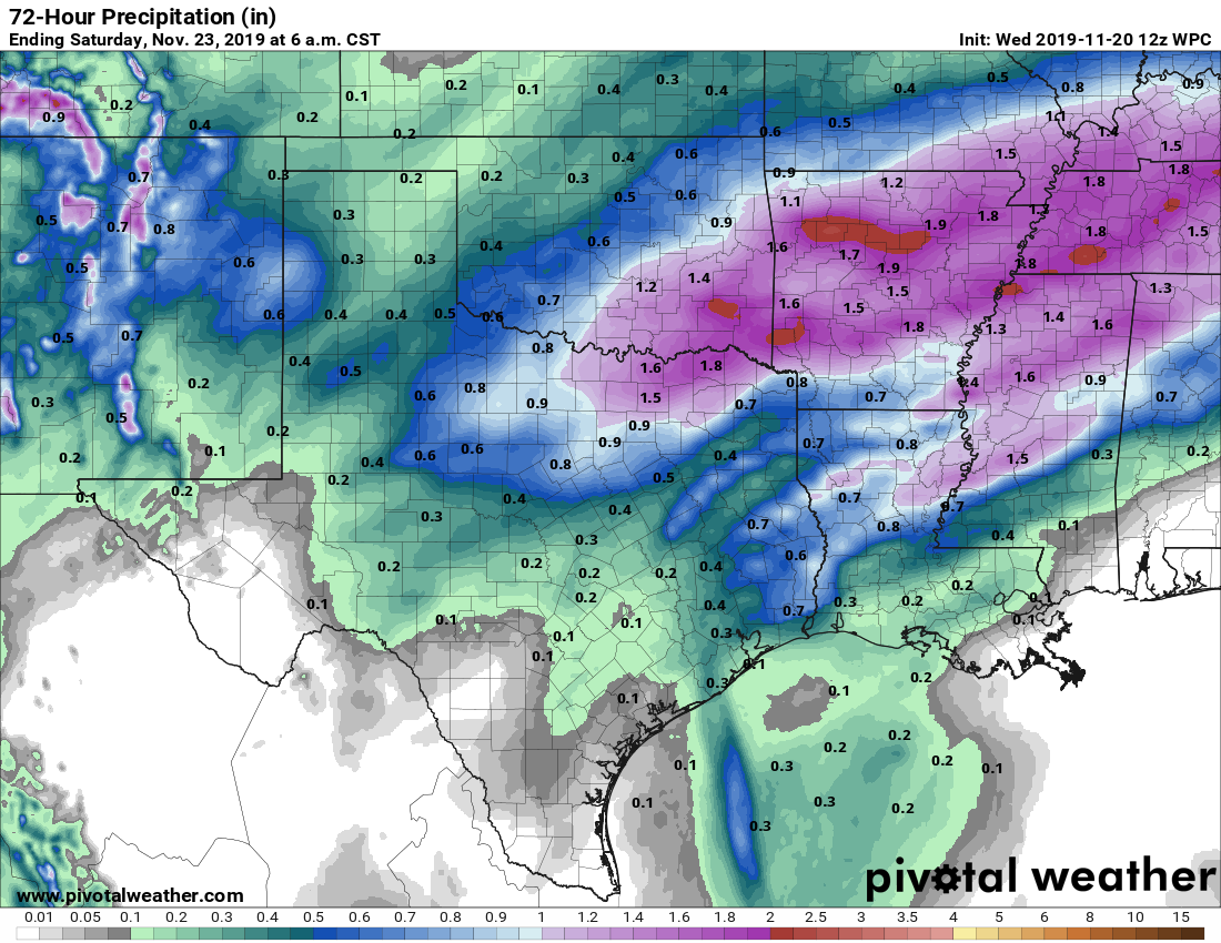
The first half of Friday will keep the warm, humid trend going ahead of the cold front. This should arrive in northwest Harris County some time around noon or shortly after, and push through the metro area before sunset. Rain accumulations look to be modest, with one-quarter to one-half inch west of Interstate 45, and perhaps a little more than one-half inch to the east. In any case, we should see gradually clearing skies on Friday night as temperatures fall to around 50 degrees for most of Houston.