In brief: A lot to get to today, including some notes on hurricane season and Houston’s chilliest day in nearly 10 months. We are going to briefly warm up before another front brings widespread rain and cooler temperatures on Thursday. Fortunately the weather for this weekend still looks exceptional.
Some news and notes to begin
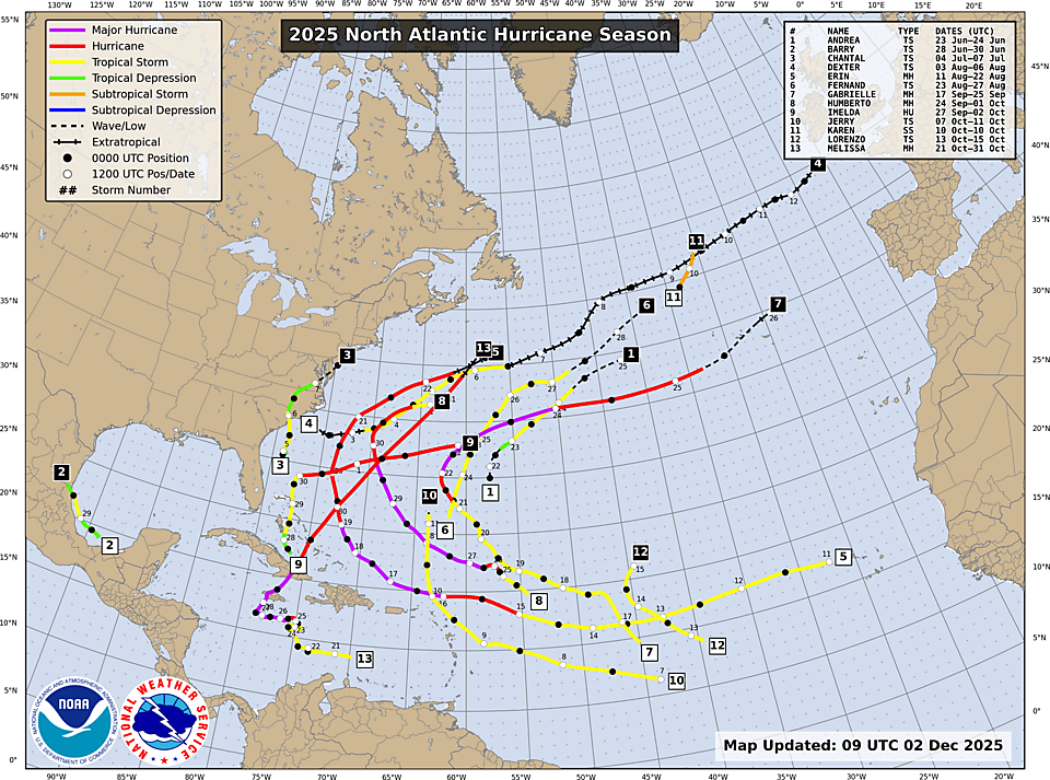
End of season: First of all, we neglected to mention yesterday that the Atlantic hurricane season officially ended on Sunday, Nov. 30. It did. Truth be told this date is pretty meaningless for Texas since activity really dies off in October in the northwestern Gulf and usually, as we did this year, we can call the ‘end’ of the Texas hurricane season in late September. It was a very quiet season for the Gulf, largely due to a weaker Bermuda High allowing storms to turn into the open Atlantic Ocean. Alas that was not the case with Melissa, a major hurricane that brought devastation to Jamaica at the end of October.
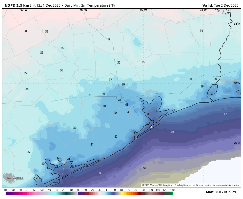
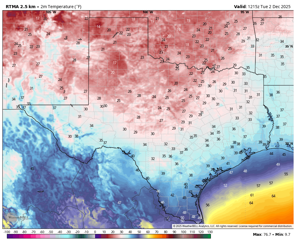
Very cold day: Monday’s high temperature was just 47 degrees. That was our coldest daily maximum temperature since February 22, when the high topped out at 44 degrees. I guess it’s only fitting because winter began on December 1. Or did it? One of the eternal debates is when winter begins. Is it Dec. 1? Is it the winter solstice later in the month? For us, here, we go with the ‘meteorological’ start of winter on the first day of December. And this year Mother Nature delivered.
No more asking for support: Our 2025 fundraiser ended on Monday night. And I just want to express my appreciation to everyone a final time for the tremendous response. Once again, our readers answered the call in a major way. Y’all took care of us, and we are going to take great care of your weather needs for the next year.
Tuesday
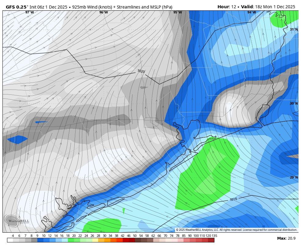
We are starting the morning out quite chilly. As expected our region has remained above freezing, with even areas well to the north of Houston such as Huntsville, Navasota, and College Station holding in the mid-30s. Most of the rest of Houston is in the upper 30s to lower 40s. We will rise into the mid-50s today, with mostly sunny skies helping to nudge temperatures upward. (This will be our last unbroken sunshine until the weekend). Winds will still be from the north, gusting up to 20 mph this morning before dying down this afternoon. We’re going to have one more cold night, with temperatures probably 1-3 degrees warmer than Monday night.
Wednesday and Thursday
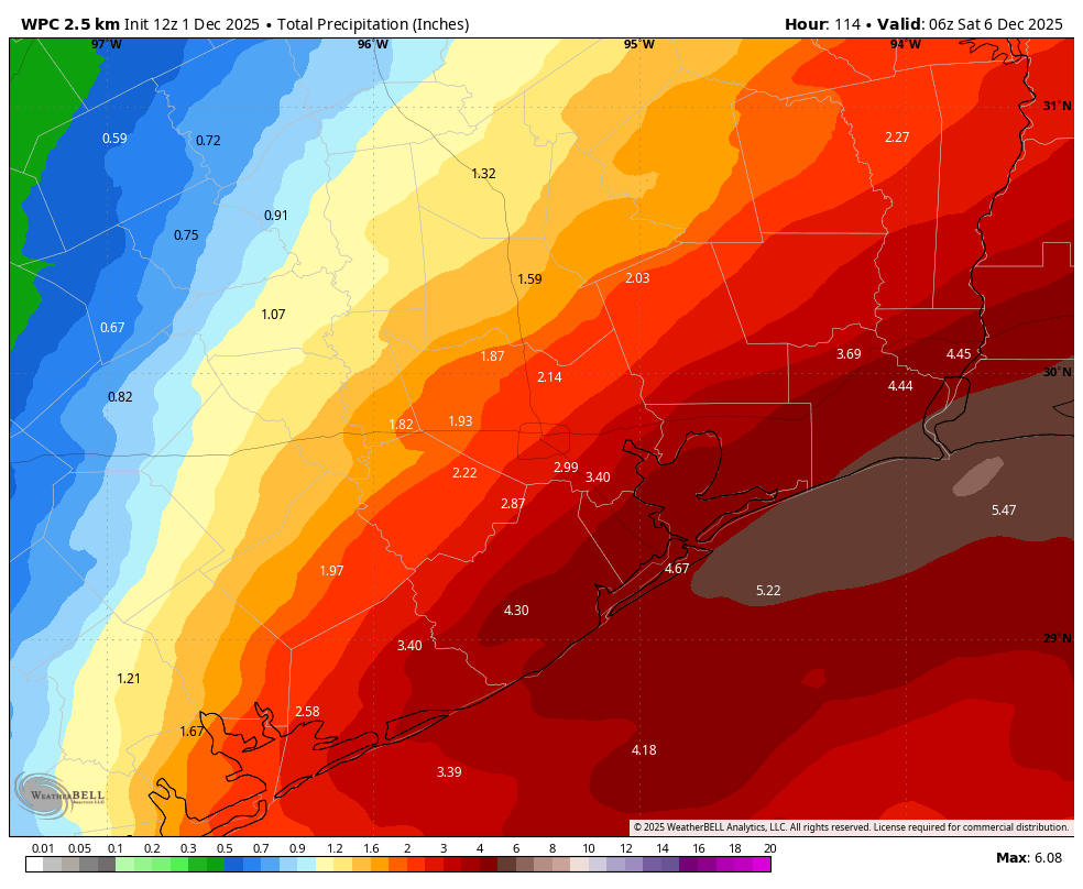
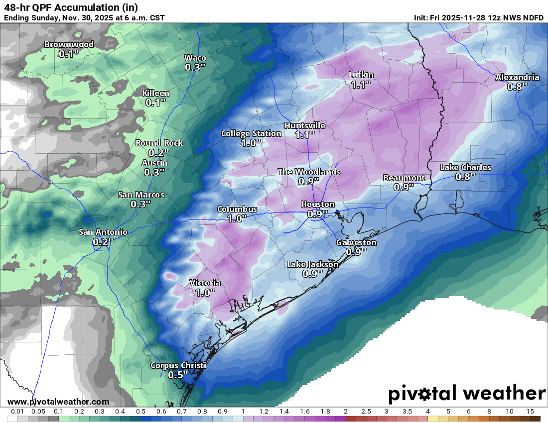
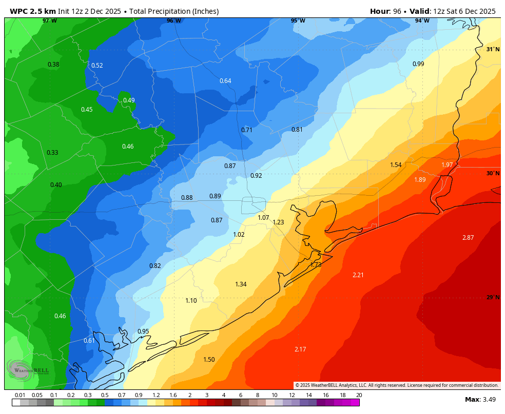
The onshore flow will be in full swing by Wednesday morning, and this is going to rapidly push temperatures to around 70 degrees, with rising humidity. We will see building clouds during the daytime, but I expect rain chances to mostly hold off until Wednesday evening or overnight. Lows drop to around 60 degrees in Houston. We will see widespread showers on Wednesday night and Thursday, as a front approaches and pushes into the region. Some of these will be moderate to heavy, and I think most of our region will pick up 0.5 to 2 inches of rain through Friday. The best chance of rain will come on Thursday, however. As the front moves in highs will top out at around 60 degrees on Thursday.
Friday
We may see some lingering, mostly light showers on Friday. Cloudy skies will keep highs in the 50s, with overnight lows dropping into the upper 40s, probably, on Friday night.
Saturday and Sunday
The weekend still looks very fine. Expect highs in the mid-60s on Saturday, and perhaps 70 degrees on Sunday. Nights will be on the chilly side, likely in the upper 40s although it’s too early to be sure. The best part? You can expect mostly sunny skies for the most part. It will be a great weekend for holiday related activities.
Next week
Overall next week looks to be fairly mild, with highs in the vicinity of 70 degrees, and lows around 50 degrees. Rain chances appear to be low for the most part.